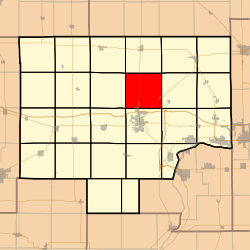
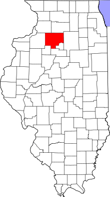
Dover Township, Bureau County, Illinois
Dover Township is one of twenty-five townships in Bureau County, Illinois, USA. As of the 2010 census, its population was 550 and it contained 249 housing units.[2]
Dover Township | |
|---|---|
 Location in Bureau County | |
 Bureau County's location in Illinois | |
| Coordinates: 41°26′59″N 89°27′18″W | |
| Country | United States |
| State | Illinois |
| County | Bureau |
| Established | November 6, 1849 |
| Area | |
| • Total | 36.85 sq mi (95.4 km2) |
| • Land | 36.85 sq mi (95.4 km2) |
| • Water | 0 sq mi (0 km2) 0% |
| Elevation | 705 ft (215 m) |
| Population (2010) | |
| • Total | 550 |
| • Estimate (2016)[1] | 527 |
| • Density | 14.9/sq mi (5.8/km2) |
| Time zone | UTC-6 (CST) |
| • Summer (DST) | UTC-5 (CDT) |
| ZIP codes | 61323, 61349, 61356, 61376 |
| FIPS code | 17-011-20539 |
Geography
According to the 2010 census, the township has a total area of 36.85 square miles (95.4 km2), all land.[2]
Cemeteries
The township contains six cemeteries:
- Dover
- Heatons Point
- Limerick
- Mason
- Pioneer
- Prairie Repose
Major highways


Landmarks
- City Co Park
Political districts
- Illinois's 11th congressional district
- State House District 74
- State Senate District 37
gollark: There are a bunch of ways I can imagine to track people, and in modern packs it's quite easy to do basically whatever you want to someone's base if it's not claimed.
gollark: I imagine a radiing thing wouldn't have dynmap. But still.
gollark: On CodersNet, for example, I can pull anyone's location off the dynmap API, fly over to them quite fast, then arbitrarily teleport through their base.
gollark: How do raiding or at least griefing/stealing-allowed servers actually work in practice, though? In my experience defense is way harder than attack, and the only reason my stuff remains mostly safe is that I play on places with claims.
gollark: Clearly you should have had FOUR turtle pairs!
References
- "Dover Township, Bureau County, Illinois". Geographic Names Information System. United States Geological Survey. Retrieved 4 January 2010.
- US Census Bureau 2007 TIGER/Line Shapefiles
- United States National Atlas
- "Population and Housing Unit Estimates". Retrieved June 9, 2017.
- "Population, Housing Units, Area, and Density: 2010 - County". US Census Bureau. Archived from the original on 12 February 2020. Retrieved 28 May 2013.
- "Census of Population and Housing". Census.gov. Retrieved June 4, 2016.
External links
This article is issued from Wikipedia. The text is licensed under Creative Commons - Attribution - Sharealike. Additional terms may apply for the media files.