Saint David Parish, New Brunswick
Saint David is a civil parish in Charlotte County, New Brunswick, Canada,[2] located northeast of St. Stephen and northwest of Saint Andrews.
Saint David St. David | |
|---|---|
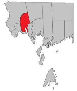 Location within Charlotte County. | |
| Country | |
| Province | |
| County | Charlotte County |
| Established | 1786 |
| Area | |
| • Land | 190.66 km2 (73.61 sq mi) |
| Population (2016)[1] | |
| • Total | 1,529 |
| • Density | 8.0/km2 (21/sq mi) |
| • Pop 2011-2016 | |
| • Dwellings | 743 |
| Time zone | UTC-4 (AST) |
| • Summer (DST) | UTC-3 (ADT) |
The local service district (LSD) and Census subdivision of the same name have the same boundaries as the parish.[3]
History
Saint David Parish was created in 1786, and named for the patron saint of Wales.
Delineation
Saint David Parish is defined in the Territorial Division Act[2] as being bounded:
- South by Dufferin Parish; west by the east line of lots on Dennis Stream prolonged southerly to Dufferin Parish and by the west lines of the grant to Henry Goldsmith and others; north by the north line of the said grant; east by the east line of the said last mentioned grant; southeast and southerly by a line commencing at the most northern angle of a four hundred and eighty-eight acre lot granted to Daniel Hill on Waweig River; thence southwesterly to the most western angle of the said lot; thence southeasterly to the northeast angle of lot number thirty, granted to W. Ross; thence westerly along the north line of the said last-mentioned grant and its western prolongation to the northeast angle of lot number eight, granted to James Garcelon; thence south to the southeast angle of lot number four, granted to James Christie; thence west to the southwest angle of the said last-mentioned lot; thence south along the eastern line of lots fronting on Oak Bay to Waweig River; thence down the channel of Waweig River and up the channel of Oak Bay to Pagans Cove, where the northern line of Dufferin Parish intersects it, excluding Rickets Island in Waweig River.
Communities
Parish population total does not include incorporated municipalities (in bold).
|
|
|
Bodies of water and islands
This is a list of rivers, lakes, streams, creeks, marshes and Islands that are at least partially in this parish
- Foster Lake
- Oak Bay
- Spoon Island
Demographics
Population
| Canada census – Saint David Parish, New Brunswick community profile | |||
|---|---|---|---|
| 2016 | 2011 | 2006 | |
| Population: | 1,529 (-4.7% from 2011) | 1,605 (+7.1% from 2006) | 1,499 (-6.0% from 2001) |
| Land area: | 190.66 km2 (73.61 sq mi) | 189.93 km2 (73.33 sq mi) | 189.91 km2 (73.32 sq mi) |
| Population density: | 8.0/km2 (21/sq mi) | 8.5/km2 (22/sq mi) | 7.9/km2 (20/sq mi) |
| Median age: | 50.5 (M: 50.9, F: 50.0) | 47.8 (M: 47.9, F: 47.6) | 42.6 (M: 41.9, F: 43.1) |
| Total private dwellings: | 743 | 787 | 676 |
| Median household income: | $54,240 | $41,215 | |
| References: 2016[4] 2011[5] 2006[6] earlier[7] | |||
|
|
| |||||||||||||||||||||||||||
| [8][1] | |||||||||||||||||||||||||||||
Language
| Canada Census Mother Tongue - Saint David Parish, New Brunswick[8] | ||||||||||||||||||
|---|---|---|---|---|---|---|---|---|---|---|---|---|---|---|---|---|---|---|
| Census | Total | English |
French |
English & French |
Other | |||||||||||||
| Year | Responses | Count | Trend | Pop % | Count | Trend | Pop % | Count | Trend | Pop % | Count | Trend | Pop % | |||||
2011 |
1,590 |
1,530 | 96.23% | 40 | 2.52% | 5 | 0.31% | 15 | 0.94% | |||||||||
2006 |
1,495 |
1,440 | 96.32% | 25 | 1.67% | 10 | 0.67% | 20 | 1.34% | |||||||||
2001 |
1,585 |
1,555 | 98.11% | 30 | 1.89% | 0 | 0.00% | 0 | 0.00% | |||||||||
1996 |
1,630 |
1,580 | n/a | 96.93% | 40 | n/a | 2.45% | 0 | n/a | 0.00% | 10 | n/a | 0.61% | |||||
Access Routes
Highways and numbered routes that run through the parish, including external routes that start or finish at the parish limits:[9]
gollark: This is also possible.
gollark: <@160279332454006795> What if accursed node.jsous [HG]Tech™ MUD?
gollark: Yes. They are somewhat beeological.
gollark: The other^6 gollark lies iff you know what iff means.
gollark: The other^5 gollark is truthful iff it predicts that you will cooperate with CooperateBot.
See also
Notes
References
- "Census Profile, 2016 Census: Saint David, Parish [Census subdivision], New Brunswick". Statistics Canada. Retrieved 30 August 2019.
- "Chapter T-3 Territorial Division Act". Government of New Brunswick. Retrieved 14 August 2020.
- "New Brunswick Regulation 84-168 under the Municipalities Act (O.C. 84-582)". Government of New Brunswick. Retrieved 14 August 2020.
- "2016 Community Profiles". 2016 Canadian Census. Statistics Canada. 21 February 2017. Retrieved 30 August 2019.
- "2011 Community Profiles". 2011 Canadian Census. Statistics Canada. 5 July 2013. Retrieved 17 March 2014.
- "2006 Community Profiles". 2006 Canadian Census. Statistics Canada. 30 March 2011. Retrieved 17 March 2014.
- "2001 Community Profiles". 2001 Canadian Census. Statistics Canada. 17 February 2012.
- Statistics Canada: 1996, 2001, 2006, 2011 census
- Atlantic Canada Back Road Atlas ISBN 978-1-55368-618-7 Pages 4, 12
Places adjacent to Saint David Parish, New Brunswick | ||||||||||
|---|---|---|---|---|---|---|---|---|---|---|
| ||||||||||
| Subdivisions |
|
|---|---|
| Cities | |
| Counties | |
| |
This article is issued from Wikipedia. The text is licensed under Creative Commons - Attribution - Sharealike. Additional terms may apply for the media files.