Saint Stephen Parish, New Brunswick
Saint Stephen is a civil parish in Charlotte County, New Brunswick, Canada,[2] located in the southwestern corner of the province. It includes one town and three local service districts (LSD).
Saint Stephen St. Stephen | |
|---|---|
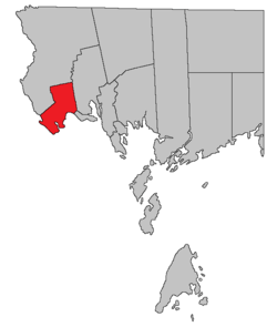 Location within Charlotte County. | |
| Country | |
| Province | |
| County | Charlotte County |
| Established | 1786 |
| Area | |
| • Land | 103.25 km2 (39.87 sq mi) |
| Population (2016)[1] | |
| • Total | 1,839 |
| • Density | 17.8/km2 (46/sq mi) |
| • Pop 2011-2016 | |
| • Dwellings | 820 |
| Time zone | UTC-4 (AST) |
| • Summer (DST) | UTC-3 (ADT) |
The LSD of the same name[3] includes only the southwestern part of the parish, an area including the communities of Mohannes and Upper Mills.
The Census subdivision of the same name includes all of the parish except the town of St. Stephen.[1]
History
Saint Stephen Parish was established in 1786 as one of the province's original parishes,[4] with boundaries that included all of modern Dufferin Parish but only ran as far north as Mayfield and Barter Settlement.
In 1813 the parish was expanded northward as far as the prolongation of the northern line of Saint David, the boundary now running through King Lake and striking the St. Croix River.[5]
In 1823 the northern part of the parish was included in the newly erected Saint James Parish,[6] giving the parish its current northern boundary.
In 1873 the eastern part of the parish was erected as Dufferin Parish,[7] giving the parish its current boundaries.
Boundaries
External boundaries
The parish runs along the St. Croix River from east of St. Stephen to above Woodland, Maine. The boundary runs northeasterly to north of Kendricks Lake, then runs northerly to include grants along Route 735, Route 740, and Route 3, as far north as Moores Lake, then turns south and runs along grant lines to the St. Croix River.
Delineation
Saint Stephen Parish is defined in the Territorial Division Act[2] as being bounded:
- South by Dufferin Parish and the St. Croix River; east by Saint David Parish, north and west by a line beginning in the intersection of the St. Croix River with the southwesterly prolongation of the northwestern limit of Lot No. 16, granted to Angus Rankin; thence northeasterly along said prolongation and said limit to the western limit of Lot No. 115, granted to Thomas Dodd; thence northerly along the western limits of Lots Numbered 115, 116, 117 and 99 to 114 inclusive to the southern limit of Lot No. 46 granted to Thomas Grimmer Junior; thence westerly along said limit and its prolongation to the eastern limit of Lot No. 60, granted to Robert M. Todd; thence northerly along the eastern limit of Lot No. 60 and its northerly prolongation, to meet the westerly prolongation of the northern limit of No. 53 granted to Peter Christie; thence easterly along said westerly prolongation, the northern limit of Lot No. 53 and the easterly prolongation of the northern limit of Lot No. 53, to the eastern bank or shore of Moore Lake.[lower-alpha 1]
Internal boundaries
- The town of St. Stephen includes most of the parish south of Route 1 from the mouth of Dennis Stream to south of Calais, Maine.
- The LSD of Dennis-Weston includes all of the parish east from the grants along Route 740;[3] it assesses for basic LSD services.[lower-alpha 2]
- The LSD of Western Charlotte includes the mainland of the parish west of Dennis-Weston and north of St. Stephen, extending along Route 725 and Mohannes Stream;[3] it assesses for basic LSD services.[lower-alpha 2]
- The LSD of the parish of Saint Stephen includes the remainder of the parish, an area of the mainland west and south of St. Stephen and Route 725 plus the islands in the St. Croix River;[3] it assesses for basic LSD services.[lower-alpha 2]
Former municipalities
- Milltown was a town on the western edge of St. Stephen, with Boundary Street as the border between them. It was incorporated in 1873,[10] and amalgamated with St. Stephen on 1 October 1973 as St. Stephen – Milltown,[11] which was renamed St. Stephen in 1975.[12]
- Upper Mills was a town along the St. Croix River from slightly west of the mouth of Mohannes Stream to the Bailey Rips. It was incorporated in 1874[13] and dissolved in 1896.[14]
Communities
|
|
|
Bodies of water and Islands
This is a list of rivers, lakes, streams, creeks, marshes and Islands that are at least partially in this parish
- Kendricks Lake
- St Croix River
Demographics
Population
| Canada census – Saint Stephen Parish, New Brunswick community profile | |||
|---|---|---|---|
| 2016 | 2011 | 2006 | |
| Population: | 1,839 (-7.4% from 2011) | 1,986 (-6.0% from 2006) | 2,113 (+13.8% from 2001) |
| Land area: | 103.25 km2 (39.87 sq mi) | 103.38 km2 (39.92 sq mi) | 104.41 km2 (40.31 sq mi) |
| Population density: | 17.8/km2 (46/sq mi) | 19.2/km2 (50/sq mi) | 20.2/km2 (52/sq mi) |
| Median age: | 47.8 (M: 46.9, F: 48.7) | 44.0 (M: 43.5, F: 44.5) | 39.6 (M: 38.9, F: 40.0) |
| Total private dwellings: | 820 | 827 | 863 |
| Median household income: | $50,560 | $50,064 | $37,430 |
| References: 2016[15] 2011[16] 2006[17] earlier[18] | |||
|
|
| |||||||||||||||||||||||||||
| [19][1] | |||||||||||||||||||||||||||||
Language
| Canada Census Mother Tongue - Saint Stephen Parish, New Brunswick[19] | ||||||||||||||||||
|---|---|---|---|---|---|---|---|---|---|---|---|---|---|---|---|---|---|---|
| Census | Total | English |
French |
English & French |
Other | |||||||||||||
| Year | Responses | Count | Trend | Pop % | Count | Trend | Pop % | Count | Trend | Pop % | Count | Trend | Pop % | |||||
2011 |
1,955 |
1,900 | 97.19% | 35 | 1.79% | 5 | 0.25% | 15 | 0.77% | |||||||||
2006 |
2,105 |
2,040 | 96.91% | 40 | 1.90% | 0 | 0.00% | 25 | 1.19% | |||||||||
2001 |
1,850 |
1,795 | 97.03% | 35 | 1.89% | 10 | 0.54% | 10 | 0.54% | |||||||||
1996 |
1,855 |
1,830 | n/a | 98.65% | 25 | n/a | 1.35% | 0 | n/a | 0.00% | 0 | n/a | 0.00% | |||||
Access Routes
Highways and numbered routes that run through the parish, including external routes that start or finish at the parish limits:[20]
See also
Notes
References
- "Census Profile, 2016 Census Saint Stephen, Parish [Census subdivision], New Brunswick". Statistics Canada. Retrieved 7 September 2019.
- "Chapter T-3 Territorial Division Act". Government of New Brunswick. Retrieved 14 August 2020.
- "New Brunswick Regulation 84-168 under the Municipalities Act (O.C. 84-582)". Government of New Brunswick. Retrieved 14 August 2020.
- Berton, George F. S. (1838). "XXVI° Georgii III, Cap. I". The Acts of the General Assembly of Her Majesty's Province of New Brunswick, from the Twenty Sixth Year of the Reign of King George the Third to the Sixth Year of the Reign of King William the Fourth. Fredericton, New Brunswick: John Simpson, Printer to the Queen's Most Excellent Majesty. p. 4. Available as a free download from Google Books.
- "53d G. III., Cap. II". Acts of the General Assembly of His Majesty's Province of New-Brunswick; Passed in the Year 1813. Saint John, New Brunswick: Jacob S. Mott, Printer to the King's Most Excellent Majesty. 1813. p. 21. Available as a free download from Canadiana.ca
- "4 Geo. III, Cap. XI". Acts of the General Assembly of His Majesty's Province of New-Brunswick, Passed in the Year 1823. Saint John, New Brunswick: Geo. K. Lugrin, Printer to the King's Most Excellent Majesty. 1823. pp. 14–16. Available as a free download from Canadiana.ca
- "36 V. C. LXXV". Acts of the General Assembly of Her Majesty's Province of New Brunswick. Passed in the Months of March & April 1873. Fredericton, New Brunswick, Canada: G. E. Fenety, Printer to the Queen's Most Excellent Majesty. 1873. pp. 253–254. Available as a free download from Google Books.
- "Moore Lake". Canadian Geographical Names. Natural Resources Canada. Retrieved 25 August 2016.
- "2019 Local Government Statistics for New Brunswick" (PDF). Department of Environment and Local Government. p. 59. Retrieved 14 August 2020.
- "36 V. C. 103". Acts of the General Assembly of Her Majesty's Province of New Brunswick. Passed in the Months of March & April 1873. Fredericton, New Brunswick, Canada: G. E. Fenety, Printer to the Queen's Most Excellent Majesty. 1873. pp. 334–363. Available as a free download from Google Books.
- Regulation 73-99 under the Municipalities Act.
- Regulation 75-59 under the Municipalities Act.
- "37 V. C. LX". Acts of the General Assembly of Her Majesty's Province of New Brunswick. Passed in the Months of March & April 1874. Fredericton, New Brunswick, Canada: G. E. Fenety, Printer to the Queen's Most Excellent Majesty. 1874. pp. 149–177.Available as a free download from Google Books.
- "59 V. C. LXXVIII". Acts of the General Assembly of Her Majesty's Province of New Brunswick. Passed in the Month of March, 1896. Fredericton, New Brunswick, Canada: Legislature of New Brunswick. 1896. pp. 397–398. Available as a free download from Google Books.
- "2016 Community Profiles". 2016 Canadian Census. Statistics Canada. 21 February 2017. Retrieved 7 September 2019.
- "2011 Community Profiles". 2011 Canadian Census. Statistics Canada. 5 July 2013. Retrieved 19 March 2014.
- "2006 Community Profiles". 2006 Canadian Census. Statistics Canada. 30 March 2011. Retrieved 19 March 2014.
- "2001 Community Profiles". 2001 Canadian Census. Statistics Canada. 17 February 2012.
- Statistics Canada: 1996, 2001, 2006, 2011 census
- Atlantic Canada Back Road Atlas ISBN 978-1-55368-618-7 Pages 4, 12
External links
Places adjacent to Saint Stephen Parish, New Brunswick | ||||||||||
|---|---|---|---|---|---|---|---|---|---|---|
| ||||||||||
| Subdivisions |
|
|---|---|
| Cities | |
| Counties | |
| |