Saint James Parish, New Brunswick
Saint James is a civil parish in Charlotte County, New Brunswick, Canada,[2] located north of St. Stephen. It includes two local service districts (LSDs), Western Charlotte and the parish of Saint James.
Saint James St. James | |
|---|---|
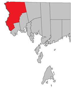 Location within Charlotte County. | |
| Country | |
| Province | |
| County | Charlotte County |
| Established | 1823 |
| Area | |
| • Land | 556.62 km2 (214.91 sq mi) |
| Population (2016)[1] | |
| • Total | 1,186 |
| • Density | 2.1/km2 (5/sq mi) |
| • Pop 2011-2016 | |
| • Dwellings | 570 |
| Time zone | UTC-4 (AST) |
| • Summer (DST) | UTC-3 (ADT) |
The Census subdivision of the same name shares the parish's borders.[1]
History
Saint James Parish was created in 1823 from part of Saint Stephen Parish. Saint James Parish was named after Saint James.
Delineation
Saint James Parish is defined in the Territorial Division Act[2] as being bounded:
- South by Saint Stephen Parish and Saint David Parish; east by the northerly prolongation of the east line of Saint David Parish; north by the County line; and west by the St. Croix River.
Communities
Parish population total does not include incorporated municipalities (in bold).
|
|
|
Bodies of water and Islands
This is a list of rivers, lakes, streams, creeks, marshes and Islands that are at least partially in this parish
- Canoose Flowage
- Cranberry Lake
- Indian Pond
- King Brook Lake
- Moores Mills Lake
- Potters Lake
Demographics
Population
| Canada census – Saint James Parish, New Brunswick community profile | |||
|---|---|---|---|
| 2016 | 2011 | 2006 | |
| Population: | 1,186 (-4.4% from 2011) | 1,241 (-8.1% from 2006) | 1,350 (-5.6% from 2001) |
| Land area: | 556.62 km2 (214.91 sq mi) | 556.00 km2 (214.67 sq mi) | 555.99 km2 (214.67 sq mi) |
| Population density: | 2.1/km2 (5.4/sq mi) | 2.2/km2 (5.7/sq mi) | 2.4/km2 (6.2/sq mi) |
| Median age: | 47.7 (M: 47.8, F: 47.5) | 44.5 (M: 42.2, F: 46.5) | 41.7 (M: 41.2, F: 42.1) |
| Total private dwellings: | 570 | 590 | 612 |
| Median household income: | $45,184 | $51,753 | $36,461 |
| References: 2016[3] 2011[4] 2006[5] earlier[6] | |||
|
|
| |||||||||||||||||||||||||||
| [7][1] | |||||||||||||||||||||||||||||
Language
| Canada Census Mother Tongue - Saint James Parish, New Brunswick[7] | ||||||||||||||||||
|---|---|---|---|---|---|---|---|---|---|---|---|---|---|---|---|---|---|---|
| Census | Total | French |
English |
French & English |
Other | |||||||||||||
| Year | Responses | Count | Trend | Pop % | Count | Trend | Pop % | Count | Trend | Pop % | Count | Trend | Pop % | |||||
2011 |
1,235 |
1,200 | 97.17% | 25 | 2.02% | 0 | 0.00% | 10 | 0.81% | |||||||||
2006 |
1,340 |
1,325 | 98.88% | 15 | 1.12% | 0 | 0.00% | 0 | 0.00% | |||||||||
2001 |
1,395 |
1,380 | 98.92% | 15 | 1.08% | 0 | 0.00% | 0 | 0.00% | |||||||||
1996 |
1,390 |
1,380 | n/a | 99.28% | 10 | n/a | 0.72% | 0 | n/a | 0.00% | 0 | n/a | 0.00% | |||||
Access Routes
Highways and numbered routes that run through the parish, including external routes that start or finish at the parish limits:[8]
See also
Notes
References
- "Census Profile, 2016 Census: Saint James, Parish [Census subdivision], New Brunswick". Statistics Canada. Retrieved 7 September 2019.
- "Chapter T-3 Territorial Division Act". Government of New Brunswick. Retrieved 14 August 2020.
- "2016 Community Profiles". 2016 Canadian Census. Statistics Canada. 21 February 2017. Retrieved 7 September 2019.
- "2011 Community Profiles". 2011 Canadian Census. Statistics Canada. 5 July 2013. Retrieved 17 March 2014.
- "2006 Community Profiles". 2006 Canadian Census. Statistics Canada. 30 March 2011. Retrieved 17 March 2014.
- "2001 Community Profiles". 2001 Canadian Census. Statistics Canada. 17 February 2012.
- Statistics Canada: 1996, 2001, 2006, 2011 census
- Atlantic Canada Back Road Atlas ISBN 978-1-55368-618-7 Pages 4, 12
External links
Places adjacent to Saint James Parish, New Brunswick | |
|---|---|
| Subdivisions |
|
|---|---|
| Cities | |
| Counties | |
| |