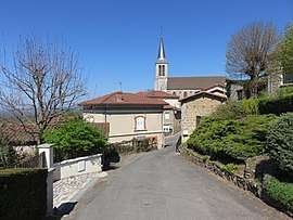
Saint-Cyr-les-Vignes
Saint-Cyr-les-Vignes is a commune in the Loire department in central France.
Saint-Cyr-les-Vignes | |
|---|---|
Commune | |
 | |
Location of Saint-Cyr-les-Vignes 
| |
 Saint-Cyr-les-Vignes  Saint-Cyr-les-Vignes | |
| Coordinates: 45°40′41″N 4°18′03″E | |
| Country | France |
| Region | Auvergne-Rhône-Alpes |
| Department | Loire |
| Arrondissement | Montbrison |
| Canton | Feurs |
| Intercommunality | Feurs en Forez |
| Government | |
| • Mayor (2014–2020) | Jean-François Reynaud |
| Area 1 | 19.38 km2 (7.48 sq mi) |
| Population (2017-01-01)[1] | 1,042 |
| • Density | 54/km2 (140/sq mi) |
| Time zone | UTC+01:00 (CET) |
| • Summer (DST) | UTC+02:00 (CEST) |
| INSEE/Postal code | 42214 /42210 |
| Elevation | 357–595 m (1,171–1,952 ft) (avg. 440 m or 1,440 ft) |
| 1 French Land Register data, which excludes lakes, ponds, glaciers > 1 km2 (0.386 sq mi or 247 acres) and river estuaries. | |
Population
| Year | Pop. | ±% |
|---|---|---|
| 1793 | 1,000 | — |
| 1806 | 845 | −15.5% |
| 1821 | 948 | +12.2% |
| 1831 | 1,001 | +5.6% |
| 1841 | 990 | −1.1% |
| 1851 | 1,033 | +4.3% |
| 1861 | 984 | −4.7% |
| 1872 | 1,012 | +2.8% |
| 1881 | 1,070 | +5.7% |
| 1891 | 1,096 | +2.4% |
| 1901 | 1,069 | −2.5% |
| 1911 | 936 | −12.4% |
| 1921 | 815 | −12.9% |
| 1931 | 811 | −0.5% |
| 1946 | 729 | −10.1% |
| 1954 | 732 | +0.4% |
| 1962 | 661 | −9.7% |
| 1968 | 625 | −5.4% |
| 1975 | 552 | −11.7% |
| 1982 | 553 | +0.2% |
| 1990 | 643 | +16.3% |
| 1999 | 789 | +22.7% |
| 2012 | 928 | +17.6% |
| 2016 | 1,015 | +9.4% |
gollark: I'm sure you'd like to think so.
gollark: Anyway, my entry was #16. I can reveal that safely now.
gollark: Do you know of alarms?
gollark: !time <@!258639553357676545>
gollark: !time <@319753218592866315>
See also
References
- "Populations légales 2017". INSEE. Retrieved 6 January 2020.
| Wikimedia Commons has media related to Saint-Cyr-les-Vignes. |
| Authority control |
|
|---|
This article is issued from Wikipedia. The text is licensed under Creative Commons - Attribution - Sharealike. Additional terms may apply for the media files.