Sabará
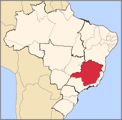
Sabará is a Brazilian municipality located in the state of Minas Gerais. The city belongs to the mesoregion Metropolitana de Belo Horizonte and to the microregion of Belo Horizonte.
Sabará | |
|---|---|
 Flag  Seal | |
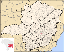 Location in Brazil | |
 Sabará Location in Brazil | |
| Coordinates: 19°53′09″S 43°48′25″W | |
| Country | Brazil |
| Region | Southeast |
| State | Minas Gerais |
| Founded | 1675 |
| Government | |
| • Mayor | Diógenes Fantini |
| Area | |
| • Total | 302.419 km2 (116.765 sq mi) |
| Elevation | 705 m (2,313 ft) |
| Population (2018 est.[2]) | |
| • Total | 135,421 |
| • Density | 450/km2 (1,200/sq mi) |
| Time zone | UTC-3 (UTC-3) |
| • Summer (DST) | UTC-2 (UTC-2) |
See also
- List of municipalities in Minas Gerais (MG)
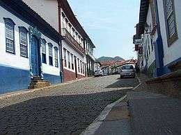
Historical buildings from the colonial period in Sabará.
References
- "Brazilian Institute of Geography and Statistics" (in Portuguese). 2017. Retrieved 27 March 2019.
2018 Area Total
- "Brazilian Institute of Geography and Statistics" (PDF) (in Portuguese). 2018. Retrieved 6 March 2019.
2018 Estimates of Population
Capital: Belo Horizonte | |||||||||||||||||||||||||
|  | ||||||||||||||||||||||||
|
| |||||||||||||||||||||||||
| |||||||||||||||||||||||||
| |||||||||||||||||||||||||
| |||||||||||||||||||||||||
| |||||||||||||||||||||||||
| |||||||||||||||||||||||||
| |||||||||||||||||||||||||
| |||||||||||||||||||||||||
| |||||||||||||||||||||||||
| |||||||||||||||||||||||||
This article is issued from Wikipedia. The text is licensed under Creative Commons - Attribution - Sharealike. Additional terms may apply for the media files.