Alto Jequitibá
Alto Jequitibá is a Brazilian municipality in the state of Minas Gerais. It belongs to the mesoregion of Zona da Mata and to the microregion of Manhuaçu. The municipality has a population of 8,528 (2015) and its area is 152 km².[1]
Alto Jequitibá | |
|---|---|
 Flag  Coat of arms | |
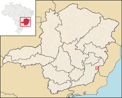 Location in Minas Gerais state | |
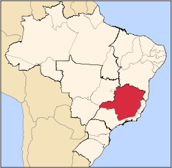
 Alto Jequitibá Location in Brazil | |
| Coordinates: 20°25′15″S 41°57′31″W | |
| Country | Brazil |
| Region | Southeast |
| State | Minas Gerais |
| Area | |
| • Total | 152 km2 (59 sq mi) |
| Population (2015) | |
| • Total | 8,528 |
| • Density | 56/km2 (150/sq mi) |
| Time zone | UTC-03:00 (BRT) |
| • Summer (DST) | UTC-02:00 (BRST) |
Geography
Settled in the highplanes among offshoots from the Pico da Bandeira, the third highest mountain of Brazil nearing 3,000 meters, in the Ocidental side of the Caparaó range of mountains. It is in the Brazil's Southeast in the bush's zone.
Demographics
Alto Jequitibá is one of the few mainly Protestant cities of Minas Gerais, mainly Presbyterian.
gollark: Heavpoot bought it.
gollark: Oh, the obelisk auction finished ages ago.
gollark: Still running.
gollark: Could you make a nice JSON one for spending it (which I assume issues a new bill) and fetching bill info?
gollark: Anyway, if I were to make osmarkscoin™, could I have some sort of API to verify a lemon bill for interop?
References
- IBGE -
External links
- (in Portuguese) Information and pictures about the city
Capital: Belo Horizonte | |||||||||||||||||||||||||
|  | ||||||||||||||||||||||||
|
| |||||||||||||||||||||||||
| |||||||||||||||||||||||||
| |||||||||||||||||||||||||
| |||||||||||||||||||||||||
| |||||||||||||||||||||||||
| |||||||||||||||||||||||||
| |||||||||||||||||||||||||
| |||||||||||||||||||||||||
| |||||||||||||||||||||||||
| |||||||||||||||||||||||||
This article is issued from Wikipedia. The text is licensed under Creative Commons - Attribution - Sharealike. Additional terms may apply for the media files.