Raghunathpur, Siwan
Raghunathpur is a Community development block and a town in district of Siwan, in Bihar state of India. It is one out of 13 blocks of Siwan Subdivision. The headquarter of the block is at Raghunathpur town.
Raghunathpur | |
|---|---|
CD Block | |
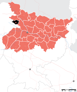
 Raghunathpur Location in Bihar, India | |
| Coordinates: 26°0′4.54″N 84°16′16.07″E | |
| Country | |
| State | Bihar |
| District | Siwan |
| Subdivision | Siwan |
| Headquarters | Raghunathpur (town) |
| Government | |
| • Type | Community development |
| • Body | Raghunathpur Block |
| Area | |
| • Total | 156.03 km2 (60.24 sq mi) |
| Population (2011) | |
| • Total | 157,694 |
| • Density | 1,000/km2 (2,600/sq mi) |
| Languages | |
| • Official | Bhojpuri, Hindi, Urdu, English |
| Time zone | UTC+5:30 (IST) |
The total area of the block is 156.03 square kilometres (60.24 sq mi) and the total population of the block as of 2011 census of India is 157,694.[1]
The block is divided into many Gram Panchayats and villages.
Gram Panchayats
Gram panchayats of Raghunathpur block in Siwan Subdivision, Siwan district[2].
- Badua
- Chakari
- Dighwalia
- Gabhirar
- Gopi Patiaon
- Karsar
- Khujwan
- Kushahara
- Narhan
- Nikhti kala
- Panjwar
- Phulwaria
- Raghunath pur
- Rajpur
- Santhi
- Tari
gollark: Furnace: convert 1 clay to 1 brick; soundofspouting: give me 1000 iron ore.
gollark: Done.
gollark: Hold on while I figure out what they are.
gollark: We don't have any RVP rules.
gollark: I *think* it works out the same.
See also
References
- "DISTRICT CENSUS HANDBOOK - Census of India" (PDF). www.censusindia.gov.in. Retrieved 3 July 2018.
- "Village & Panchayats". www.siwan.nic.in. Retrieved 3 July 2018.
Headquarter: Siwan | ||
| Siwan Subdivision |
|  |
| Maharajganj Subdivision |
| |
| Municipalities | ||
This article is issued from Wikipedia. The text is licensed under Creative Commons - Attribution - Sharealike. Additional terms may apply for the media files.