Basantpur, Siwan
Basantpur is a Community development block and a town in district of Siwan, in Bihar state of India. It is one out of 6 blocks of Maharajganj Subdivision. The headquarter of the block is situated at Maharajganj Nagar Panchayat.
Basantpur | |
|---|---|
CD Block | |
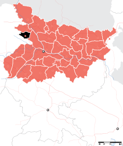
 Basantpur Location in Bihar, India | |
| Coordinates: 26.16947°N 84.663°E | |
| Country | |
| State | Bihar |
| District | Siwan |
| Subdivision | Maharajganj |
| Headquarters | Basantpur (town) |
| Government | |
| • Type | Community development |
| • Body | Maharajganj Block |
| Area | |
| • Total | 62.22 km2 (24.02 sq mi) |
| Population (2011) | |
| • Total | 105,229 |
| • Density | 1,700/km2 (4,400/sq mi) |
| Languages | |
| • Official | Bhojpuri, Hindi, Urdu, English |
| Time zone | UTC+5:30 (IST) |
Total area of the block is 62.22 square kilometres (24.02 sq mi) and the total population of the block as of 2011 census of India is 105,229.[1]
The block is divided into many Gram Panchayats and villages.
Gram Panchayats
Gram panchayats of Basantpur block in Maharajganj Subdivision, Siwan district[2].
- Baiju barhoga
- Basant pur
- Basaon
- Kanhauli
- Kumkumpur
- Molanapur
- Rajapur
- Sareya Srikant
- Suryapura
gollark: * TEA lasers
gollark: Initiating orbital tea lasers.
gollark: HERESY!
gollark: What about THE QUEEN‽!?!?!/‽!‽/⸘?!?
gollark: Replying to https://discord.com/channels/346530916832903169/348702212110680064/747219936598032417LIES! Some of us are very REFINED and will only say things like "One desires more tea."
References
- "DISTRICT CENSUS HANDBOOK - Census of India" (PDF). www.censusindia.gov.in. Retrieved 3 July 2018.
- "Village & Panchayats". www.siwan.nic.in. Retrieved 3 July 2018.
Headquarter: Siwan | ||
| Siwan Subdivision |
|  |
| Maharajganj Subdivision |
| |
| Municipalities | ||
This article is issued from Wikipedia. The text is licensed under Creative Commons - Attribution - Sharealike. Additional terms may apply for the media files.