Daraundha
Daraunda or Duraundha/Daraundha is a Community development block in district of Siwan, in Bihar state of India. It is one out of 6 blocks of Maharajganj Subdivision. The headquarter of the block is at Daraunda town.
Daraunda | |
|---|---|
CD Block | |
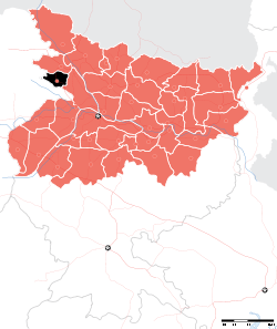
 Daraunda Location in Bihar, India | |
| Coordinates: 26.08426°N 84.45919°E | |
| Country | |
| State | Bihar |
| District | Siwan |
| Subdivision | Maharajganj |
| Headquarters | Daraunda town |
| Government | |
| • Type | Community development |
| • Body | Daraunda Block |
| Area | |
| • Total | 126.60 km2 (48.88 sq mi) |
| Population (2011) | |
| • Total | 173,200 |
| • Density | 1,400/km2 (3,500/sq mi) |
| Languages | |
| • Official | Bhojpuri, Hindi, Urdu, English |
| Time zone | UTC+5:30 (IST) |
Total area of the block is 126.60 square kilometres (48.88 sq mi) and the total population of the block as of 2011 census of India is 1,73,200.[1]
The block is divided into many Village Councils and villages.
Panchayats
The block is divided into many Gram panchayats (Village councils)[2].
- Bagoura
- Bal Bangara
- Chherahi
- Harsar
- Jalalpur
- Karsaut
- Kathua Sarangpur
- Korari Kala
- Marasara
- Pakawalia
- Pandeypur
- Pinarthu Khurd
- Ramgarha
- Ramsapur
- Rasulpur
- Rukundipur
- Sirsawn
gollark: <@331320482047721472>
gollark: It's temporarily off while I try futiley to fix the issue with pings.
gollark: https://i.redd.it/mdl2zgl2ecr51.png
gollark: [REDACTED]
gollark: The internet?
References
- "DISTRICT CENSUS HANDBOOK - Census of India" (PDF). www.censusindia.gov.in. Retrieved 3 July 2018.
- "Village & Panchayats". www.siwan.nic.in. Retrieved 3 July 2018.
Headquarter: Siwan | ||
| Siwan Subdivision |
|  |
| Maharajganj Subdivision |
| |
| Municipalities | ||
This article is issued from Wikipedia. The text is licensed under Creative Commons - Attribution - Sharealike. Additional terms may apply for the media files.