Bhagwanpur Hat
Bhagwanpur Hat is a community development block and a town in Siwan district, in Bihar state of India. It is one of the six blocks that comprise Maharajganj Subdivision. The headquarter of the block is at Bhagwanpur Hat town.
Bhagwanpur Hat | |
|---|---|
CD block | |
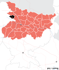
 Bhagwanpur Hat Location in Bihar, India | |
| Coordinates: 26.08685°N 84.67999°E | |
| Country | |
| State | Bihar |
| District | Siwan |
| Subdivision | Maharajganj |
| Headquarters | town |
| Government | |
| • Type | Community development |
| • Body | Bhagwanpur Hat Block |
| Area | |
| • Total | 149.40 km2 (57.68 sq mi) |
| Population (2011) | |
| • Total | 220,651 |
| • Density | 1,500/km2 (3,800/sq mi) |
| Languages | |
| • Official | Bhojpuri, Hindi, Urdu, English |
| Time zone | UTC+5:30 (IST) |
The block's total area is 149.40 square kilometres (57.68 sq mi) and the total population as of the 2011 census of India is 220,651.[1]
The block is divided into many gram panchayats (village councils) and villages.
Gram panchayats
Gram panchayats of Bhagwanpur Hat block in Maharajganj Subdivision, Siwan district:[2].
- Balahan arazi
- Bansohi
- Barka gaon
- Bhikhampur
- Bilaspur
- Bithuna
- Brahmasthan
- Gopalpur
- Kauria
- Kherwa
- Mahamada
- Mahamadpur
- Mirjumala
- Morakhas
- Sagar Sultanpur dakshin
- Sagar Sultanpur uttar
- Sahasaraon
- Sankarpur
- Saraya parauli
- Sondhani
gollark: Well, the patchy leaf doesn't do much.
gollark: Why should I?
gollark: I don't see why you can't just run the system on Minoteaur.
gollark: i.e. a similar vaguely game-theoretic thing but more complicated.
gollark: Idea: iterated prisoner's dilemma but good (some offense)?
References
- "DISTRICT CENSUS HANDBOOK - Census of India" (PDF). www.censusindia.gov.in. Retrieved 3 July 2018.
- "Village & Panchayats". www.siwan.nic.in. Retrieved 3 July 2018.
Headquarter: Siwan | ||
| Siwan Subdivision |
|  |
| Maharajganj Subdivision |
| |
| Municipalities | ||
This article is issued from Wikipedia. The text is licensed under Creative Commons - Attribution - Sharealike. Additional terms may apply for the media files.