Guthani
Guthani is a Community development block and a town in district of Siwan, in Bihar state of India. It is one out of 13 blocks of Siwan Subdivision. The headquarter of the block is at Guthani town. Total area of the block is 91.70 square kilometres (35.41 sq mi) and the total population of the block as of 2011 census of India is 128,155. [1]
Guthani | |
|---|---|
CD Block | |
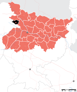
 Guthani Location in Bihar, India | |
| Coordinates: 26.1636°N 84.0364°E | |
| Country | |
| State | Bihar |
| District | Siwan |
| Subdivision | Siwan |
| Headquarters | Guthani (town) |
| Government | |
| • Type | Community development |
| • Body | Guthani Block |
| Area | |
| • Total | 91.70 km2 (35.41 sq mi) |
| Elevation | 73 m (240 ft) |
| Population (2011) | |
| • Total | 128,155 |
| • Density | 1,400/km2 (3,600/sq mi) |
| Languages | |
| • Official | Bhojpuri, Hindi, Urdu, English |
| Time zone | UTC+5:30 (IST) |
| PIN | 841435 |
| Telephone code | 06157 |
The block is divided into many Gram Panchayats and villages.
Gram Panchayats
Gram panchayats of Guthani block in Siwan Subdivision, Siwan district[2].
- Balua
- Barpalia
- Belaur
- Biswar
- Chitakhal
- Guthani east
- Guthani west
- Jataur
- Parari
- Sohagara
- Sonahula
- Tarawa khurd
- Chillmarwa
gollark: There's a karma requirement IIRC.
gollark: I guess if you just don't care about it and have it throw away money and build up increasingly large debts...
gollark: But won't that just result in one of the bots losing out?
gollark: Hmmmm...
gollark: So the optimal approach would probably either be something like long-term boring trading humans won't do which works on large amounts of the market, or relatively high-speed reaction to new memes.
See also
References
- "DISTRICT CENSUS HANDBOOK - Census of India" (PDF). www.censusindia.gov.in. Retrieved 3 July 2018.
- "Village & Panchayats". www.siwan.nic.in. Retrieved 3 July 2018.
Headquarter: Siwan | ||
| Siwan Subdivision |
|  |
| Maharajganj Subdivision |
| |
| Municipalities | ||
This article is issued from Wikipedia. The text is licensed under Creative Commons - Attribution - Sharealike. Additional terms may apply for the media files.