Provincial Highway 63 (Taiwan)
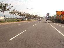
Provincial Highway 63 (Chinese: 台63線) is a limited-access highway, which begins in Taichung at the intersection of Guoguang Road (Provincial Highway No. 3) and Zhongming South Road and ends in Caotun, Nantou on Bixing Road (Provincial Road 14B). It is commonly known as Zhongtou (Taichung-Nantou) Highway.
| ||||
|---|---|---|---|---|
 | ||||
| Route information | ||||
| Maintained by Directorate General of Highways | ||||
| Length | 18.9 km[1] (11.7 mi) | |||
| Major junctions | ||||
| North end | ||||
| East end | ||||
| Highway system | ||||
Highway system in Taiwan
| ||||

Provincial Highway 63
Length
The total length of the highway is 18.9 km. However, the viaduct actually begins at 1.8 km (on Wuquan South Road).
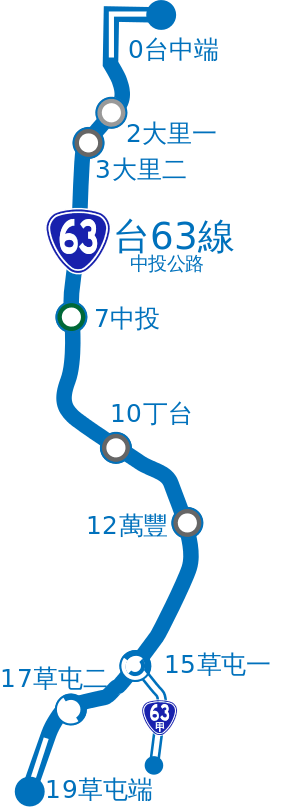
Exit list
| City | Location | km[1] | Mile | Exit | Name | Destinations | Notes |
|---|---|---|---|---|---|---|---|
| Taichung City | South District | 0.000 | 0.000 | — | |||
| Dali | 2.6 | 1.6 | 2 | Dali 1 | Defang Rd., Wenxin South Rd. - Dali, Nantun | ||
| 3.9 | 2.4 | 3 | Dali 2 | Dali Rd., Wuguang Rd. - Wufeng, Wuri | |||
| Wufeng | 6.2 | 3.9 | 6 | Wufu | Wufu Rd., Wufu South Rd. - Dali, Wufeng | ||
| 7.74 | 4.81 | 7 | Zhongtou | ||||
| 8.2 | 5.1 | 8 | Taiming | ||||
| 10.1 | 6.3 | 10 | Dingtai | Dingtai Rd. | |||
| 12.4 | 7.7 | 12 | Wanfeng | Fengzheng Rd. | |||
| Nantou County | Caotun | 14.8 | 9.2 | 14 | Caotun 1 | ||
| 16.7 | 10.4 | 16 | Caotun 2 | ||||
| 18.98 | 11.79 | 18 | |||||
| 1.000 mi = 1.609 km; 1.000 km = 0.621 mi | |||||||
Major Cities Along the Route
- Taichung
- Caotun, Nantou
Intersections with other Freeways and Expressways
- None. However, it crosses National Highway No. 3 near Zhongtou IC. in Wufeng, Taichung. To access National Highway No. 3, one must navigate surface streets for two or three minutes to get onto a northbound or southbound ramp for the highway.
Spurs
There is a spur (No. 63A) connecting to Bo-ai Road (Provincial Highway No. 14) in downtown Caotun, Nantou. The length of the spur is 2.8 km.
gollark: Odd. SQLite is meant to run basically anywhere.
gollark: You could probably just use SQLite.
gollark: Probably? I just use the grml-zsh-config package but I don't see why that would break.
gollark: It's the name of the PACkage MANager.
gollark: I didn't mention graphical interfaces.
See also
Notes
Completed on January 1, 1998.
This highway is no longer classified as an expressway on July 1, 2006. Despite this lack of designation, it still functions as one.
References
- "Expressway Mileage Chart" (in Chinese). Directorate General of Highways, MOTC. Retrieved October 2, 2015.
Provincial Highways of Taiwan | ||
|---|---|---|
This article is issued from Wikipedia. The text is licensed under Creative Commons - Attribution - Sharealike. Additional terms may apply for the media files.