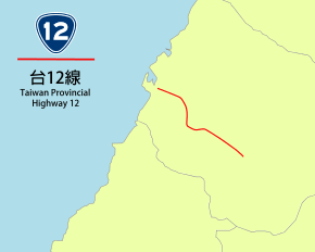
Provincial Highway 12 (Taiwan)
Provincial Highway 12, named as Taiwan Blvd. (台灣大道) for its entire length, is a 23.2 km[1] east-west highway that connects Port of Taichung in Wuqi with downtown Taichung City.
| ||||
|---|---|---|---|---|
| 台12線 | ||||
| Taiwan Blvd. | ||||
 | ||||
| Route information | ||||
| Maintained by Directorate General of Highways | ||||
| Length | 23.193 km (14.411 mi) | |||
| Major junctions | ||||
| West end | ||||
| East end | Taichung railway station | |||
| Highway system | ||||
Highway system in Taiwan
| ||||
Highway 12 is one of the major thoroughfares of Taichung, connecting the historic downtown at Central District with its newer central business district in Xitun District. The road is also one of three that connect to National freeway 1 in Xitun. Between 2014-2015, the Taichung BRT ran on Highway 12 between Taichung railway station and Providence University in Shalu District, and there are plans to build a metro line at the BRT systems's former course.[2][3]
Route description
Highway 12 begins on the north side of Taichung railway station, where it runs as a four-lane road in a northwest direction through Central District. After crossing Highway 1A in West District, Taichung, the road widens into a six lane road with additional separated motorcycle lanes on each side. The two lanes directly adjacent to the motorcycle lane divider are bus lanes, which were formerly dedicated to the Taichung BRT, but now permit conventional buses to run on.[4] In Xitun District right after Maple Garden Park, the middle lanes are elevated over Route 127 on an overpass known as Guangming Overpass (光明陸橋) before returning to ground level to pass under Highway 74.[5] Then, the highway connects to National Freeway 1.
After crossing the Fazi River, the road begins its ascent over Dadu Plateau. At its peak near Tunghai University, the road meets Zhongxing Rd, which connects to Route 136 for access to National Freeway 3. Here, Highway 12 turns north as it descends into Shalu District. The bus lane ends at Providence University. At downtown Shalu, the road turns northwest and is elevated again to cross the Western Trunk railway line on an overpass named Shalu Overpass (沙鹿陸橋).[6] After the overpass, the highway flattens out as it enters Wuqi District. It crosses Highway 1, Highway 61, and lastly Highway 17 before arriving at the gate of the Port of Taichung.
References
- "省道公路里程表" (PDF). Directorate General of Highways (in Chinese). 28 May 2015. Retrieved 8 June 2020.
- "台中捷運藍線、橘線規劃進度 專案報告" (PDF). Taichung City Government (in Chinese). Retrieved 8 June 2020.
- 張菁雅 (19 November 2019). "台中捷運藍線2020動工?中市府這麼說..." (in Chinese). Liberty Times. Retrieved 8 June 2020.
- 張菁雅 (8 June 2015). "取代BRT 9線公車走台灣大道" (in Chinese). Liberty Times. Retrieved 8 June 2020.
- 盧金足 (11 February 2016). "中市光明陸橋是否拆除?網友意見兩極" (in Chinese). China Times. Retrieved 8 June 2020.
- 張軒哲 (13 July 2018). "沙鹿陸橋歷時三年多改建完工 今午開放全線通車" (in Chinese). Liberty Times. Retrieved 8 June 2020.
