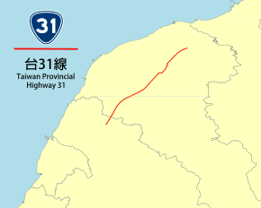
Provincial Highway 31 (Taiwan)
Provincial Highway 31 (Chinese: 台31線) is a 17.876-kilometre-long (11.108-mile) provincial highway in Taoyuan City, Taiwan. An elevated section of the Taiwan High Speed Rail viaduct and under-tunnel acts as a median for most of the highway, except when the highway is near THSR Taoyuan Station and when the highway is near and on its southern terminus.[2] The highway serves the THSR Taoyuan Station.
| ||||
|---|---|---|---|---|
 | ||||
| Route information | ||||
| Maintained by Directorate General of Highways | ||||
| Length | 17.876 km[1] (11.108 mi) | |||
| Major junctions | ||||
| North end | ||||
| South end | ||||
| Highway system | ||||
Highway system in Taiwan
| ||||
Major intersections
| County | Location | km[2] | mi | Destinations | Notes |
|---|---|---|---|---|---|
| Luzhu | 0.0 | 0.0 | |||
| 0.75 | 0.47 | TR 15 (Fuguo Road) – Shuiwei, Zhuwei, Taoyuan District | |||
| 2.1 | 1.3 | TR 19 (Fuhua Road) – Dahua, Luzhu Village | |||
| 4.8 | 3.0 | Exit 5 (Dazhu Interchange) on Fwy. 2 | |||
| 4.8 | 3.0 | Northbound exit and southbound entrance | |||
| Dayuan | 5.7 | 3.5 | |||
| Zhongli | 8.8 | 5.5 | North end of CR 113C concurrency | ||
| 9.3 | 5.8 | South end of CR 113C concurrency | |||
| 10.6 | 6.6 | ||||
| 11.8 | 7.3 | TR 43-1 (Shengde Road) – Zhongli, Dayuan | |||
| 12.9 | 8.0 | ||||
| Zhongli–Xinwu border | 16.5 | 10.3 | |||
| Xinwu | 17.9 | 11.1 | At-grade intersection | ||
1.000 mi = 1.609 km; 1.000 km = 0.621 mi
| |||||
gollark: I also made it so that you can do `1 / "d" * "abcdefg"`.
gollark: `{"abc", "efg"}`
gollark: Thanks to metatable insanity.
gollark: `"abcdefg" / "d"` works.
gollark: Like how potatOS implements string division.
References
- "Provincial Highway Mileage Table". Directorate General of Highways. Retrieved 27 March 2014.
- Google (27 March 2014). "Provincial Highway 31 (Taiwan)" (Map). Google Maps. Google. Retrieved 27 March 2014.
External links
This article is issued from Wikipedia. The text is licensed under Creative Commons - Attribution - Sharealike. Additional terms may apply for the media files.
