Shalu District
Shalu District (Chinese: 沙鹿區; pinyin: Shālù Qū) is a suburban district in central Taichung City, Taiwan.
Shalu 沙鹿區 | |
|---|---|
| Shalu District | |
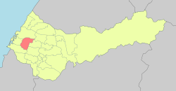 Shalu District in Taichung City | |
 Shalu Shalu District in Taichung City | |
| Coordinates: 24°14′21.9″N 120°33′43.6″E | |
| Location | Taichung, Taiwan |
| Government | |
| • Mayor | 廖財崇 |
| Area | |
| • Total | 40.46 km2 (15.62 sq mi) |
| Population (December 2018)[3] | |
| • Total | 94,079 |
| • Rank | 12 out of 29 |
| • Density | 2,300/km2 (6,000/sq mi) |
| Website | www.shalu.taichung.gov.tw (in Chinese) |
History
Originally a settlement of the Papora people, this region was named 沙轆社. During the Kingdom of Tungning (1662-1683), the Taiwanese Plains Aborigines were driven away or sinicized, and the area became a Han settlement. In 1731 during Qing rule, Tamsui Subprefecture (淡水廳) extended from the Tai-kah River northward up to Kelang (雞籠; Keelung).
In 1920, during Japanese rule, the written name was changed to Sharoku (沙鹿). Administratively, Sharoku was under Taikō District (大甲郡), Taichū Prefecture. In Taiwanese Hokkien, the old name (Soa-la̍k) is still used.
In 1945 the village was changed to an township, and was upgraded to a district in 2010.
Administrative divisions
Juren, Luoquan, Shalu, Meiren, Xingren, Xingan, Doudi, Lufeng, Luliao, Zhulin, Lifen, Fuxing, Beishi, Jinjiang, Liulu, Nanshi, Puzi, Sanlu, Gongming, Qingquan and Xishi Village.
Education
Tourist attractions
Notable natives
- Hung Tzu-yung, member of Legislative Yuan
- Yen Ching-piao, member of Legislative Yuan (2002–2012)
- Yen Kuan-heng, member of Legislative Yuan
See also
References
- "廖財崇". 臺中市沙鹿區公所.
- "地理氣候". 臺中市沙鹿區公所.
- "臺中市政府民政局 ::: 人口統計管理平台 :::". demographics.taichung.gov.tw.
External links
| Wikimedia Commons has media related to Shalu District, Taichung. |
- Shalu District Government (in Chinese)