Pok To Yan
Pok To Yan (Chinese: 薄刀屻, literally "Thin Razor's Edge"), is a mountain on Lantau Island, Hong Kong, with a height of 529 metres (1,736 ft) above sea level.
| Pok To Yan | |
|---|---|
| 薄刀屻 | |
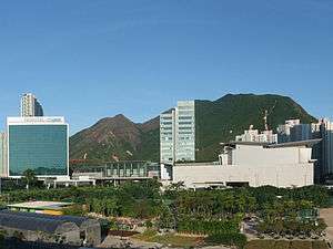
 On the right is Pok To Yan | |
| Highest point | |
| Elevation | 529 m (1,736 ft) |
| Coordinates | 22°16′55″N 113°57′24″E |
| Geography | |
 Pok To Yan Location of Pok To Yan in Hong Kong | |
| Location | Lantau Island, |
Geology

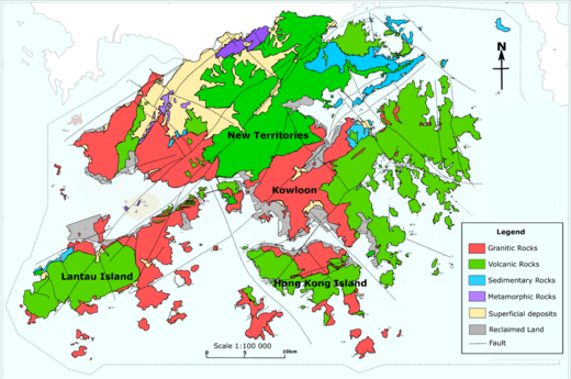
Pok To Yan is in the Green area on Lantau Island
Pok To Yan is formed by Volcanic rocks, much like many of the tallest mountains on Lantau Island, such as Lantau Peak.
Flora
Pok To Yan and neighbouring Por Kai Shan were designated together a "Site of Special Scientific Interest" in 1994. According to the local government, Pok To Yan has "over 200 species of native plants." and "a number of rare and protected indigenous plants".[1]
Geography
To the northwest is Tung Chung, while to the south is Sunset Peak.[2]
gollark: > Frame analysis (also called framing analysis) is a multi-disciplinary social science research method used to analyze how people understand situations and activities. Frame analysis looks at images, stereotypes, metaphors, actors, messages, and more. It examines how important these factors are and how and why they are chosen.This seems unrelated.
gollark: What is a ”frame analysis” and why not use bigger samples?
gollark: That seems unthingy.
gollark: For purposes only.
gollark: Well, tell me if you do things I guess?
References
- "環境保護署 - 策略性環境評估". www.epd.gov.hk. Retrieved 2020-04-10.
- "District Council Constituency Boundaries" (PDF). HK Government Electoral Affairs Commission.
This article is issued from Wikipedia. The text is licensed under Creative Commons - Attribution - Sharealike. Additional terms may apply for the media files.