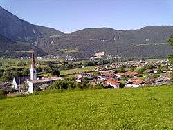
Pfaffenhofen, Tyrol
![]()
Pfaffenhofen | |
|---|---|
 | |
 Coat of arms | |
 Pfaffenhofen Location within Austria | |
| Coordinates: 47°17′00″N 11°04′00″E | |
| Country | Austria |
| State | Tyrol |
| District | Innsbruck |
| Government | |
| • Mayor | Andreas Schmid |
| Area | |
| • Total | 7 km2 (3 sq mi) |
| Elevation | 642 m (2,106 ft) |
| Population (2018-01-01)[2] | |
| • Total | 1,102 |
| • Density | 160/km2 (410/sq mi) |
| Time zone | UTC+1 (CET) |
| • Summer (DST) | UTC+2 (CEST) |
| Postal code | 6405 |
| Area code | 05262 |
| Vehicle registration | IL |
| Website | www.pfaffenhofen.tirol.gv.at |
Population
| Year | Pop. | ±% |
|---|---|---|
| 1869 | 353 | — |
| 1880 | 398 | +12.7% |
| 1890 | 463 | +16.3% |
| 1900 | 510 | +10.2% |
| 1910 | 541 | +6.1% |
| 1923 | 625 | +15.5% |
| 1934 | 677 | +8.3% |
| 1939 | 686 | +1.3% |
| 1951 | 742 | +8.2% |
| 1961 | 762 | +2.7% |
| 1971 | 885 | +16.1% |
| 1981 | 954 | +7.8% |
| 1991 | 979 | +2.6% |
| 2001 | 1,113 | +13.7% |
| 2011 | 1,062 | −4.6% |
gollark: Extra tickets, not an actual prize.
gollark: To Suggestions/Requests! Again!
gollark: Hmm... good idea.
gollark: 🌵
gollark: I think they should limit it to one per person though.
References
- "Dauersiedlungsraum der Gemeinden Politischen Bezirke und Bundesländer - Gebietsstand 1.1.2018". Statistics Austria. Retrieved 10 March 2019.
- "Einwohnerzahl 1.1.2018 nach Gemeinden mit Status, Gebietsstand 1.1.2018". Statistics Austria. Retrieved 9 March 2019.
This article is issued from Wikipedia. The text is licensed under Creative Commons - Attribution - Sharealike. Additional terms may apply for the media files.