Götzens
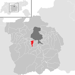
Götzens is a community in the district of Innsbruck-Land in Tyrol and lies on a terrace of the highlands above the capital. The nearest neighbouring villages are Axams and Birgitz in the west. The village was founded in 1869.
Götzens | |
|---|---|
 Coat of arms | |
 Location in the district | |
 Götzens Location within Austria | |
| Coordinates: 47°14′10″N 11°18′41″E | |
| Country | Austria |
| State | Tyrol |
| District | Innsbruck Land |
| Government | |
| • Mayor | Hans Payr (Die neue ÖVP) |
| Area | |
| • Total | 9.72 km2 (3.75 sq mi) |
| Elevation | 868 m (2,848 ft) |
| Population (2018-01-01)[2] | |
| • Total | 4,062 |
| • Density | 420/km2 (1,100/sq mi) |
| Time zone | UTC+1 (CET) |
| • Summer (DST) | UTC+2 (CEST) |
| Postal code | 6091 |
| Area code | 05234 |
| Vehicle registration | IL |
| Website | www.goetzens.tirol.gv.at |
Population
| Year | Pop. | ±% |
|---|---|---|
| 1869 | 695 | — |
| 1880 | 683 | −1.7% |
| 1890 | 675 | −1.2% |
| 1900 | 652 | −3.4% |
| 1910 | 686 | +5.2% |
| 1923 | 677 | −1.3% |
| 1934 | 810 | +19.6% |
| 1939 | 857 | +5.8% |
| 1951 | 1,018 | +18.8% |
| 1961 | 1,249 | +22.7% |
| 1971 | 2,090 | +67.3% |
| 1981 | 2,734 | +30.8% |
| 1991 | 3,261 | +19.3% |
| 2001 | 3,526 | +8.1% |
| 2011 | 3,888 | +10.3% |
| 2015 | 3,984 | +2.5% |
gollark: Do villagers actually do that? Usually it would be backwards.
gollark: Please crop these better.
gollark: I'm surprised Elon Musk hasn't volunteered some ridiculous proposal yet.
gollark: You can read it directly from the website: https://www.smbc-comics.com/
gollark: I do have an actual word-y internal monologue, personally.
References
- "Dauersiedlungsraum der Gemeinden Politischen Bezirke und Bundesländer - Gebietsstand 1.1.2018". Statistics Austria. Retrieved 10 March 2019.
- "Einwohnerzahl 1.1.2018 nach Gemeinden mit Status, Gebietsstand 1.1.2018". Statistics Austria. Retrieved 9 March 2019.
This article is issued from Wikipedia. The text is licensed under Creative Commons - Attribution - Sharealike. Additional terms may apply for the media files.