Ormas, Indiana
Ormas is an unincorporated community in Whitley and Noble counties, in the U.S. state of Indiana.[2]
Ormas, Indiana | |
|---|---|
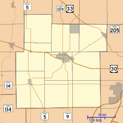
 Ormas Ormas, as seen in a map of Whitley County | |
| Coordinates: 41°17′43″N 85°32′45″W | |
| Country | United States |
| State | Indiana |
| County | Whitley, Noble |
| Township | Etna-Troy, Washington |
| Elevation | 906 ft (276 m) |
| Time zone | UTC-5 (Eastern (EST)) |
| • Summer (DST) | UTC-4 (EDT) |
| ZIP code | 46725 |
| Area code(s) | 260 |
| GNIS feature ID | 450573 |
History
Ormas was founded in 1856.[3] The community's name honors Ormas Jones, an early settler.[4]
A post office was established at Ormas in 1880, and remained in operation until it was discontinued in 1904.[5]
Geography
Ormas is located at 41°17′43″N 85°32′45″W.
gollark: <@345300752975003649> <@341618941317349376>
gollark: 🔥🦊: A Browser Which Isn't Chrome™
gollark: https://i.osmarks.tk/gVO9.jpg
gollark: `null`
gollark: How to Write Perfect Python Command-line Interfaces (blog.sicara.com)submitted 5 hours ago by __yannickw__ 60 commentssharesavehidegive awardreportcrosspost2120A tiny compiler with ELF and PE executable for x86 (github.com)submitted 13 hours ago by l0n3_c0d3r 24 commentssharesavehidegive awardreportcrosspost327Why you should learn F# (dusted.codes)submitted 4 hours ago by dustinmoris 28 commentssharesavehidegive awardreportcrosspost41635Sandspiel – A falling sand game built in Rust and WebGL (sandspiel.club)submitted 1 day ago by j_orshman 131 commentssharesavehidegive awardreportcrosspost547Implementing VisiCalc (2015) (rmf.vc)submitted 10 hours ago by erad 1 commentsharesavehidegive awardreportcrosspost6•16x AA font rendering using coverage masks (part III) (superluminal.eu)submitted an hour ago by rovarma commentsharesavehidegive awardreportcrosspost7357The Consequences of Your Code | Tom Scott (youtube.com)submitted 1 day ago by STR_Warrior 59 commentssharesavehidegive awardreportcrosspost816Building a telegram Bot from scratch - R (codecampanion.blogspot.com)
References
- "US Board on Geographic Names". United States Geological Survey. 2007-10-25. Retrieved 2016-07-06.
- "Ormas, Indiana". Geographic Names Information System. United States Geological Survey. Retrieved July 16, 2017.
- Baker, Ronald L. (October 1995). From Needmore to Prosperity: Hoosier Place Names in Folklore and History. Indiana University Press. p. 253. ISBN 978-0-253-32866-3.
This village was laid out on May 9, 1856...
- "Profile for Ormas, IN". ePodunk. Retrieved 13 September 2015.
- "Whitley County". Jim Forte Postal History. Retrieved 13 September 2015.
This article is issued from Wikipedia. The text is licensed under Creative Commons - Attribution - Sharealike. Additional terms may apply for the media files.