Coesse, Indiana
Coesse is an unincorporated community in Union Township, Whitley County, in the U.S. state of Indiana.[3]
Coesse, Indiana | |
|---|---|
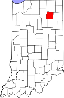 Whitley County's location in Indiana | |
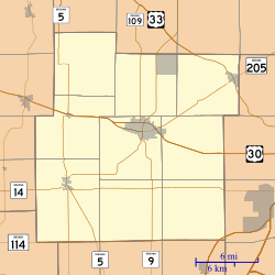 Coesse Location of Coesse in Whitley County | |
| Coordinates: 41°07′40″N 85°23′43″W | |
| Country | United States |
| State | Indiana |
| County | Whitley |
| Township | Union |
| Elevation | 876 ft (267 m) |
| Time zone | UTC-5 (Eastern (EST)) |
| • Summer (DST) | UTC-4 (EDT) |
| ZIP code | 46725 |
| Area code(s) | 260 |
| FIPS code | 18-14104[2] |
| GNIS feature ID | 432728 |
History
Coesse was platted in 1854, and was named after Chief Coesse (Kowazi), who was the grandson of Miami Chief Michikinikwa (Little Turtle).[4] A post office was established at Coesse in 1843, and remained in operation until it was discontinued in 1967.[5]
Geography
Coesse is located at 41°07′40″N 85°23′43″W.
gollark: Fiona™, YOU should join Heavserver.
gollark: ↑ engage in observance, apipsoids
gollark: ++help remind
gollark: ++remind 44w apio`ᵖʳᵢⁿ`ᵗoform
gollark: No.
References
- "US Board on Geographic Names". United States Geological Survey. October 25, 2007. Retrieved 2016-07-05.
- "U.S. Census website". United States Census Bureau. Retrieved 2008-01-31.
- "Coesse, Indiana". Geographic Names Information System. United States Geological Survey. Retrieved July 24, 2017.
- Baker, Ronald L. (October 1995). From Needmore to Prosperity: Hoosier Place Names in Folklore and History. Indiana University Press. p. 99. ISBN 978-0-253-32866-3.
...was laid out in 1854. The name is a derivation of a Potawatomi nickname of a Miami chief, Ku-wa-zi...
- "Whitley County". Jim Forte Postal History. Retrieved 5 July 2016.
Municipalities and communities of Whitley County, Indiana, United States | ||
|---|---|---|
| City | Map of Indiana highlighting Whitley County | |
| Towns | ||
| Townships | ||
| CDP | ||
| Other unincorporated communities | ||
| Footnotes | ‡This populated place also has portions in an adjacent county or counties | |
This article is issued from Wikipedia. The text is licensed under Creative Commons - Attribution - Sharealike. Additional terms may apply for the media files.