Green Township, Noble County, Indiana
Green Township is one of thirteen townships in Noble County, Indiana, United States. As of the 2010 census, its population was 2,123 and it contained 734 housing units.[2]
Green Township | |
|---|---|
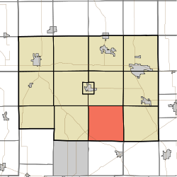 Location in Noble County | |
| Coordinates: 41°18′54″N 85°22′31″W | |
| Country | |
| State | |
| County | Noble |
| Government | |
| • Type | Indiana township |
| Area | |
| • Total | 36.03 sq mi (93.3 km2) |
| • Land | 35.67 sq mi (92.4 km2) |
| • Water | 0.37 sq mi (1.0 km2) 1.03% |
| Elevation | 984 ft (300 m) |
| Population (2010) | |
| • Total | 2,123 |
| • Density | 59.5/sq mi (23.0/km2) |
| Time zone | UTC-5 (Eastern (EST)) |
| • Summer (DST) | UTC-4 (EDT) |
| ZIP codes | 46701, 46710, 46723, 46763 |
| Area code(s) | 260 |
| GNIS feature ID | 453345 |
History
The Stanley School-District No. 2 was listed on the National Register of Historic Places in 2014.[3]
Geography
According to the 2010 census, the township has a total area of 36.03 square miles (93.3 km2), of which 35.67 square miles (92.4 km2) (or 99.00%) is land and 0.37 square miles (0.96 km2) (or 1.03%) is water.[2]
Unincorporated towns
(This list is based on USGS data and may include former settlements.)
Cemeteries
The township contains Grays Cemetery.
Major highways
Airports and landing strips
- Green Center Airport
Lakes
- Bowen Lake
- Dock Lake
- Hickman Lake
- Krieger Lake
- Lindsey Lake
- Long Lake
- Mc Henry Lake
- Millers Lake
- Norman Lake
- River Lake
- Sand Lake
- Sucker Lake
- Summit Lake
School districts
- Smith-Green Community Schools
Political districts
- Indiana's 3rd congressional district
- State House District 83
- State Senate District 13
gollark: If, on other servers, there is a significant enough furry presence already that there's actually much of a "war", then you would expect that to have already triggered a war if that's all that's needed.
gollark: It, er, sounds like you stir up conflict somehow then?
gollark: > They'll make it as good as all the software they makeThis is Google. They will randomly kill it, or make another application doing nearly the same thing but lacking some critical feature and make everyone switch, while mining your data.
gollark: Greetings, mortal.
gollark: Apparently having music functions is very trendy in Discord bots, so I just have six of them streaming random YouTube videos into my brain.
References
- "Green Township, Noble County, Indiana". Geographic Names Information System. United States Geological Survey. Retrieved 2009-10-17.
- United States Census Bureau 2008 TIGER/Line Shapefiles
- IndianaMap
- "US Board on Geographic Names". United States Geological Survey. October 25, 2007. Retrieved 2017-05-09.
- "Population, Housing Units, Area, and Density: 2010 - County -- County Subdivision and Place -- 2010 Census Summary File 1". United States Census. Archived from the original on 2020-02-12. Retrieved 2013-05-10.
- "National Register of Historic Places Listings". Weekly List of Actions Taken on Properties: 12/15/14 through 12/19/14. National Park Service. 2014-12-24.
External links
- Indiana Township Association
- United Township Association of Indiana
- City-Data.com page for Green Township
Places adjacent to Green Township, Noble County, Indiana | |
|---|---|
Municipalities and communities of Noble County, Indiana, United States | ||
|---|---|---|
| Cities | Map of Indiana highlighting Noble County | |
| Towns | ||
| Townships | ||
| CDP | ||
| Unincorporated communities | ||
| Footnotes | ‡This populated place also has portions in an adjacent county or counties | |
| Authority control |
|
|---|
This article is issued from Wikipedia. The text is licensed under Creative Commons - Attribution - Sharealike. Additional terms may apply for the media files.