Allen Township, Noble County, Indiana
Allen Township is one of thirteen townships in Noble County, Indiana, United States. As of the 2010 census, its population was 7,134 and it contained 2,933 housing units.[2]
Allen Township | |
|---|---|
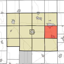 Location in Noble County | |
| Coordinates: 41°23′32″N 85°14′51″W | |
| Country | |
| State | |
| County | Noble |
| Government | |
| • Type | Indiana township |
| Area | |
| • Total | 35.85 sq mi (92.9 km2) |
| • Land | 35.76 sq mi (92.6 km2) |
| • Water | 0.08 sq mi (0.2 km2) 0.22% |
| Elevation | 974 ft (297 m) |
| Population (2010) | |
| • Total | 7,134 |
| • Density | 199.5/sq mi (77.0/km2) |
| Time zone | UTC-5 (Eastern (EST)) |
| • Summer (DST) | UTC-4 (EDT) |
| ZIP codes | 46710, 46755 |
| Area code(s) | 260 |
| GNIS feature ID | 453086 |
Geography
According to the 2010 census, the township has a total area of 35.85 square miles (92.9 km2), of which 35.76 square miles (92.6 km2) (or 99.75%) is land and 0.08 square miles (0.21 km2) (or 0.22%) is water.[2]
Cities, towns, villages
- Avilla
- Kendallville (south side)
Unincorporated towns
(This list is based on USGS data and may include former settlements.)
Cemeteries
The township contains Saint Marys Cemetery. Information about decedents buried in this cemetery is available through the Indiana Genealogical Society, Fort Wayne, Indiana. The Lisbon Cemetery is accessed via a private drive off West Lisbon Road. Information about decedents buried in this cemetery is available through the Indiana Genealogical Society, Fort Wayne, Indiana.
Major highways
School districts
- East Noble School Corporation
Political districts
- Indiana's 3rd congressional district
- State House District 52
- State Senate District 13
References
- "Allen Township, Noble County, Indiana". Geographic Names Information System. United States Geological Survey. Retrieved 2009-10-17.
- United States Census Bureau 2008 TIGER/Line Shapefiles
- IndianaMap
- "US Board on Geographic Names". United States Geological Survey. October 25, 2007. Retrieved 2017-05-09.
- "Population, Housing Units, Area, and Density: 2010 - County -- County Subdivision and Place -- 2010 Census Summary File 1". United States Census. Archived from the original on 2020-02-12. Retrieved 2013-05-10.
External links
- Indiana Township Association
- United Township Association of Indiana
- City-Data.com page for Allen Township
Places adjacent to Allen Township, Noble County, Indiana | |
|---|---|
Municipalities and communities of Noble County, Indiana, United States | ||
|---|---|---|
| Cities | Map of Indiana highlighting Noble County | |
| Towns | ||
| Townships | ||
| CDP | ||
| Unincorporated communities | ||
| Footnotes | ‡This populated place also has portions in an adjacent county or counties | |