Elkhart Township, Noble County, Indiana
Elkhart Township is one of thirteen townships in Noble County, Indiana, United States. As of the 2010 census, its population was 2,065 and it contained 826 housing units.[2]
Elkhart Township | |
|---|---|
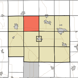 Location in Noble County | |
| Coordinates: 41°28′53″N 85°28′43″W | |
| Country | |
| State | |
| County | Noble |
| Government | |
| • Type | Indiana township |
| Area | |
| • Total | 35.9 sq mi (93 km2) |
| • Land | 35.38 sq mi (91.6 km2) |
| • Water | 0.52 sq mi (1.3 km2) 1.45% |
| Elevation | 899 ft (274 m) |
| Population (2010) | |
| • Total | 2,065 |
| • Density | 58.4/sq mi (22.5/km2) |
| Time zone | UTC-5 (Eastern (EST)) |
| • Summer (DST) | UTC-4 (EDT) |
| ZIP codes | 46571, 46767, 46784, 46794 |
| Area code(s) | 260 |
| GNIS feature ID | 453276 |
Geography
According to the 2010 census, the township has a total area of 35.9 square miles (93 km2), of which 35.38 square miles (91.6 km2) (or 98.55%) is land and 0.52 square miles (1.3 km2) (or 1.45%) is water.[2]
Unincorporated towns
Cemeteries
The township contains 3 cemeteries Lower (Lauer), Cosperville, & Rice (Brothwell) Cemeteries. The township contains Cosperville Cemetery. The township contains Rice/Brothwell Cemetery.
Major highways
Lakes
- Mirror Lake
- a portion of Diamond lake
School districts
- West Noble School Corporation
Political districts
- Indiana's 3rd congressional district
- State House District 52
- State Senate District 13
gollark: Is for clientside things, yes.
gollark: This is because I like the web platform™ for all user facing stuff ever.
gollark: For tasks like "database IO" and "interweb".
gollark: I IKR, right?
gollark: I investigated this but the libraries were bad.
References
- "Elkhart Township, Noble County, Indiana". Geographic Names Information System. United States Geological Survey. Retrieved 2009-10-17.
- United States Census Bureau 2008 TIGER/Line Shapefiles
- IndianaMap
- "US Board on Geographic Names". United States Geological Survey. October 25, 2007. Retrieved 2017-05-09.
- "Population, Housing Units, Area, and Density: 2010 - County -- County Subdivision and Place -- 2010 Census Summary File 1". United States Census. Archived from the original on 2020-02-12. Retrieved 2013-05-10.
External links
- Indiana Township Association
- United Township Association of Indiana
- City-Data.com page for Elkhart Township
Places adjacent to Elkhart Township, Noble County, Indiana | |
|---|---|
Municipalities and communities of Noble County, Indiana, United States | ||
|---|---|---|
| Cities | Map of Indiana highlighting Noble County | |
| Towns | ||
| Townships | ||
| CDP | ||
| Unincorporated communities | ||
| Footnotes | ‡This populated place also has portions in an adjacent county or counties | |
This article is issued from Wikipedia. The text is licensed under Creative Commons - Attribution - Sharealike. Additional terms may apply for the media files.