Nový Malín
Nový Malín (until 1947 Frankštát, German: Frankstadt an der Mährischen Grenzbahn) is a village and municipality (obec) in Šumperk District in the Olomouc Region of the Czech Republic.
Nový Malín | |
|---|---|
Municipality | |
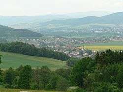 Nový Malín seen from the east | |
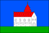 Flag 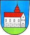 Coat of arms | |
 Nový Malín | |
| Coordinates: 49°56′51″N 17°1′51″E | |
| Country | |
| Region | Olomouc |
| District | Šumperk |
| Area | |
| • Total | 27.32 km2 (10.55 sq mi) |
| Elevation | 317 m (1,040 ft) |
| Population (2006) | |
| • Total | 2,892 |
| • Density | 110/km2 (270/sq mi) |
| Postal code | 788 01 to 788 03 |
| Website | http://www.novymalin.cz |
The municipality covers an area of 27.32 square kilometres (10.55 sq mi), and has a population of 2,892 (as at 28 August 2006).
Nový Malín lies approximately 5 kilometres (3 mi) south-east of Šumperk, 43 km (27 mi) north of Olomouc, and 188 km (117 mi) east of Prague.
In 1947 the village was renamed, in the context of the removal of Germans from the German-originated Frankštát to Nový Malín (New Malín) in honor of Český Malín,[1] a Czech village in Volhynia (today's Ukraine) destroyed by Nazis (with the help of Poles (or Polish speakers)) just 4 years before with 374 Czechs being killed.[2] Several survivors from Český Malín also settled in Nový Malín.
References
- Czech Malin - Lidice of the Volhynian
- Three pitfalls of the Volhynia tragedy by Sviatoslav Lypovetsky, The Ukrainian Week (6 September 2018)
| Wikimedia Commons has media related to Nový Malín. |