Natural hazard
A natural hazard[1] is a natural phenomenon that might have a negative effect on humans and other animals, or the environment. Natural hazard events can be classified into two broad categories: geophysical and biological.[2]
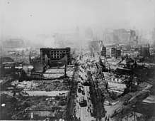
An example of the distinction between a natural hazard and a disaster is that an earthquake is the hazard which caused the 1906 San Francisco earthquake disaster. Natural hazards can be provoked or affected by anthropogenic processes, e.g. land-use change, drainage and construction.[3]
Geological hazards
Avalanche
An avalanche occurs when a large snow (or rock) mass slides down a mountainside.[4] An avalanche is an example of a gravity current consisting of granular material. In an avalanche, much material or mixtures of different types of material fall or slide rapidly under the force of gravity. Avalanches are often classified by the size or severity of consequences resulting from the event.[5]
Earthquake

Seismic waves at the Earth's surface, earthquakes may manifest with a shaking or displacement of the ground; when the earthquake occurs on the seafloor, the resulting displacement of water can sometimes result in a tsunami. Most of the world's earthquakes (90%, and 81% of the largest) take place in the 40,000-km-long, horseshoe-shaped zone called the circum-Pacific seismic belt, also known as the Pacific Ring of Fire, which for the most part bounds the Pacific Plate.[6] Many earthquakes happen each day, few of which are large enough to cause significant damage.
Coastal erosion
Coastal erosion is a physical process by which shorelines in coastal areas around the world shift and change, primarily in response to waves and currents that can be influenced by tides and storm surge.[7] Coastal erosion can result from long-term processes (see also beach evolution) as well as from episodic events such as tropical cyclones or other severe storm events.
Lahar
A lahar is a type of natural event closely related to a volcanic eruption, and involves a large amount of material originating from an eruption of a glaciated volcano, including mud from the melted ice, rock, and ash sliding down the side of the volcano at a rapid pace. These flows can destroy entire towns in seconds and kill thousands of people, and form flood basalt. This is based on natural events.
Landslide
A landslide is a mass displacement of sediment, usually down a slope. It can be caused by pressure pulling natural objects down a declining hill.[8]
Sinkhole
A sinkhole is a localized depression in the surface topography, usually caused by the collapse of a subterranean structure such as a cave. Although rare, large sinkholes that develop suddenly in populated areas can lead to the collapse of buildings and other structures.
Volcanic eruption
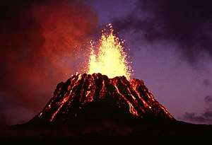
A volcanic eruption is the point in which a volcano is active and releases its power, and the eruptions come in many forms. They range from daily small eruptions which occur in places like Kilauea in Hawaii, to megacolossal eruptions (where the volcano expels at least 1,000 cubic kilometers of material) from supervolcanoes like Lake Taupo (26,500 years ago) and Yellowstone Caldera. According to the Toba catastrophe theory, 70 to 75 thousand years ago, a supervolcanic event at Lake Toba reduced the human population to 10,000 or even 1,000 breeding pairs, creating a bottleneck in human evolution. Some eruptions form pyroclastic flows, which are high-temperature clouds of ash and steam that can travel down mountainsides at speed exceeding an airliner.
Meteorological or climate hazards

Blizzard
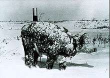
A blizzard is a severe winter storm with icy and windy conditions characterized by low temperature, strong wind and heavy snow.
Drought
A drought is a period of below-average precipitation in a given region, resulting in prolonged shortages in the water supply, whether atmospheric, surface water or ground water. Scientists warn that global warming and climate change may result in more extensive droughts in coming years. These extensive droughts are likely to occur within the African continent due to its very low precipitation levels and high temperatures.
Hailstorm
A hailstorm is a natural hazard where a thunderstorm produces numerous hailstones which damage the location in which they fall. Hailstorms can be especially devastating to farm fields, ruining crops and damaging equipment.
Heat wave
A heat wave is a hazard characterized by heat which is considered extreme and unusual in the area in which it occurs. Heat waves are rare and require specific combinations of weather events to take place, and may include temperature inversions, katabatic winds, or other phenomena. There is potential for longer-term events causing global warming, including stadial events (the opposite to glacial "ice age" events), or through human-induced climatic warming.
Cyclonic storm
Cyclone is a large scale air mass that rotates around a strong center of low atmospheric pressure.
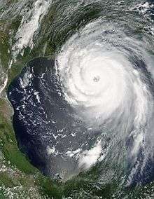
Hurricane, tropical cyclone, and typhoon are different names for the cyclonic storm system that forms over the oceans. It is caused by evaporated water that comes off of the ocean and becomes a storm. The Coriolis effect causes the storms to spin.74 mph (119 km/h). Hurricane is used for these phenomena in the Atlantic and eastern Pacific Oceans, tropical cyclone in the Indian, and typhoon in the western Pacific.
Ice storm
An ice storm is a particular weather event in which precipitation falls as ice, due to atmosphere conditions. It causes damage.
Tornado
A tornado is a natural disaster resulting from a thunderstorm. Tornadoes are violent, rotating columns of air which can blow at speeds between 50 mph (80 km/h) and 300 mph (480 km/h), and possibly higher. Tornadoes can occur one at a time, or can occur in large tornado outbreaks associated with supercells or in other large areas of thunderstorm development. Waterspouts are tornadoes occurring over tropical waters in light rain conditions.
Climate change
Climate change can increase or decrease weather hazards, and also directly endanger property due to sea level rise and biological organisms due to habitat destruction.
Geomagnetic storm
Geomagnetic storms can disrupt or damage technological infrastructure, and disorient species with magnetoception.
Hydrological hazards
Biological hazards
Disease
Disease is a natural hazard that can be enhanced by human factors such as urbanization or poor sanitation. Disease affecting multiple people can be termed an outbreak or epidemic.
In some cases, a hazard exists in that a human-made defense against disease could fail, for example through antibiotic resistance.
Multi-hazard analysis
Each of the natural hazard types outlined above have very different characteristics, in terms of the spatial and temporal scales they influence, hazard frequency and return period, and measures of intensity and impact. These complexities result in "single-hazard" assessments being commonplace, where the hazard potential from one particular hazard type is constrained. In these examples, hazards are often treated as isolated or independent. An alternative is a "multi-hazard" approach which seeks to identify all possible natural hazards and their interactions or interrelationships.[11][12]
Many examples exist of one natural hazard triggering or increasing the probability of one or more other natural hazards. For example, an earthquake may trigger landslides, whereas a wildfire may increase the probability of landslides being generated in the future.[12] A detailed review of such interactions across 21 natural hazards identified 90 possible interactions, of varying likelihood and spatial importance.[12] There may also be interactions between these natural hazards and anthropic processes.[13] For example, groundwater abstraction may trigger groundwater-related subsidence.[14]
Effective hazard analysis in any given area (e.g., for the purposes of disaster risk reduction) should ideally include an examination of all relevant hazards and their interactions. To be of most use for risk reduction, hazard analysis should be extended to risk assessment wherein the vulnerability of the built environment to each of the hazards is taken into account. This step is well developed for seismic risk, where the possible effect of future earthquakes on structures and infrastructure is assessed, as well as for risk from extreme wind and to a lesser extent flood risk. For other types of natural hazard the calculation of risk is more challenging, principally because of the lack of functions linking the intensity of a hazard and the probability of different levels of damage (fragility curves).[15] ThinkHazard! is an online tool that provides an overview of the hazards from eight natural hazards (river floods, earthquakes, water scarcity, cyclones, coastal floods, tsunamis, volcanoes and landslides) developed by the Global Facility for Disaster Reduction and Recovery in partnership with other institutions.[16][17]
International campaigns
In 2000, the United Nations launched the International Early Warning Programme to address the underlying causes of vulnerability and to build disaster-resilient communities by promoting increased awareness of the importance of disaster risk reduction as an integral component of sustainable development, with the goal of reducing human, economic and environmental losses due to hazards of all kinds (UN/ISDR, 2000).
The 2006-2007 United Nations International Disaster Reduction Day theme was “Disaster reduction education begins in school”. The Foundation of Public Safety Professionals launched an international campaign with an international open essay or documentary competition.
See also
- Act of God
- Civil defense
- Disaster relief
- Disaster risk reduction
- Emergency management
- Global catastrophic risk
- List of environmental disasters
- Social vulnerability
- Standardized Natural Hazards Disclosure Statement
- Ten Threats identified by the United Nations
References
- Organization of American States, Department of Regional Development; Organization of American States, Natural Hazards Project; United States Agency for International Development, Office of Foreign Disaster Assistance (1990). Disaster, planning and development: managing natural hazards to reduce loss (PDF). Washington, D.C.: Organization of American States. Retrieved 21 July 2014.
- Burton, I.; Kates, R.W.; White, G.F. (1993). The environment as hazard. Guilford Press. ISBN 9780898621594.
- Gill, Joel C.; Malamud, Bruce D. (2017-03-01). "Anthropogenic processes, natural hazards, and interactions in a multi-hazard framework". Earth-Science Reviews. 166: 246–269. doi:10.1016/j.earscirev.2017.01.002.
- "Snow avalanches". All about snow. National Snow & Ice Data Center. Retrieved 22 July 2014.
- "North American Public Avalanche Danger Scale". Avalanche.org. American Avalanche Association. Archived from the original on 16 April 2015. Retrieved 27 April 2015.
- Simkin, Tom; Tilling, Robert I.; Vogt, Peter R.; et al. (2006). This Dynamic Planet: World map of volcanoes, earthquakes, impact craters, and plate tectonics (map). U.S. Geological Survey Map I-2800. ISBN 978-1-411-30959-3. Retrieved 18 July 2014.
- Komar, Paul D. (1983). CRC handbook of coastal processes and erosion. CRC Press. ISBN 9780849302251.
- Koch, Nicholas K. (1995). Geohazards: natural and human. Prentice Hall. ISBN 9780023229923.
- "Wildfire". Cambridge dictionaries online. Cambridge University Press. Retrieved 22 July 2014.
- "Flood". Meteorology glossary. American Meteorological Society. Retrieved 22 July 2014.
- Kappes, Melanie S.; Keiler, Margreth; von Elverfeldt, Kirsten; Glade, Thomas (2012). "Challenges of analyzing multi-hazard risk: a review" (PDF). Natural Hazards. 64 (2): 1925–1958. doi:10.1007/s11069-012-0294-2.
- Gill, Joel C.; Malamud, Bruce D. (December 2014). "Reviewing and visualizing the interactions of natural hazards". Reviews of Geophysics. 52 (4): 680–722. Bibcode:2014RvGeo..52..680G. doi:10.1002/2013RG000445.
- http://meetingorganizer.copernicus.org/EGU2014/EGU2014-3049.pdf
- "Land Subsidence". USGS Water Science School. Retrieved 11 May 2017.
- Douglas, J. (2007-04-05). "Physical vulnerability modelling in natural hazard risk assessment" (PDF). Nat. Hazards Earth Syst. Sci. 7 (2): 283–288. doi:10.5194/nhess-7-283-2007. ISSN 1684-9981.
- ThinkHazard!
- Global Facility for Disaster Reduction and Recovery
External links
| Wikiquote has quotations related to: Natural hazard |
| Wikimedia Commons has media related to Natural hazard. |
- Natural hazard research from Bushfire and Natural Hazards CRC
- Natural Hazards of the U.S. Geological Survey

