National Register of Historic Places listings in northern Boston
Boston, Massachusetts is home to many listings on the National Register of Historic Places. This list encompasses those locations that are located north of the Massachusetts Turnpike. See National Register of Historic Places listings in southern Boston for listings south of the Turnpike. Properties and districts located elsewhere in Suffolk County's other three municipalities are also listed separately.
Location of Boston in Massachusetts
There are 324 properties and districts listed on the National Register in Suffolk County, including 58 National Historic Landmarks. The northern part of the city of Boston is the location of 147 of these properties and districts, including 44 National Historic Landmarks.
- This National Park Service list is complete through NPS recent listings posted August 14, 2020.[1]
Current listings
| [2] | Name on the Register[3] | Image | Date listed[4] | Location | City or town | Description |
|---|---|---|---|---|---|---|
| 1 | 1767 Milestones | 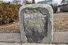 1767 Milestones |
April 7, 1971 (#71000084) |
Between Boston and Springfield along Old Post Rd. 42°21′42″N 71°07′48″W |
Allston | Includes markers in Roxbury and Mission Hill, and markers in Hampden, Middlesex, and Worcester counties |
| 2 | John Adams Courthouse | 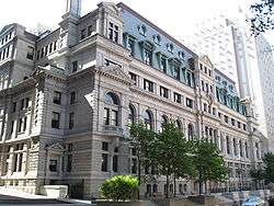 John Adams Courthouse |
May 8, 1974 (#74000391) |
Pemberton Sq. 42°21′33″N 71°03′42″W |
Downtown | Contains the nation's oldest law library, the Social Law Library |
| 3 | African Meetinghouse | 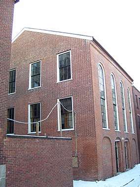 African Meetinghouse |
October 7, 1971 (#71000087) |
8 Smith Ct. 42°21′35″N 71°03′57″W |
Beacon Hill | This is the nation's longest standing black church edifice; it also hosts the Museum of African American History, open to the public. |
| 4 | Ames Building | 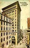 Ames Building |
April 26, 1974 (#74000382) |
1 Court St. 42°21′32″N 71°03′31″W |
Downtown | Considered Boston's first skyscraper. |
| 5 | Nathan Appleton Residence | 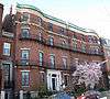 Nathan Appleton Residence |
December 22, 1977 (#77001541) |
39–40 Beacon St. 42°21′25″N 71°04′01″W |
Beacon Hill | |
| 6 | Arlington Street Church | 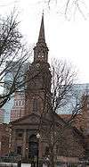 Arlington Street Church |
May 4, 1973 (#73000313) |
Arlington and Boylston Sts. 42°21′07″N 71°04′16″W |
Back Bay | |
| 7 | Armory of the First Corps of Cadets | 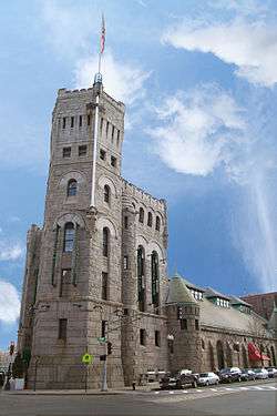 Armory of the First Corps of Cadets |
May 22, 1973 (#73000314) |
97–105 Arlington St. and 130 Columbus Ave. 42°20′59″N 71°04′14″W |
Bay Village | |
| 8 | Francis B. Austin House |  Francis B. Austin House |
October 21, 1988 (#87001478) |
58 High St. 42°22′34″N 71°04′37″W |
Charlestown | |
| 9 | Frederick Ayer Mansion |  Frederick Ayer Mansion |
April 5, 2005 (#05000459) |
395 Commonwealth Ave. 42°20′57″N 71°05′25″W |
Back Bay | |
| 10 | Back Bay Historic District | Back Bay Historic District |
August 14, 1973 (#73001948) |
Roughly bounded by the Charles River, Arlington, Providence, Boylston, and Newbury Sts., and Charlesgate East 42°21′04″N 71°04′50″W |
Back Bay | |
| 11 | Baker Congregational Church |  Baker Congregational Church |
November 19, 1998 (#98001381) |
760 Saratoga St. 42°23′02″N 71°01′04″W |
East Boston | |
| 12 | Beach-Knapp District |  Beach-Knapp District |
December 9, 1980 (#80000462) |
Roughly bounded by Harrison Ave., Washington, Kneeland, and Beach Sts. 42°21′04″N 71°03′44″W |
Chinatown | |
| 13 | Beacon Hill Historic District | Beacon Hill Historic District |
October 15, 1966 (#66000130) |
Bounded by Beacon St., the Charles River Embankment, and Pinckney, Revere, and Hancock Sts. 42°21′33″N 71°04′05″W |
Beacon Hill | |
| 14 | Bedford Building | 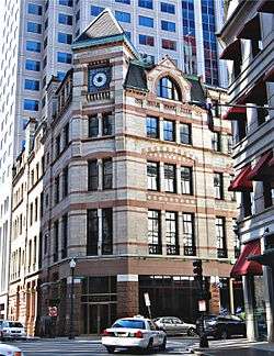 Bedford Building |
August 21, 1979 (#79000368) |
89–103 Bedford St. 42°21′10″N 71°03′32″W |
Downtown | |
| 15 | Bennington Street Burying Ground | 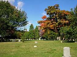 Bennington Street Burying Ground |
May 22, 2002 (#02000548) |
Bennington St., between Swift and Harmony Sts. 42°22′50″N 71°01′19″W |
East Boston | |
| 16 | Blackstone Block Historic District | 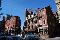 Blackstone Block Historic District |
May 26, 1973 (#73000315) |
Area bound by Union, Hanover, Blackstone, and North Sts. 42°21′40″N 71°03′25″W |
Downtown | |
| 17 | Blake and Amory Building | 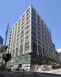 Blake and Amory Building |
June 2, 2014 (#14000272) |
59 Temple Pl. 42°21′17″N 71°03′41″W |
Downtown | |
| 18 | Boston African American National Historic Site | Boston African American National Historic Site |
October 10, 1980 (#80004396) |
Joy St. 42°21′36″N 71°03′55″W |
Beacon Hill | |
| 19 | Boston Athenæum | 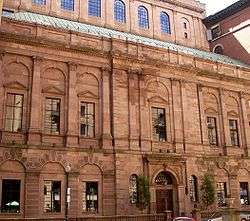 Boston Athenæum |
October 15, 1966 (#66000132) |
10½ Beacon St. 42°21′28″N 71°03′45″W |
Beacon Hill | |
| 20 | Boston Common |  Boston Common |
February 27, 1987 (#87000760) |
Beacon, Park, Tremont, Boylston, and Charles Sts. 42°21′16″N 71°03′54″W |
multiple | |
| 21 | Boston Common and Public Garden | 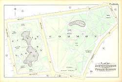 Boston Common and Public Garden |
July 12, 1972 (#72000144) |
Beacon, Park, Tremont, Boylston, and Arlington Sts. 42°21′15″N 71°04′12″W |
multiple | |
| 22 | Boston Edison Electric Illuminating Company | 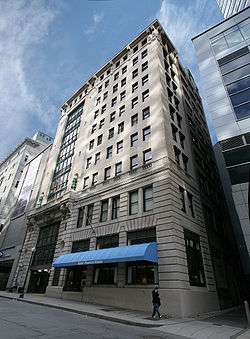 Boston Edison Electric Illuminating Company |
December 9, 1980 (#80000453) |
25–39 Boylston St. 42°21′08″N 71°03′51″W |
Chinatown | |
| 23 | Boston Fish Pier Historic District | 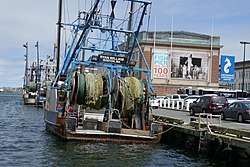 Boston Fish Pier Historic District |
July 13, 2017 (#100001314) |
212–234 Northern Ave. 42°21′06″N 71°02′15″W |
South Boston | |
| 24 | Boston National Historical Park |  Boston National Historical Park |
October 26, 1974 (#74002222) |
Inner harbor at the mouth of the Charles River 42°22′12″N 71°03′20″W |
Boston Harbor | |
| 25 | Boston Naval Shipyard |  Boston Naval Shipyard |
November 15, 1966 (#66000134) |
East of Chelsea St., Charlestown 42°22′30″N 71°03′09″W |
Charlestown | Updated listing May 5, 2015 as "Boston National Historical Park/Charlestown Navy Yard". |
| 26 | Boston Police Station Number One-Traffic Tunnel Administration Building |  Boston Police Station Number One-Traffic Tunnel Administration Building |
March 3, 2015 (#15000048) |
128, 150 North & 130–140 Richmond St. 42°21′45″N 71°03′17″W |
North End | |
| 27 | Boston Public Garden |  Boston Public Garden |
February 27, 1987 (#87000761) |
Beacon, Charles, Boylston, and Arlington Sts. 42°21′15″N 71°04′12″W |
Back Bay | |
| 28 | Boston Public Library | 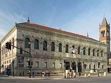 Boston Public Library |
May 6, 1973 (#73000317) |
Copley Sq. 42°20′57″N 71°04′43″W |
Back Bay | |
| 29 | Boston Transit Commission Building | Boston Transit Commission Building |
August 31, 2007 (#07000861) |
15 Beacon St. 42°21′30″N 71°03′46″W |
Beacon Hill | |
| 30 | Boston Young Men's Christian Union | 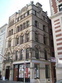 Boston Young Men's Christian Union |
December 9, 1980 (#80000451) |
48 Boylston St. 42°21′07″N 71°03′53″W |
Chinatown | |
| 31 | Boylston Building | 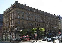 Boylston Building |
December 9, 1980 (#80000450) |
2–22 Boylston St. 42°21′07″N 71°03′49″W |
Chinatown | |
| 32 | Building at 138–142 Portland Street |  Building at 138–142 Portland Street |
September 5, 1985 (#85002015) |
138–142 Portland St. 42°21′51″N 71°03′43″W |
Downtown | |
| 33 | Bulfinch Triangle Historic District |  Bulfinch Triangle Historic District |
February 27, 1986 (#86000274) |
Roughly bounded by Canal, Market, Merrimac, and Causeway Sts. 42°21′50″N 71°03′41″W |
Downtown | |
| 34 | Bunker Hill Monument | 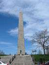 Bunker Hill Monument |
October 15, 1966 (#66000138) |
Breed's Hill 42°22′35″N 71°03′41″W |
Charlestown | |
| 35 | Bunker Hill School |  Bunker Hill School |
October 15, 1987 (#87001771) |
68 Baldwin St. 42°22′56″N 71°04′15″W |
Charlestown | |
| 36 | Central Congregational Church |  Central Congregational Church |
October 16, 2012 (#12001012) |
67 Newbury St. 42°21′08″N 71°04′27″W |
Back Bay | This church has the largest intact Tiffany-designed ecclesiastical interior in its original location in America. The congregation is now known as the Church of the Covenant. |
| 37 | Charles Playhouse |  Charles Playhouse |
June 16, 1980 (#80000676) |
74–78 Warenton St. 42°20′58″N 71°03′59″W |
Theatre District | |
| 38 | Charles River Basin Historic District |  Charles River Basin Historic District |
December 22, 1978 (#78000436) |
Both banks of the Charles River from Eliot Bridge to Charles River Dam 42°21′46″N 71°06′28″W |
Back Bay | |
| 39 | Charles River Reservation Parkways |  Charles River Reservation Parkways |
January 18, 2006 (#05001530) |
Soldiers Field, Nonantum, Leo Birmingham, Arsenal, Greenough, N. Beacon, Charles River, Norumbega, Recreation 42°21′42″N 71°09′31″W |
Allston/Brighton | Extends into Cambridge, Newton, Waltham, and Watertown and Weston in Middlesex County |
| 40 | Charles River Reservation (Speedway)-Upper Basin Headquarters | Charles River Reservation (Speedway)-Upper Basin Headquarters |
July 19, 2010 (#10000506) |
1420–1440 Soldiers Field Rd. 42°21′41″N 71°08′47″W |
Brighton | |
| 41 | Charlestown Heights | .JPG) Charlestown Heights |
January 8, 1998 (#97000969) |
Roughly bounded by St. Martin, Bunker Hill, Medford, and Sackville Sts. 42°22′56″N 71°04′05″W |
Charlestown | |
| 42 | Church Green Buildings Historic District | 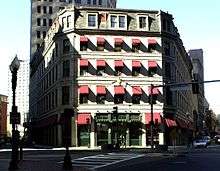 Church Green Buildings Historic District |
December 30, 1999 (#99001614) |
101–113 Summer St. 42°21′12″N 71°03′30″W |
Downtown | |
| 43 | Codman Building | 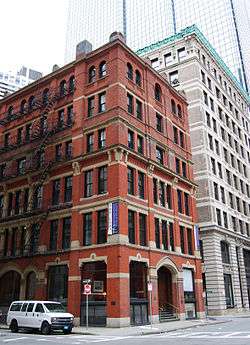 Codman Building |
October 19, 1983 (#83004097) |
55 Kilby St. 42°21′28″N 71°03′23″W |
Downtown | |
| 44 | Compton Building | 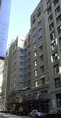 Compton Building |
December 31, 2008 (#08001284) |
159, 161–175 Devonshire Street, 18–20 Arch Street 42°21′21″N 71°03′27″W |
Downtown | |
| 45 | Congress Street Fire Station |  Congress Street Fire Station |
September 3, 1987 (#87001396) |
344 Congress St. 42°20′58″N 71°02′56″W |
South Boston | |
| 46 | Copp's Hill Burying Ground | 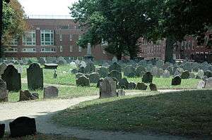 Copp's Hill Burying Ground |
April 18, 1974 (#74000385) |
Charter, Snowhill, and Hull Sts. 42°22′02″N 71°03′23″W |
North End | |
| 47 | Copp's Hill Terrace | 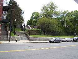 Copp's Hill Terrace |
April 19, 1990 (#90000631) |
Between Commercial and Charter Sts. west of Jackson Place 42°22′04″N 71°03′22″W |
North End | |
| 48 | Crowninshield House | 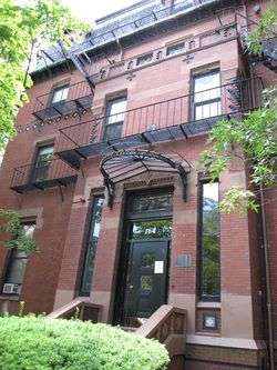 Crowninshield House |
February 23, 1972 (#72000145) |
164 Marlborough St. 42°21′09″N 71°04′45″W |
Back Bay | |
| 49 | Custom House District | 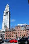 Custom House District |
May 11, 1973 (#73000321) |
Between the J.F.K. Expressway and Kirby St. and S. Market and High and Batterymarch Sts. 42°21′28″N 71°03′12″W |
Downtown | |
| 50 | Dill Building |  Dill Building |
December 9, 1980 (#80000448) |
11–25 Stuart St. 42°21′04″N 71°03′50″W |
Theatre District | |
| 51 | Eagle Hill Historic District |  Eagle Hill Historic District |
February 26, 1998 (#98000149) |
Roughly bounded by Border, Lexington, Trenton, and Falcon Sts. 42°22′51″N 71°02′05″W |
East Boston | |
| 52 | Old East Boston High School |  Old East Boston High School |
March 15, 2006 (#06000127) |
127 Marion St. 42°22′41″N 71°02′16″W |
East Boston | |
| 53 | Engine House No. 34 |  Engine House No. 34 |
October 24, 1985 (#85003375) |
444 Western Ave. 42°21′43″N 71°08′30″W |
Brighton | |
| 54 | Ether Dome |  Ether Dome |
October 15, 1966 (#66000366) |
Fruit St. 42°21′48″N 71°04′07″W |
West End | Part of Massachusetts General Hospital, Bulfinch Building |
| 55 | Faneuil Hall | 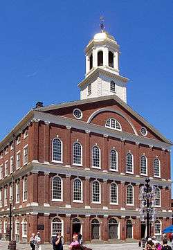 Faneuil Hall |
October 15, 1966 (#66000368) |
Dock Sq. 42°21′36″N 71°03′24″W |
Downtown | |
| 56 | Peter Faneuil School |  Peter Faneuil School |
December 16, 1994 (#94001492) |
60 Joy St. 42°21′37″N 71°03′58″W |
Beacon Hill | |
| 57 | Filene's Department Store |  Filene's Department Store |
July 24, 1986 (#86001909) |
426 Washington St. 42°21′18″N 71°03′39″W |
Downtown | Partially demolished by investors in 2008, irrespective of its historical significance. Historic Burnham Building (Beaux-Arts) remains, now part of Millennium Tower development. |
| 58 | First Baptist Church |  First Baptist Church |
February 23, 1972 (#72000146) |
Commonwealth Ave. and Clarendon St. 42°21′06″N 71°04′36″W |
Back Bay | |
| 59 | Fort Point Channel Historic District | Fort Point Channel Historic District |
September 10, 2004 (#04000959) |
Necco Court, Thomson Place, and A, Binford, Congress, Farnsworth, Melcher, Midway, Sleeper, Stillings, and Summer Sts. 42°20′59″N 71°03′05″W |
South Boston | |
| 60 | I.J. Fox Building |  I.J. Fox Building |
December 29, 2015 (#15000942) |
407 Washington St. 42°21′21″N 71°03′36″W |
Downtown Crossing | |
| 61 | Fulton-Commercial Streets District |  Fulton-Commercial Streets District |
March 21, 1973 (#73000319) |
Fulton, Commercial, Mercantile, Lewis, and Richmond Sts.; also 81–95 Richmond St. 42°21′43″N 71°03′12″W |
North End | 81-95 Richmond St. represent a boundary increase |
| 62 | Gibson House |  Gibson House |
August 7, 2001 (#01001048) |
137 Beacon St. 42°21′17″N 71°04′27″W |
Back Bay | |
| 63 | Ozias Goodwin House |  Ozias Goodwin House |
June 23, 1988 (#88000908) |
7 Jackson Ave. 42°22′03″N 71°03′19″W |
North End | |
| 64 | Gridley Street Historic District | 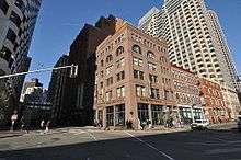 Gridley Street Historic District |
December 3, 2014 (#14000974) |
Bounded by Congress, High, Pearl & Purchase Sts. 42°21′17″N 71°03′15″W |
Financial District | |
| 65 | Chester Harding House | 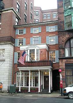 Chester Harding House |
October 15, 1966 (#66000764) |
16 Beacon St. 42°21′28″N 71°03′47″W |
Beacon Hill | |
| 66 | Harvard Stadium | 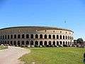 Harvard Stadium |
February 27, 1987 (#87000757) |
60 N. Harvard St. 42°22′01″N 71°07′36″W |
Allston | |
| 67 | Hayden Building | 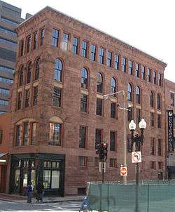 Hayden Building |
December 9, 1980 (#80000446) |
681–683 Washington St. 42°21′05″N 71°03′50″W |
Downtown | |
| 68 | Headquarters House | 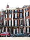 Headquarters House |
October 15, 1966 (#66000765) |
55 Beacon St. 42°21′23″N 71°04′08″W |
Beacon Hill | |
| 69 | Hoosac Stores 1 & 2-Hoosac Stores 3 | 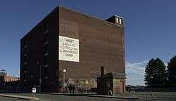 Hoosac Stores 1 & 2-Hoosac Stores 3 |
August 14, 1985 (#85002339) |
115 Constitution St. 42°22′16″N 71°03′40″W |
Charlestown | Hoosac Stores 3 was demolished in 2000. |
| 70 | House at 1 Bay Street | 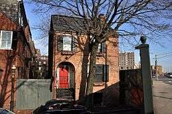 House at 1 Bay Street |
February 9, 1994 (#93001573) |
1 Bay St. 42°20′53″N 71°04′07″W |
Bay Village | |
| 71 | Samuel Gridley and Julia Ward Howe House | 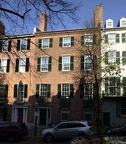 Samuel Gridley and Julia Ward Howe House |
September 13, 1974 (#74002044) |
13 Chestnut St. 42°21′27″N 71°04′03″W |
Beacon Hill | |
| 72 | International Trust Company Building | 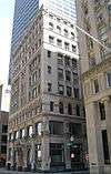 International Trust Company Building |
September 10, 1979 (#79000369) |
39–47 Milk St. 42°21′23″N 71°03′29″W |
Downtown | |
| 73 | King's Chapel | 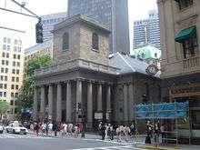 King's Chapel |
May 2, 1974 (#74002045) |
Tremont and School Sts. 42°21′28″N 71°03′38″W |
Downtown | |
| 74 | Leather District |  Leather District |
December 21, 1983 (#83004098) |
Roughly bounded by Atlantic Ave., Kneeland, Lincoln, and Essex Sts. 42°21′03″N 71°03′30″W |
Leather District | |
| 75 | Liberty Tree District | 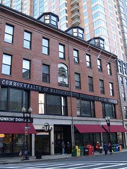 Liberty Tree District |
December 9, 1980 (#80000460) |
Roughly bounded by Harrison Ave., Washington, Essex and Beach Sts. 42°21′07″N 71°03′47″W |
Downtown | |
| 76 | Locke-Ober Restaurant |  Locke-Ober Restaurant |
July 24, 1986 (#86001911) |
3–4 Winter Pl. 42°21′20″N 71°03′46″W |
Downtown | |
| 77 | Long Wharf and Customhouse Block |  Long Wharf and Customhouse Block |
November 13, 1966 (#66000768) |
Foot of State St. 42°21′37″N 71°02′59″W |
Downtown | |
| 78 | Theodore Lyman School |  Theodore Lyman School |
December 2, 2014 (#14000975) |
30 Gove St. 42°22′19″N 71°02′16″W |
East Boston | |
| 79 | Mariner's House |  Mariner's House |
November 12, 1999 (#99001302) |
11 North Square 42°21′50″N 71°03′13″W |
North End | |
| 80 | Massachusetts General Hospital | 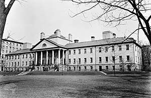 Massachusetts General Hospital |
December 30, 1970 (#70000682) |
Fruit Street 42°21′48″N 71°04′08″W |
West End | 1820s hospital building by Charles Bulfinch |
| 81 | Massachusetts Statehouse | 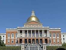 Massachusetts Statehouse |
October 15, 1966 (#66000771) |
Beacon Hill 42°21′31″N 71°03′52″W |
Beacon Hill | |
| 82 | Donald McKay House | 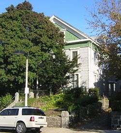 Donald McKay House |
June 2, 1982 (#82004450) |
78–80 White St. 42°22′49″N 71°02′14″W |
East Boston | |
| 83 | Metropolitan Theatre | 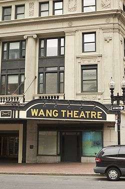 Metropolitan Theatre |
December 9, 1980 (#80000445) |
252–272 Tremont St. 42°21′01″N 71°03′56″W |
Theatre District | |
| 84 | Monument Square Historic District | 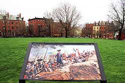 Monument Square Historic District |
June 2, 1987 (#87001128) |
Monument Square 42°22′35″N 71°03′38″W |
Charlestown | Not to be confused with the Monument Square Historic District (Jamaica Plain, Boston, Massachusetts). |
| 85 | Middlesex Canal Historic and Archaeological District |  Middlesex Canal Historic and Archaeological District |
November 19, 2009 (#09000936) |
Numerous locations along the historic route of the Middlesex Canal |
Charlestown | Extends into Middlesex County.[5] |
| 86 | Lightship No. 112, Nantucket | 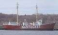 Lightship No. 112, Nantucket |
December 20, 1989 (#89002464) |
Boston Harbor Shipyard and Marina end of Marginal Street 42°21′40″N 71°02′07″W |
East Boston | Largest lightship ever built. Listed in Portland, Maine. Arrived in Boston May 11, 2010 |
| 87 | William C. Nell House | .jpg) William C. Nell House |
May 11, 1976 (#76001979) |
3 Smith Ct. 42°21′28″N 71°03′53″W |
Beacon Hill | |
| 88 | Newspaper Row |  Newspaper Row |
July 7, 1983 (#83000607) |
322–328 Washington St., 5–23 Milk St., and 11 Hawley St. 42°21′24″N 71°03′33″W |
Downtown | |
| 89 | North Terminal Garage | 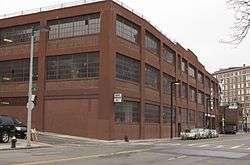 North Terminal Garage |
September 11, 1997 (#97000971) |
600 Commercial St. 42°22′01″N 71°03′28″W |
North End | |
| 90 | Ohabei Shalom Cemetery | 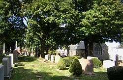 Ohabei Shalom Cemetery |
August 19, 2008 (#08000795) |
147 Wordsworth St. 42°22′59″N 71°00′52″W |
East Boston | |
| 91 | Old City Hall | 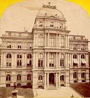 Old City Hall |
December 30, 1970 (#70000687) |
School and Providence Sts. 42°21′29″N 71°03′35″W |
Downtown | |
| 92 | Old Corner Bookstore | 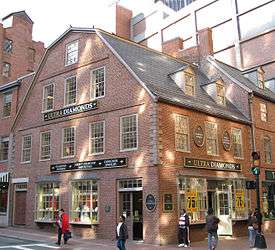 Old Corner Bookstore |
April 11, 1973 (#73000322) |
Northwestern corner of Washington and School Sts. 42°21′27″N 71°03′32″W |
Downtown | |
| 93 | Old North Church |  Old North Church |
October 15, 1966 (#66000776) |
193 Salem St. 42°21′58″N 71°03′18″W |
North End | |
| 94 | Old South Church in Boston | 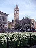 Old South Church in Boston |
December 30, 1970 (#70000690) |
645 Boylston St. 42°21′01″N 71°04′43″W |
Back Bay | |
| 95 | Old South Meetinghouse | 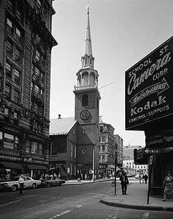 Old South Meetinghouse |
October 15, 1966 (#66000778) |
Milk and Washington Sts. 42°21′25″N 71°03′31″W |
Downtown | |
| 96 | Old State House | 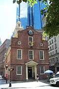 Old State House |
October 15, 1966 (#66000779) |
Washington and State Sts. 42°21′32″N 71°03′28″W |
Downtown | |
| 97 | Old West Church | 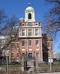 Old West Church |
December 30, 1970 (#70000691) |
131 Cambridge St. 42°21′41″N 71°03′55″W |
West End | |
| 98 | Olmsted Park System | 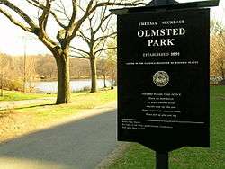 Olmsted Park System |
December 8, 1971 (#71000086) |
Encompassing the Back Bay Fens, Muddy River, Olmsted (Leverett Park), Jamaica Park, Arborway, and Franklin Park 42°20′43″N 71°05′45″W |
Jamaica Plain and Fenway-Kenmore | |
| 99 | (First) Harrison Gray Otis House | 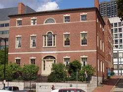 (First) Harrison Gray Otis House |
December 30, 1970 (#70000539) |
141 Cambridge St. 42°21′41″N 71°03′57″W |
West End | |
| 100 | (Second) Harrison Gray Otis House |  (Second) Harrison Gray Otis House |
July 27, 1973 (#73001955) |
85 Mt. Vernon St. 42°21′29″N 71°04′05″W |
Beacon Hill | |
| 101 | Paine Furniture Building | 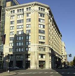 Paine Furniture Building |
September 12, 2002 (#02001039) |
75–81 Arlington St. 42°21′04″N 71°04′17″W |
Back Bay | |
| 102 | Park Street District |  Park Street District |
May 1, 1974 (#74000390) |
Tremont, Park, and Beacon Sts. 42°21′26″N 71°03′44″W |
Beacon Hill | |
| 103 | Francis Parkman House | 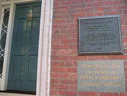 Francis Parkman House |
October 15, 1966 (#66000782) |
50 Chestnut St. 42°21′25″N 71°04′09″W |
Beacon Hill | |
| 104 | Phipps Street Burying Ground |  Phipps Street Burying Ground |
May 14, 1974 (#74000907) |
Phipps St. 42°22′34″N 71°04′13″W |
Charlestown | |
| 105 | Piano Row District |  Piano Row District |
December 9, 1980 (#80000458) |
Boston Common, Park Sq., Boylston Pl. and Tremont St. 42°21′08″N 71°03′55″W |
Downtown | |
| 106 | Pierce–Hichborn House | .jpg) Pierce–Hichborn House |
November 24, 1968 (#68000042) |
29 North Sq. 42°21′48″N 71°03′16″W |
North End | |
| 107 | Publicity Building | 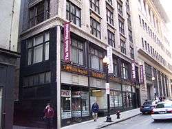 Publicity Building |
August 20, 2003 (#03000781) |
40–44 Bromfield St. 42°21′23″N 71°03′41″W |
Downtown | |
| 108 | Quincy Grammar School | 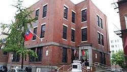 Quincy Grammar School |
August 1, 2017 (#100001458) |
88-90 Tyler St. 42°20′56″N 71°03′41″W |
Chinatown | |
| 109 | Quincy Market | 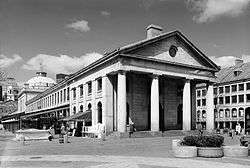 Quincy Market |
November 13, 1966 (#66000784) |
S. Market St. 42°21′36″N 71°03′18″W |
Downtown | |
| 110 | Paul Revere House | 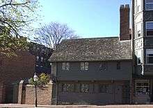 Paul Revere House |
October 15, 1966 (#66000785) |
19 North Sq. 42°21′49″N 71°03′16″W |
North End | |
| 111 | Richardson Block | 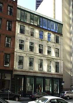 Richardson Block |
August 9, 1986 (#86001504) |
113–151 Pearl and 109–119 High Sts. 42°21′18″N 71°03′17″W |
Downtown | |
| 112 | ROSEWAY (schooner) | 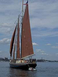 ROSEWAY (schooner) |
September 25, 1997 (#97001278) |
Boston Harbor 44°12′38″N 69°03′46″W |
Boston Harbor | National Historic Landmark |
| 113 | Roughan Hall |  Roughan Hall |
April 15, 1982 (#82004448) |
15–18 City Sq. 42°22′20″N 71°03′44″W |
Charlestown | |
| 114 | Russia Wharf Buildings | 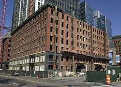 Russia Wharf Buildings |
December 2, 1980 (#80000463) |
518–540 Atlantic Ave., 270 Congress St. and 276–290 Congress St. 42°21′12″N 71°03′11″W |
Downtown | |
| 115 | St. Paul's Church | 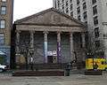 St. Paul's Church |
December 30, 1970 (#70000730) |
136 Tremont St. 42°21′21″N 71°03′46″W |
Downtown | |
| 116 | St. Stephen's Church | 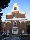 St. Stephen's Church |
April 14, 1975 (#75000300) |
Hanover St. between Clark and Harris Sts. 42°21′56″N 71°03′10″W |
North End | |
| 117 | Sears' Crescent and Sears' Block |  Sears' Crescent and Sears' Block |
August 9, 1986 (#86001486) |
38–68 and 70–72 Cornhill 42°21′34″N 71°03′34″W |
Downtown | |
| 118 | David Sears House | 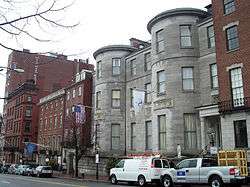 David Sears House |
December 30, 1970 (#70000731) |
42 Beacon St. 42°21′25″N 71°04′03″W |
Beacon Hill | |
| 119 | Second Brazer Building | 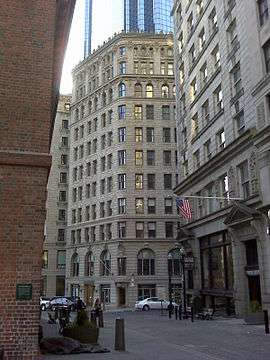 Second Brazer Building |
July 24, 1986 (#86001913) |
25–29 State St. 42°21′30″N 71°03′28″W |
Downtown | |
| 120 | Sam S. Shubert Theatre | 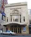 Sam S. Shubert Theatre |
December 9, 1980 (#80000444) |
263–265 Tremont St. 42°21′00″N 71°03′58″W |
Theatre District | |
| 121 | South Station Headhouse | 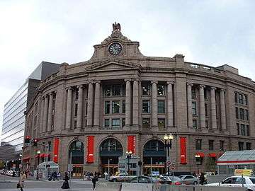 South Station Headhouse |
February 13, 1975 (#75000299) |
Atlantic Ave. and Summer St. 42°21′07″N 71°03′21″W |
Downtown | |
| 122 | R.H. Stearns House | 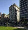 R.H. Stearns House |
June 16, 1980 (#80000671) |
140 Tremont St. 42°21′20″N 71°03′47″W |
Downtown | Although the site is named the "R.H. Stearns House", it is the former main building of the R.H. Stearns Department Store company. |
| 123 | Suffolk County Jail | 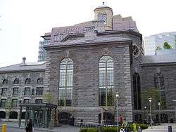 Suffolk County Jail |
April 23, 1980 (#80000670) |
215 Charles St. 42°21′43″N 71°04′13″W |
West End | |
| 124 | Charles Sumner House |  Charles Sumner House |
November 7, 1973 (#73001953) |
20 Hancock St. 42°21′36″N 71°03′56″W |
Beacon Hill | |
| 125 | Temple Place Historic District |  Temple Place Historic District |
July 26, 1988 (#88000427) |
11–55, 26–58 Temple Pl. 42°21′18″N 71°03′40″W |
Downtown | |
| 126 | Terminal Storage Warehouse District |  Terminal Storage Warehouse District |
March 12, 2012 (#12000099) |
267–281 Medford St., 40 & 50 Terminal St. 42°22′51″N 71°03′42″W |
Charlestown | |
| 127 | Textile District |  Textile District |
November 29, 1990 (#90001757) |
Roughly Essex St. from Phillips Sq. to Columbia St. and Chauncy St. from Phillips Sq. to Rowe Pl. 42°20′52″N 71°03′17″W |
Downtown | |
| 128 | Town Hill District | Town Hill District |
May 11, 1973 (#73000850) |
Bounded roughly by Rutherford Ave. and Main and Warren Sts. 42°22′21″N 71°03′44″W |
Charlestown | |
| 129 | Tremont Street Subway | 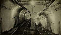 Tremont Street Subway |
October 15, 1966 (#66000788) |
Beneath Tremont, Boylston, and Washington Sts. 42°21′23″N 71°03′47″W |
Downtown | First subway in the Western Hemisphere; still operating (as part of the MBTA's Green Line) |
| 130 | Trinity Church | 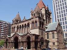 Trinity Church |
July 1, 1970 (#70000733) |
Copley Sq. 42°21′07″N 71°04′28″W |
Back Bay | |
| 131 | Trinity Neighborhood House | 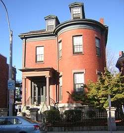 Trinity Neighborhood House |
April 14, 1992 (#92000356) |
406 Meridian St. 42°22′49″N 71°02′23″W |
East Boston | |
| 132 | Trinity Rectory |  Trinity Rectory |
February 23, 1972 (#72000150) |
Clarendon and Newbury Sts. 42°21′06″N 71°04′34″W |
Back Bay | |
| 133 | Union Oyster House | 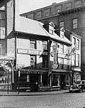 Union Oyster House |
May 27, 2003 (#03000645) |
41–43 Union Street 42°21′46″N 71°03′38″W |
Downtown | |
| 134 | Union Wharf | 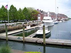 Union Wharf |
June 22, 1980 (#80000669) |
295–353 Commercial St. 42°21′56″N 71°03′03″W |
North End | |
| 135 | United Shoe Machinery Corporation Building | 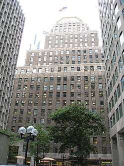 United Shoe Machinery Corporation Building |
August 19, 1980 (#80000668) |
138–164 Federal St. 42°21′14″N 71°03′23″W |
Downtown | |
| 136 | United States Post Office, Courthouse, and Federal Building | 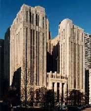 United States Post Office, Courthouse, and Federal Building |
April 8, 2011 (#11000160) |
5 Post Office Square 42°21′26″N 71°03′25″W |
Downtown | |
| 137 | USS Cassin Young (destroyer) |  USS Cassin Young (destroyer) |
January 14, 1986 (#86000084) |
Charlestown Navy Yard 42°22′17″N 71°03′18″W |
Charlestown | |
| 138 | U.S.S. Constitution | 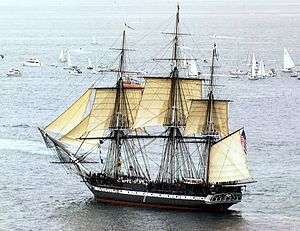 U.S.S. Constitution |
October 15, 1966 (#66000789) |
Boston Naval Shipyard 42°22′21″N 71°03′25″W |
Charlestown | |
| 139 | Vermont Building | 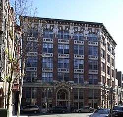 Vermont Building |
November 13, 1984 (#84000421) |
6–12 Thacher St. 42°21′56″N 71°03′28″W |
North End | |
| 140 | Washington Street Theatre District | 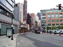 Washington Street Theatre District |
March 19, 1979 (#79000370) |
511–559 Washington St. 42°21′14″N 71°03′46″W |
Theatre District | |
| 141 | West Street District | 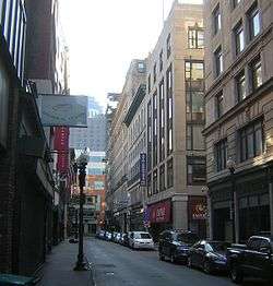 West Street District |
December 9, 1980 (#80000455) |
West St. 42°21′18″N 71°03′49″W |
Downtown | |
| 142 | Wigglesworth Building | 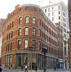 Wigglesworth Building |
October 21, 1982 (#82000486) |
89-83 Franklin St. 42°21′18″N 71°03′29″W |
Downtown | |
| 143 | Wilbur Theatre | 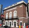 Wilbur Theatre |
December 9, 1980 (#80000443) |
244–250 Tremont St. 42°21′02″N 71°03′56″W |
Theatre District | |
| 144 | Winthrop Building | 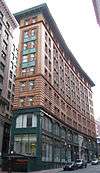 Winthrop Building |
April 18, 1974 (#74000392) |
7 Water St. 42°21′27″N 71°03′29″W |
Downtown | |
| 145 | Jacob Wirth Buildings | 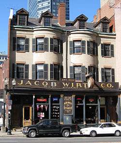 Jacob Wirth Buildings |
December 9, 1980 (#80000442) |
31–39 Stuart St. 42°21′04″N 71°03′52″W |
Theatre District | |
| 146 | Youth's Companion Building | 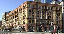 Youth's Companion Building |
May 2, 1974 (#74000393) |
209 Columbus Ave. 42°20′54″N 71°04′22″W |
Back Bay | |
| 147 | YWCA Boston | 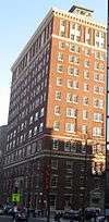 YWCA Boston |
March 3, 2004 (#04000119) |
140 Clarendon St. 42°21′01″N 71°04′33″W |
Back Bay | Neoclassical building of YWCA Boston. |
Former listing
| [2] | Name on the Register | Image | Date listed | Date removed | Location | City or town | Summary |
|---|---|---|---|---|---|---|---|
| 1 | Alice S. Wentworth (schooner) | 1973 (#73002284) | 1974 | Pier 4, Northern Ave. |
Destroyed in a storm in 1974. |
See also
| Wikimedia Commons has media related to National Register of Historic Places in Boston. |
References
- "National Register of Historic Places: Weekly List Actions". National Park Service, United States Department of the Interior. Retrieved on August 14, 2020.
- Numbers represent an ordering by significant words. Various colorings, defined here, differentiate National Historic Landmarks and historic districts from other NRHP buildings, structures, sites or objects.
- "National Register Information System". National Register of Historic Places. National Park Service. March 13, 2009.
- The eight-digit number below each date is the number assigned to each location in the National Register Information System database, which can be viewed by clicking the number.
- "Listing for Middlesex Canal district". Commonwealth of Massachusetts. Retrieved 2011-11-21.
| Topics | 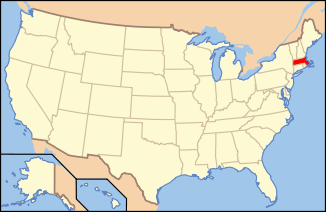 | ||||||||||||||||
|---|---|---|---|---|---|---|---|---|---|---|---|---|---|---|---|---|---|
| Lists by county | |||||||||||||||||
| Lists by city |
| ||||||||||||||||
| Other lists | |||||||||||||||||
| |||||||||||||||||
This article is issued from Wikipedia. The text is licensed under Creative Commons - Attribution - Sharealike. Additional terms may apply for the media files.