National Register of Historic Places listings in Sherborn, Massachusetts
This is a list of properties and historic districts listed on the National Register of Historic Places in Sherborn, Massachusetts.
The locations of National Register properties and districts (at least for all showing latitude and longitude coordinates below) may be seen in a Google map by clicking on "Map of all coordinates".[1]
- This National Park Service list is complete through NPS recent listings posted August 14, 2020.[2]
Current listings
| [3] | Name on the Register | Image | Date listed[4] | Location | City or town | Description |
|---|---|---|---|---|---|---|
| 1 | Assington | 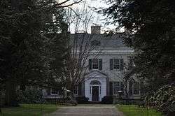 Assington |
January 3, 1986 (#86000490) |
172 Forest St. 42°13′41″N 71°20′30″W |
||
| 2 | Bullen–Stratton–Cozzen House | 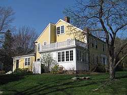 Bullen–Stratton–Cozzen House |
January 3, 1986 (#86000496) |
52 Brush Hill Rd. 42°15′15″N 71°24′06″W |
||
| 3 | Clark–Northrup House | 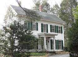 Clark–Northrup House |
January 3, 1986 (#86000497) |
93 Maple St. 42°14′19″N 71°23′14″W |
||
| 4 | Joseph Cleale House | 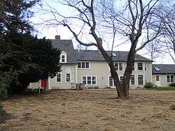 Joseph Cleale House |
January 3, 1986 (#86000498) |
147 Western Ave. 42°14′21″N 71°24′23″W |
||
| 5 | Rev. Edmund Dowse House | 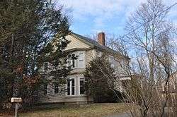 Rev. Edmund Dowse House |
January 3, 1986 (#86000499) |
25 Farm Rd. 42°14′19″N 71°21′55″W |
||
| 6 | Edward's Plain–Dowse's Corner Historic District | 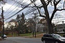 Edward's Plain–Dowse's Corner Historic District |
January 3, 1986 (#86000492) |
N. Main St. between Eliot and Everett Sts. 42°15′11″N 71°22′06″W |
||
| 7 | Thomas Fleming House |  Thomas Fleming House |
January 3, 1986 (#86000500) |
18 Maple St. 42°14′28″N 71°22′29″W |
||
| 8 | Addington Gardner House | 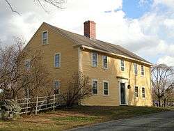 Addington Gardner House |
March 9, 1990 (#90000179) |
128 Hollis St. 42°12′58″N 71°23′55″W |
||
| 9 | Eleazer Goulding House | 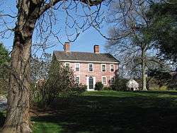 Eleazer Goulding House |
January 3, 1986 (#86000501) |
137 Western Ave. 42°14′27″N 71°24′24″W |
||
| 10 | Charles Holbrook House | 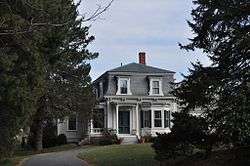 Charles Holbrook House |
January 3, 1986 (#86000502) |
137 S. Main St. 42°13′31″N 71°21′47″W |
||
| 11 | Deacon William Leland House | 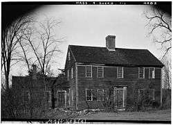 Deacon William Leland House |
January 3, 1986 (#86000503) |
27 Hollis St. 42°12′29″N 71°23′05″W |
||
| 12 | Charles D. Lewis House | 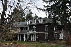 Charles D. Lewis House |
January 3, 1986 (#86000504) |
81 Hunting Ln. 42°14′58″N 71°23′00″W |
||
| 13 | Daniel Morse III House | 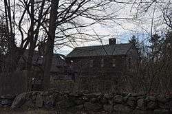 Daniel Morse III House |
January 3, 1986 (#86000505) |
210 Farm Rd. 42°14′05″N 71°20′13″W |
||
| 14 | Morse–Barber House | 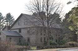 Morse–Barber House |
January 3, 1986 (#86000493) |
46 Forest St. 42°13′14″N 71°21′23″W |
||
| 15 | Morse–Tay–Leland–Hawes House |  Morse–Tay–Leland–Hawes House |
January 3, 1986 (#86000506) |
266 Western Ave. 42°13′24″N 71°24′03″W |
||
| 16 | Asa Sanger House | 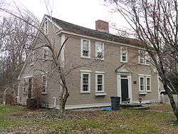 Asa Sanger House |
January 3, 1986 (#86000507) |
70 Washington St. 42°14′08″N 71°22′52″W |
||
| 17 | Richard Sanger III House | 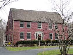 Richard Sanger III House |
January 3, 1986 (#86000508) |
60 Washington St. 42°14′09″N 71°22′48″W |
||
| 18 | Sawin–Bullen–Bullard House | 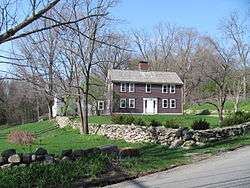 Sawin–Bullen–Bullard House |
January 3, 1986 (#86000509) |
60 Brush Hill Rd. 42°15′27″N 71°24′15″W |
||
| 19 | Sewall–Ware House | January 3, 1986 (#86000494) |
100 S. Main St. 42°13′43″N 71°22′02″W |
|||
| 20 | Sherborn Center Historic District | 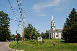 Sherborn Center Historic District |
January 3, 1986 (#86000495) |
Roughly bounded by Zion's Ln., Conrail railroad tracks, Farm and Sawin Sts., and Washington and N. Main Sts. 42°14′30″N 71°22′16″W |
||
| 21 | Sudbury Aqueduct Linear District | 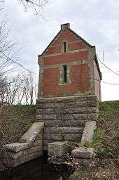 Sudbury Aqueduct Linear District |
January 18, 1990 (#89002293) |
Along Sudbury Aqueduct from Farm Pond at Waverly St. (Framingham) to Chestnut Hill Reservoir (Newton) 42°16′09″N 71°22′56″W |
Extends from Framingham to Newton. | |
| 22 | Joseph Twitchell House | 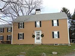 Joseph Twitchell House |
January 3, 1986 (#86000510) |
32 Pleasant St. 42°13′55″N 71°24′06″W |
||
| 23 | H. G. Vaughn House |  H. G. Vaughn House |
January 3, 1986 (#86000511) |
5 Sparhawk Rd. 42°12′24″N 71°22′09″W |
||
| 24 | Ware's Tavern | 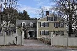 Ware's Tavern |
January 3, 1986 (#86000512) |
113 S. Main St. 42°13′39″N 71°21′58″W |
||
| 25 | Woodland Farm–Leland House |  Woodland Farm–Leland House |
January 3, 1986 (#86000513) |
104 Woodland St. 42°13′19″N 71°22′54″W |
gollark: Who says we even have alts?
gollark: Hmm, so what if we reveal that umnikos is secretly gibson?
gollark: ÆÆÆÆÆÆÆÆÆÆÆÆÆÆÆÆÆÆÆÆÆÆÆÆÆÆÆÆÆÆÆÆÆÆÆÆÆÆÆÆÆÆÆÆÆÆÆÆÆÆÆÆÆÆÆÆÆAAAAAAAÅAAAAAAAAAAAAAAAAA
gollark: Probably.
gollark: Gibson, vote gibson and help.
References
| Wikimedia Commons has media related to National Register of Historic Places in Sherborn, Massachusetts. |
- The latitude and longitude information provided in this table was derived originally from the National Register Information System, which has been found to be fairly accurate for about 99% of listings. Some locations in this table may have been corrected to current GPS standards.
- "National Register of Historic Places: Weekly List Actions". National Park Service, United States Department of the Interior. Retrieved on August 14, 2020.
- Numbers represent an ordering by significant words. Various colorings, defined here, differentiate National Historic Landmarks and historic districts from other NRHP buildings, structures, sites or objects.
- The eight-digit number below each date is the number assigned to each location in the National Register Information System database, which can be viewed by clicking the number.
| Topics | |
|---|---|
| Lists by state |
|
| Lists by insular areas | |
| Lists by associated state | |
| Other areas | |
| Related | |
| |
This article is issued from Wikipedia. The text is licensed under Creative Commons - Attribution - Sharealike. Additional terms may apply for the media files.