National Register of Historic Places listings in Cambridge, Massachusetts
This is a list of sites listed on the National Register of Historic Places in Cambridge, Massachusetts. This is intended to be a complete list of the properties and districts on the National Register of Historic Places in Cambridge, Massachusetts, United States. Latitude and longitude coordinates are provided for many National Register properties and districts; these locations may be seen together in an online map.[1]
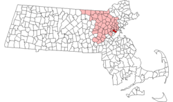
Location of Cambridge in Massachusetts
There are 206 properties and districts listed on the National Register in Cambridge, including 18 National Historic Landmarks.
- This National Park Service list is complete through NPS recent listings posted August 14, 2020.[2]
Current listings
| [3] | Name on the Register[4] | Image | Date listed[5] | Location | City or town | Description |
|---|---|---|---|---|---|---|
| 1 | Edwin Abbot House |  Edwin Abbot House |
May 10, 1979 (#79000354) |
1 Follen St. 42°22′43″N 71°07′24″W |
||
| 2 | John Aborn House |  John Aborn House |
April 13, 1982 (#82001883) |
41 Orchard St. 42°23′29″N 71°07′14″W |
||
| 3 | Alewife Brook Parkway |  Alewife Brook Parkway |
March 18, 2004 (#04000249) |
Alewife Brook Parkway 42°23′45″N 71°08′26″W |
||
| 4 | Almshouse |  Almshouse |
April 13, 1982 (#82001908) |
45 Matignon Road[6] 42°24′08″N 71°07′57″W |
Property is mostly in Cambridge; building extends into Somerville. | |
| 5 | American Net and Twine Company Factory | 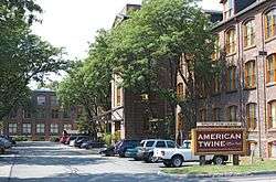 American Net and Twine Company Factory |
April 1, 1982 (#82001906) |
155 2nd St. 42°22′01″N 71°04′47″W |
||
| 6 | Ash Street Historic District | 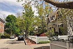 Ash Street Historic District |
April 13, 1982 (#82001916) |
Ash St. and Ash St. Place between Brattle and Mount Auburn Sts. 42°22′30″N 71°07′29″W |
||
| 7 | Athenaeum Press |  Athenaeum Press |
April 13, 1982 (#82001917) |
215 1st St. 42°21′51″N 71°04′43″W |
||
| 8 | Ephraim Atwood House | 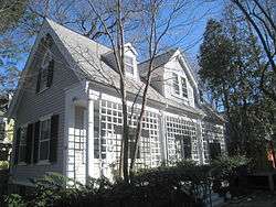 Ephraim Atwood House |
June 30, 1983 (#83000781) |
110 Hancock St. 42°22′09″N 71°06′28″W |
||
| 9 | Austin Hall |  Austin Hall |
April 19, 1972 (#72000128) |
Harvard University campus 42°22′37″N 71°07′08″W |
||
| 10 | Avon Hill Historic District |  Avon Hill Historic District |
June 30, 1983 (#83000782) |
Washington and Walnut Aves. and Agassiz, Humboldt, Arlington and Lancaster Sts. 42°23′09″N 71°07′21″W |
||
| 11 | B and B Chemical Company |  B and B Chemical Company |
April 13, 1982 (#82001918) |
780 Memorial Dr. 42°21′35″N 71°06′57″W |
Flagship center building of the complex is 784 Memorial Drive[7] | |
| 12 | Maria Baldwin House | .jpg) Maria Baldwin House |
May 11, 1976 (#76000272) |
196 Prospect St. 42°22′13″N 71°06′01″W |
||
| 13 | James B. Barnes House |  James B. Barnes House |
April 13, 1982 (#82001919) |
109 Hampshire Street 42°22′11″N 71°05′45″W |
||
| 14 | Beck-Warren House |  Beck-Warren House |
May 20, 1996 (#96000520) |
11 Prescott St. 42°22′23″N 71°06′51″W |
||
| 15 | Bennink-Douglas Cottages |  Bennink-Douglas Cottages |
May 19, 1986 (#86001272) |
35-51 Walker St. 42°22′48″N 71°07′23″W |
||
| 16 | Berkeley Street Historic District |  Berkeley Street Historic District |
April 13, 1982 (#82001920) |
Berkeley St.; also 1-8 Berkeley Pl. 42°22′42″N 71°07′33″W |
Berkeley Place represents a boundary increase | |
| 17 | Bertram Hall at Radcliffe College | Bertram Hall at Radcliffe College |
May 19, 1986 (#86001270) |
53 Shepard St. 42°22′50″N 71°07′27″W |
||
| 18 | Beth Israel Synagogue |  Beth Israel Synagogue |
April 13, 1982 (#82001921) |
238 Columbia St. 42°22′09″N 71°05′47″W |
||
| 19 | Bigelow Street Historic District |  Bigelow Street Historic District |
April 13, 1982 (#82001922) |
Bigelow St. 42°22′05″N 71°06′19″W |
||
| 20 | Frederick Billings House |  Frederick Billings House |
April 13, 1982 (#82001923) |
45 Orchard St. 42°23′30″N 71°07′14″W |
||
| 21 | George D. Birkhoff House |  George D. Birkhoff House |
May 15, 1975 (#75000295) |
22 Craigie St. 42°22′41″N 71°07′42″W |
||
| 22 | Blake and Knowles Steam Pump Company National Register District |  Blake and Knowles Steam Pump Company National Register District |
June 13, 1997 (#97000561) |
Bounded by Third, Binney, Fifth, and Rogers Sts. 42°21′58″N 71°05′02″W |
||
| 23 | Bottle House Block |  Bottle House Block |
April 13, 1982 (#82001924) |
204-214 3rd St. 42°22′02″N 71°04′53″W |
||
| 24 | E. H. Brabrook House |  E. H. Brabrook House |
May 19, 1986 (#86001276) |
42-44 Avon St. 42°22′59″N 71°07′24″W |
||
| 25 | William F. Bradbury House |  William F. Bradbury House |
June 30, 1983 (#83000784) |
369 Harvard St. 42°22′17″N 71°06′42″W |
||
| 26 | Brattle Hall |  Brattle Hall |
April 13, 1982 (#82001925) |
40 Brattle St. 42°22′25″N 71°07′17″W |
||
| 27 | William Brattle House | .jpg) William Brattle House |
May 8, 1973 (#73000286) |
42 Brattle St. 42°22′25″N 71°07′18″W |
||
| 28 | Percy Bridgman House | .JPG) Percy Bridgman House |
May 15, 1975 (#75000298) |
10 Buckingham Pl. 42°22′45″N 71°07′44″W |
||
| 29 | Luther Brooks House |  Luther Brooks House |
September 12, 1986 (#86002068) |
34 Kirkland St. 42°22′36″N 71°06′47″W |
||
| 30 | Building at 1707-1709 Cambridge Street |  Building at 1707-1709 Cambridge Street |
June 30, 1983 (#83000787) |
1707-1709 Cambridge St. 42°22′31″N 71°06′44″W |
||
| 31 | Building at 1715-1717 Cambridge Street |  Building at 1715-1717 Cambridge Street |
June 30, 1983 (#83000788) |
1715-1717 Cambridge St. 42°22′31″N 71°06′45″W |
||
| 32 | Building at 10 Follen Street |  Building at 10 Follen Street |
April 13, 1982 (#82001926) |
10 Follen St. 42°22′43″N 71°07′21″W |
||
| 33 | Building at 104-106 Hancock Street |  Building at 104-106 Hancock Street |
June 30, 1983 (#83000789) |
104-106 Hancock St. 42°22′09″N 71°06′28″W |
||
| 34 | Building at 102-104 Inman Street |  Building at 102-104 Inman Street |
June 30, 1983 (#83000790) |
102-104 Inman St. 42°22′19″N 71°06′05″W |
||
| 35 | Building at 106-108 Inman St |  Building at 106-108 Inman St |
April 13, 1982 (#82001927) |
106-108 Inman St. 42°22′20″N 71°06′05″W |
||
| 36 | Buildings at 110-112 Inman St. |  Buildings at 110-112 Inman St. |
April 13, 1982 (#82001929) |
110-112 Inman St. 42°22′21″N 71°06′04″W |
||
| 37 | Buildings at 15-17 Lee St. |  Buildings at 15-17 Lee St. |
April 13, 1982 (#82001930) |
15-17 Lee St. 42°22′07″N 71°06′25″W |
||
| 38 | Building at 42 Edward J. Lopez Avenue |  Building at 42 Edward J. Lopez Avenue |
April 13, 1982 (#82001928) |
42 Edward J. Lopez Ave. 42°22′04″N 71°04′48″W |
||
| 39 | Building at 259 Mount Auburn Street |  Building at 259 Mount Auburn Street |
June 30, 1983 (#83000786) |
259 Mt. Auburn St. 42°22′29″N 71°07′55″W |
||
| 40 | Cambridge Common Historic District |  Cambridge Common Historic District |
April 13, 1973 (#73000281) |
Garden, Waterhouse, Cambridge, and Peabody Sts., and Massachusetts Ave. Amendment (listed June 30, 1983, refnum 83004293): Massachusetts Ave. and Garden, Waterhouse, Cambridge, and Peabody Sts. Boundary increase and decrease (listed January 26, 1987, refnum 87000499): Roughly northwest of Waterhouse St. on Concord Ave. between Garden and Follen Sts. 42°22′35″N 71°07′15″W |
A historic district | |
| 41 | Cambridge Home for the Aged and Infirm |  Cambridge Home for the Aged and Infirm |
October 22, 2002 (#02001189) |
650 Concord Ave. 42°23′18″N 71°08′57″W |
Now Neville Place, a nursing facility. | |
| 42 | Cambridge Public Library |  Cambridge Public Library |
April 13, 1982 (#82001931) |
449 Broadway 42°22′27″N 71°06′41″W |
||
| 43 | Carpenter Center for the Visual Arts | 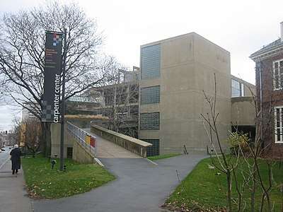 Carpenter Center for the Visual Arts |
April 20, 1978 (#78000435) |
19 Prescott St. 42°22′25″N 71°06′50″W |
||
| 44 | Central Square Historic District |  Central Square Historic District |
March 2, 1990 (#90000128) |
Roughly Massachusetts Ave. from Clinton St. to Main St. Boundary increase (listed July 11, 2012, refnum 12000404): Roughly 831 to 351-355 Massachusetts Ave. 42°21′54″N 71°06′13″W |
||
| 45 | Charles River Basin Historic District | .jpg) Charles River Basin Historic District |
December 22, 1978 (#78000436) |
Both banks of the Charles River from Eliot Bridge to Charles River Dam 42°21′25″N 71°05′03″W |
||
| 46 | Charles River Reservation Parkways |  Charles River Reservation Parkways |
January 18, 2006 (#05001530) |
Soldiers Field, Nonantum, Leo Birmingham, Arsenal, Greenough, N. Beacon, Charles River, Norumbega, Recreation 42°22′03″N 71°08′11″W |
Extends into Newton, Waltham, and Watertown and Weston, elsewhere in Middlesex County, and into Boston in Suffolk County | |
| 47 | Francis J. Child House |  Francis J. Child House |
June 30, 1983 (#83000791) |
67 Kirkland St. 42°22′40″N 71°06′34″W |
||
| 48 | Christ Church |  Christ Church |
October 15, 1966 (#66000140) |
Garden St. 42°22′31″N 71°07′16″W |
||
| 49 | Church of the New Jerusalem |  Church of the New Jerusalem |
June 30, 1983 (#83000792) |
50 Quincy St. 42°22′35″N 71°06′50″W |
Also known as Cambridge Swedenborg Chapel | |
| 50 | City Hall Historic District |  City Hall Historic District |
April 13, 1982 (#82001932) |
Massachusetts Ave., Bigelow and Temple Sts, Inman and Richard Allen Dr. 42°22′00″N 71°06′20″W |
||
| 51 | George Close Company Building |  George Close Company Building |
March 15, 2019 (#100003472) |
243 Broadway 42°22′02″N 71°05′44″W |
||
| 52 | Cloverden |  Cloverden |
June 30, 1983 (#83000793) |
29 Follen St. 42°22′44″N 71°07′16″W |
||
| 53 | Sara Foster Colburn House |  Sara Foster Colburn House |
April 13, 1982 (#82004968) |
7 Dana St. 42°22′12″N 71°06′37″W |
||
| 54 | Conventual Church of St. Mary and St. John |  Conventual Church of St. Mary and St. John |
April 13, 1982 (#82001933) |
980 Memorial Dr. 42°22′20″N 71°07′29″W |
||
| 55 | William Cook House |  William Cook House |
April 13, 1982 (#82001934) |
71 Appleton St. 42°22′46″N 71°08′02″W |
||
| 56 | Josiah Coolidge House | 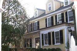 Josiah Coolidge House |
June 30, 1983 (#83000795) |
24 Coolidge Hill Rd. 42°22′27″N 71°08′23″W |
||
| 57 | Cooper-Frost-Austin House | 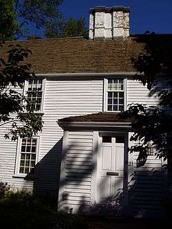 Cooper-Frost-Austin House |
September 22, 1972 (#72000124) |
21 Linnaean St. 42°23′04″N 71°07′18″W |
||
| 58 | Craigie Arms | 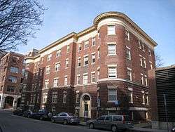 Craigie Arms |
July 10, 1986 (#86001575) |
2-6 University Rd., 122 Mt. Auburn, and 6 Bennett Sts. 42°22′22″N 71°07′25″W |
||
| 59 | e.e. cummings House | 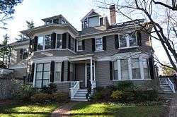 e.e. cummings House |
June 30, 1983 (#83000796) |
104 Irving St. 42°22′44″N 71°06′38″W |
||
| 60 | Reginald A. Daly House | .JPG) Reginald A. Daly House |
January 7, 1976 (#76000305) |
23 Hawthorn St. 42°22′31″N 71°07′34″W |
||
| 61 | Dana-Palmer House | 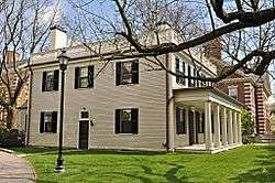 Dana-Palmer House |
May 19, 1986 (#86001682) |
12-16 Quincy St. 42°22′23″N 71°06′53″W |
||
| 62 | William Morris Davis House |  William Morris Davis House |
January 7, 1976 (#76000306) |
17 Francis Ave. 42°22′42″N 71°06′43″W |
||
| 63 | Anna Day House |  Anna Day House |
April 13, 1982 (#82001935) |
139 Cushing St. 42°22′43″N 71°09′08″W |
||
| 64 | Deane-Williams House |  Deane-Williams House |
April 13, 1982 (#82001936) |
21-23 Fayette St. 42°22′20″N 71°06′13″W |
||
| 65 | DeRosay-McNamee House |  DeRosay-McNamee House |
March 2, 1990 (#90000142) |
50 Mt. Vernon St. 42°23′14″N 71°07′17″W |
||
| 66 | Divinity Hall |  Divinity Hall |
September 12, 1986 (#86002071) |
12 Divinity Ave. 42°22′43″N 71°06′53″W |
||
| 67 | Edward Dodge House |  Edward Dodge House |
April 13, 1982 (#82001937) |
70 Sparks St. 42°22′47″N 71°07′53″W |
||
| 68 | The Dunvegan |  The Dunvegan |
May 19, 1986 (#86001279) |
1654 Massachusetts Ave. 42°22′54″N 71°07′12″W |
||
| 69 | East Cambridge Historic District |  East Cambridge Historic District |
June 30, 1983 (#83000797) |
Roughly bounded by Cambridge, Hurley and 5th Sts. 42°22′12″N 71°04′51″W |
||
| 70 | East Cambridge Savings Bank |  East Cambridge Savings Bank |
April 13, 1982 (#82001938) |
292 Cambridge St. 42°22′16″N 71°04′51″W |
||
| 71 | Eliot Hall at Radcliffe College |  Eliot Hall at Radcliffe College |
May 19, 1986 (#86001280) |
51 Shepard St. 42°22′52″N 71°07′25″W |
||
| 72 | Asa Ellis House |  Asa Ellis House |
June 30, 1983 (#83000798) |
158 Auburn St. 42°21′49″N 71°06′18″W |
||
| 73 | Elmwood |  Elmwood |
October 15, 1966 (#66000364) |
33 Elmwood Ave. 42°22′31″N 71°08′19″W |
||
| 74 | R.H. Farwell House |  R.H. Farwell House |
April 13, 1982 (#82001939) |
2222-2224 Massachusetts Ave. 42°23′37″N 71°07′34″W |
||
| 75 | Isaac Fay House |  Isaac Fay House |
June 30, 1983 (#83000799) |
125 Antrim St. 42°22′23″N 71°06′06″W |
||
| 76 | First Baptist Church | .jpg) First Baptist Church |
April 14, 1975 (#75000249) |
Magazine and River Sts. 42°21′53″N 71°06′20″W |
||
| 77 | Ernst Flentje House |  Ernst Flentje House |
June 30, 1983 (#83000800) |
129 Magazine St. 42°21′32″N 71°06′40″W |
||
| 78 | Fogg Art Museum |  Fogg Art Museum |
May 19, 1986 (#86001282) |
26-32 Quincy St. 42°22′27″N 71°06′53″W |
||
| 79 | Follen Street Historic District |  Follen Street Historic District |
May 19, 1986 (#86001681) |
1-44 and 5-29 Follen St. 42°22′43″N 71°07′19″W |
||
| 80 | Fort Washington | .JPG) Fort Washington |
April 3, 1973 (#73000284) |
95 Waverly St. 42°21′23″N 71°06′17″W |
||
| 81 | Fresh Pond Hotel |  Fresh Pond Hotel |
April 13, 1982 (#82001940) |
234 Lakeview Ave. 42°22′59″N 71°08′28″W |
||
| 82 | Fresh Pond Parkway-Metropolitan Park System of Greater Boston |  Fresh Pond Parkway-Metropolitan Park System of Greater Boston |
January 5, 2005 (#04001429) |
Fresh Pond Parkway 42°22′48″N 71°08′40″W |
||
| 83 | David Frost House |  David Frost House |
June 30, 1983 (#83000801) |
26 Gray St. 42°23′00″N 71°07′20″W |
||
| 84 | Elizabeth Frost Tenanthouse |  Elizabeth Frost Tenanthouse |
June 30, 1983 (#83000802) |
35 Bowdoin St. 42°23′01″N 71°07′17″W |
||
| 85 | Robert Frost House |  Robert Frost House |
April 13, 1982 (#82001941) |
29-35 Brewster St. 42°22′43″N 71°07′56″W |
||
| 86 | Walter Frost House |  Walter Frost House |
April 13, 1982 (#82001942) |
10 Frost St. 42°23′10″N 71°07′03″W |
||
| 87 | Margaret Fuller House | 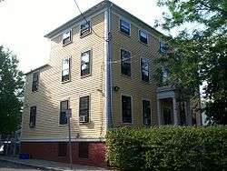 Margaret Fuller House |
July 2, 1971 (#71000686) |
71 Cherry St. 42°21′52″N 71°05′51″W |
||
| 88 | George Gale House | 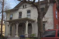 George Gale House |
February 10, 1988 (#87002543) |
14-16 Clinton St. 42°22′06″N 71°06′22″W |
||
| 89 | Garfield Street Historic District |  Garfield Street Historic District |
June 30, 1983 (#83000803) |
Garfield St. between Massachusetts Ave. and Oxford St. 42°23′02″N 71°07′06″W |
||
| 90 | Gray Gardens East and West Historic District |  Gray Gardens East and West Historic District |
May 19, 1986 (#86001283) |
1-37 Gray Gardens E, 3-24 Gray Gardens W, 91 Garden and 60 Raymond Sts. 42°23′01″N 71°07′43″W |
||
| 91 | Asa Gray House | 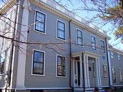 Asa Gray House |
October 15, 1966 (#66000655) |
88 Garden St. 42°22′59″N 71°07′41″W |
||
| 92 | Greek Revival Cottage | 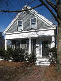 Greek Revival Cottage |
April 13, 1982 (#82001943) |
59 Rice St. 42°23′39″N 71°07′47″W |
||
| 93 | Hall Tavern | 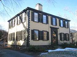 Hall Tavern |
June 30, 1983 (#83000806) |
20 Gray Gardens West St. 42°22′59″N 71°07′46″W |
||
| 94 | Richard Hapgood House | 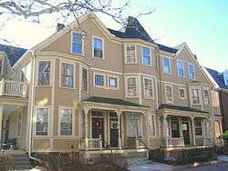 Richard Hapgood House |
May 19, 1986 (#86001284) |
382-392 Harvard St. 42°22′18″N 71°06′48″W |
||
| 95 | Harvard Houses Historic District | 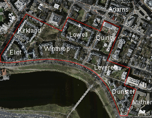 Harvard Houses Historic District |
September 12, 1986 (#86002073) |
Roughly bounded by Mt. Auburn, Grant, and Cowperwaite Sts., Banks St., Putman Ave., Memorial Drive, and John F. Kennedy St. 42°22′12″N 71°07′05″W |
||
| 96 | Harvard Lampoon Building |  Harvard Lampoon Building |
March 30, 1978 (#78000440) |
44 Bow St. 42°22′18″N 71°07′04″W |
||
| 97 | Harvard Square Historic District |  Harvard Square Historic District |
April 13, 1982 (#82001944) |
Massachusetts Ave., John F. Kennedy and Brattle Sts.; also roughly bounded by Massachusetts Ave. and Harvard, Mt. Auburn, Winthrop, Bennett, Story, and Church Sts. 42°22′25″N 71°07′11″W |
Second set of boundaries represents a boundary increase | |
| 98 | Harvard Square Subway Kiosk | Harvard Square Subway Kiosk |
January 30, 1978 (#78000441) |
Massachusetts Ave. and John F. Kennedy St. 42°22′25″N 71°07′08″W |
||
| 99 | Harvard Street Historic District |  Harvard Street Historic District |
April 13, 1982 (#82001945) |
Harvard St. between Ellery and Hancock Sts. 42°22′14″N 71°06′35″W |
||
| 100 | Harvard Union | 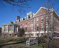 Harvard Union |
January 26, 1987 (#87000500) |
Quincy and Harvard Sts. 42°22′21″N 71°06′54″W |
||
| 101 | Harvard Yard Historic District | Harvard Yard Historic District |
February 6, 1973 (#73000287) |
Roughly bounded by an underpass, Broadway and Quincy Sts., Massachusetts Ave., and Peabody St. 42°22′28″N 71°07′02″W |
Originally listed as "Old Harvard Yard"; expanded and renamed December 14, 1987 | |
| 102 | Hastings Square Historic District | 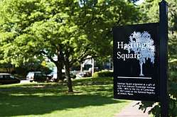 Hastings Square Historic District |
April 13, 1982 (#82001946) |
Roughly bounded by Rockingham, Henry, Chestnut and Brookline Sts. 42°21′23″N 71°06′36″W |
||
| 103 | Oliver Hastings House | .JPG) Oliver Hastings House |
December 30, 1970 (#70000681) |
101 Brattle St. 42°22′35″N 71°07′33″W |
||
| 104 | Hasty Pudding Club |  Hasty Pudding Club |
January 9, 1978 (#78000442) |
12 Holyoke St. 42°22′21″N 71°07′05″W |
||
| 105 | Henderson Carriage Repository | Henderson Carriage Repository |
April 13, 1982 (#82001947) |
2067-2089 Massachusetts Ave. 42°23′29″N 71°07′23″W |
||
| 106 | Col. Thomas Wentworth Higginson House |  Col. Thomas Wentworth Higginson House |
April 13, 1982 (#82001948) |
29 Buckingham St. 42°22′50″N 71°07′47″W |
||
| 107 | Aaron Hill House |  Aaron Hill House |
June 30, 1983 (#83000807) |
17 Brown St. 42°22′34″N 71°07′44″W |
||
| 108 | Joseph Holmes House |  Joseph Holmes House |
June 30, 1983 (#83000808) |
144 Coolidge Hill St. 42°22′20″N 71°08′24″W |
||
| 109 | Homer-Lovell House |  Homer-Lovell House |
December 22, 1983 (#83004030) |
11 Forest St. 42°23′07″N 71°07′04″W |
||
| 110 | Hooper-Eliot House |  Hooper-Eliot House |
June 30, 1983 (#83000809) |
25 Reservoir Rd. 42°22′44″N 71°08′13″W |
||
| 111 | Hooper-Lee-Nichols House | 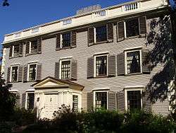 Hooper-Lee-Nichols House |
June 15, 1979 (#79000355) |
159 Brattle St. 42°22′39″N 71°08′03″W |
||
| 112 | Howe House | 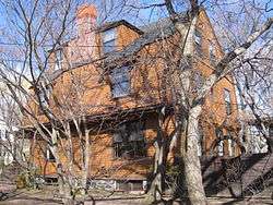 Howe House |
June 30, 1983 (#83000811) |
6 Appleton St. 42°22′41″N 71°08′00″W |
||
| 113 | William Dean Howells House | .JPG) William Dean Howells House |
April 13, 1982 (#82001949) |
37 Concord Ave. 42°22′48″N 71°07′36″W |
||
| 114 | Benjamin Hoyt House | 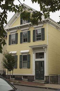 Benjamin Hoyt House |
April 13, 1982 (#82001953) |
134 Otis St. 42°22′15″N 71°05′04″W |
||
| 115 | Hubbard Park Historic District |  Hubbard Park Historic District |
April 13, 1982 (#82001950) |
Hubbard Park, Mercer Circle and Sparks Sts. 42°22′36″N 71°07′54″W |
||
| 116 | Inman Square Historic District | 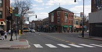 Inman Square Historic District |
April 13, 1982 (#82001951) |
Hampshire, Cambridge, and Inman Sts. 42°22′25″N 71°06′05″W |
||
| 117 | The Jarvis | 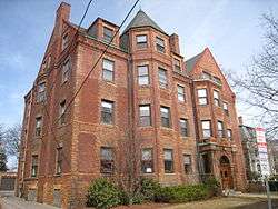 The Jarvis |
May 19, 1986 (#86001308) |
27 Everett St. 42°22′48″N 71°07′03″W |
||
| 118 | William R. Jones House | 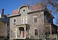 William R. Jones House |
June 30, 1983 (#83000813) |
307 Harvard St. 42°22′12″N 71°06′23″W |
||
| 119 | F. A. Kennedy Steam Bakery | 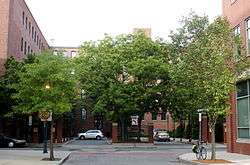 F. A. Kennedy Steam Bakery |
January 4, 1990 (#89002285) |
129 Franklin St. 42°21′44″N 71°06′05″W |
||
| 120 | Kidder-Sargent-McCrehan House | 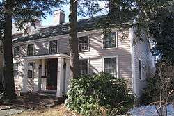 Kidder-Sargent-McCrehan House |
April 13, 1982 (#82001952) |
146 Rindge Ave. 42°23′36″N 71°07′49″W |
||
| 121 | Chester Kingsley House | 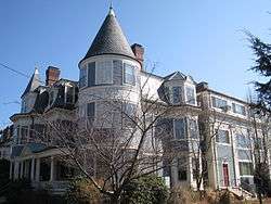 Chester Kingsley House |
April 13, 1982 (#82001954) |
10 Chester St. 42°23′37″N 71°07′29″W |
||
| 122 | Kirkland Place Historic District | 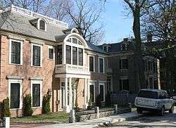 Kirkland Place Historic District |
May 19, 1986 (#86001683) |
Kirkland Pl. 42°22′40″N 71°06′46″W |
||
| 123 | Rufus Lamson House | 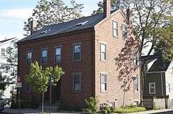 Rufus Lamson House |
April 13, 1982 (#82001955) |
72-74 Hampshire St. 42°22′04″N 71°05′38″W |
||
| 124 | The Larches | 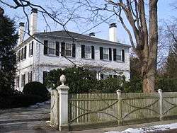 The Larches |
April 13, 1982 (#82001956) |
22 Larch Rd. 42°22′36″N 71°08′35″W |
||
| 125 | Lechmere Point Corporation Houses | 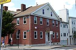 Lechmere Point Corporation Houses |
April 13, 1982 (#82001957) |
45-51 Gore St. and 25 3rd St. 42°22′18″N 71°04′49″W |
||
| 126 | Arthur D. Little, Inc. Building | 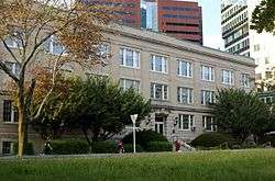 Arthur D. Little, Inc. Building |
December 8, 1976 (#76001970) |
30 Memorial Dr. 42°21′40″N 71°04′56″W |
||
| 127 | Littlefield-Roberts House | 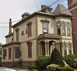 Littlefield-Roberts House |
September 12, 1986 (#86002070) |
16 Prescott St. 42°22′24″N 71°06′50″W |
||
| 128 | Longfellow National Historic Site |  Longfellow National Historic Site |
October 15, 1966 (#66000049) |
105 Brattle St. 42°22′36″N 71°07′35″W |
||
| 129 | Lovell Block |  Lovell Block |
June 30, 1983 (#83000814) |
1853 Massachusetts Ave. 42°23′16″N 71°07′08″W |
||
| 130 | Joseph Lovering House |  Joseph Lovering House |
September 12, 1986 (#86002076) |
38 Kirkland St. 42°22′37″N 71°06′45″W |
||
| 131 | Lowell School |  Lowell School |
April 13, 1982 (#82001958) |
25 Lowell St. 42°22′31″N 71°08′00″W |
||
| 132 | The Lowell |  The Lowell |
June 30, 1983 (#83000815) |
33 Lexington Ave. 42°22′37″N 71°08′25″W |
||
| 133 | Maple Avenue Historic District |  Maple Avenue Historic District |
June 30, 1983 (#83000816) |
Maple Ave. between Marie Ave. and Broadway 42°22′20″N 71°06′18″W |
||
| 134 | Josiah Mason, Jr. House |  Josiah Mason, Jr. House |
April 13, 1982 (#82001959) |
11 Market St. 42°22′01″N 71°05′40″W |
||
| 135 | W. A. Mason House |  W. A. Mason House |
June 30, 1983 (#83000817) |
87 Raymond St. 42°23′09″N 71°07′35″W |
||
| 136 | Massachusetts Hall, Harvard University |  Massachusetts Hall, Harvard University |
October 15, 1966 (#66000769) |
Harvard University Yard 42°22′28″N 71°07′06″W |
||
| 137 | Isaac McLean House |  Isaac McLean House |
April 13, 1982 (#82001960) |
2218 Massachusetts Ave. 42°23′36″N 71°07′34″W |
Hartwell and Richardson, architects (1894). | |
| 138 | Alpheus Mead House |  Alpheus Mead House |
April 13, 1982 (#82001961) |
2200 Massachusetts Ave. 42°23′35″N 71°07′32″W |
||
| 139 | Isaac Melvin House |  Isaac Melvin House |
April 13, 1982 (#82001962) |
19 Centre St. 42°22′11″N 71°06′34″W |
||
| 140 | Memorial Drive Apartments Historic District | Memorial Drive Apartments Historic District |
May 19, 1986 (#86001310) |
983-984, 985-986, 987-989, and 992-993 Memorial Dr. 42°22′22″N 71°07′33″W |
||
| 141 | Memorial Hall, Harvard University | _-_general_view.JPG) Memorial Hall, Harvard University |
December 30, 1970 (#70000685) |
Cambridge and Quincy Sts., Harvard University campus 42°22′33″N 71°06′54″W |
||
| 142 | The Montrose |  The Montrose |
May 19, 1986 (#86001311) |
1648 Massachusetts Ave. 42°22′53″N 71°07′12″W |
||
| 143 | Mount Auburn Cemetery | 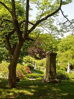 Mount Auburn Cemetery |
April 21, 1975 (#75000254) |
580 Mount Auburn St. 42°22′14″N 71°08′45″W |
Declared a National Historic Landmark on May 27, 2003 with a small boundary increase | |
| 144 | Mount Auburn Cemetery Reception House |  Mount Auburn Cemetery Reception House |
June 30, 1983 (#83000818) |
583 Mt. Auburn St. 42°22′32″N 71°08′42″W |
The cemetery's first (1870) reception house, located across the street from the main entrance. | |
| 145 | New England Confectionery Company Factory | 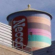 New England Confectionery Company Factory |
November 9, 2005 (#05001209) |
250 Massachusetts Ave. 42°21′39″N 71°05′54″W |
||
| 146 | Andrew Newman House |  Andrew Newman House |
April 13, 1982 (#82001963) |
23 Fairmont St. 42°21′41″N 71°06′37″W |
||
| 147 | Norfolk Street Historic District |  Norfolk Street Historic District |
April 13, 1982 (#82001964) |
Norfolk St. between Suffolk and Austin Sts. 42°21′57″N 71°06′04″W |
||
| 148 | North Avenue Congregational Church | 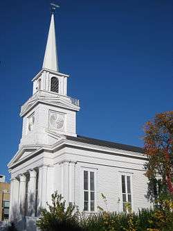 North Avenue Congregational Church |
June 30, 1983 (#83000819) |
1801 Massachusetts Ave. 42°23′11″N 71°07′07″W |
||
| 149 | J.A. Noyes House | 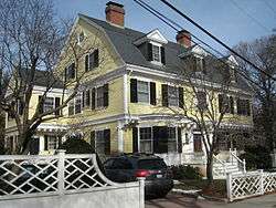 J.A. Noyes House |
April 13, 1982 (#82001965) |
1 Highland St. 42°22′46″N 71°07′54″W |
||
| 150 | Odd Fellows Hall | 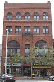 Odd Fellows Hall |
April 13, 1982 (#82001967) |
536 Massachusetts Ave. 42°21′51″N 71°06′09″W |
Hartwell and Richardson, architects (1884). | |
| 151 | Old Cambridge Baptist Church | 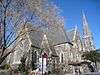 Old Cambridge Baptist Church |
April 13, 1982 (#82001968) |
398 Harvard St. 42°22′19″N 71°06′51″W |
||
| 152 | Old Cambridge Historic District |  Old Cambridge Historic District |
June 30, 1983 (#83000821) |
Irregular pattern along Brattle St. 42°22′37″N 71°08′25″W |
||
| 153 | Old Cambridgeport Historic District |  Old Cambridgeport Historic District |
June 30, 1983 (#83000820) |
Cherry, Harvard and Washington Sts. 42°21′57″N 71°05′50″W |
Spelled "Cambridgport" on the National Register. | |
| 154 | Opposition House |  Opposition House |
April 13, 1982 (#82001969) |
2-4 Hancock Pl. 42°22′11″N 71°06′25″W |
||
| 155 | Sarah Orne House |  Sarah Orne House |
June 30, 1983 (#83000822) |
10 Coolidge Hill Rd. 42°22′27″N 71°08′18″W |
||
| 156 | Peabody Court Apartments |  Peabody Court Apartments |
May 19, 1986 (#86001312) |
41-43 Linnaean St. 42°23′00″N 71°07′26″W |
||
| 157 | Porcellian Club |  Porcellian Club |
June 30, 1983 (#83000824) |
1320-24 Massachusetts Ave. 42°22′23″N 71°07′04″W |
||
| 158 | Dexter Pratt House | 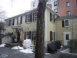 Dexter Pratt House |
May 8, 1973 (#73000288) |
54 Brattle St. 42°22′28″N 71°07′19″W |
||
| 159 | Prospect Congregational Church |  Prospect Congregational Church |
April 13, 1982 (#82001970) |
99 Prospect St. 42°22′04″N 71°06′09″W |
||
| 160 | Cheney Read House | 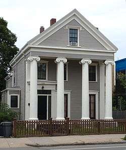 Cheney Read House |
April 13, 1982 (#82001971) |
135 Western Ave. 42°21′54″N 71°06′31″W |
||
| 161 | Edmund Reardon House | 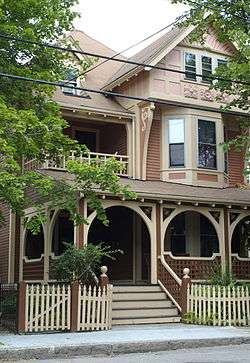 Edmund Reardon House |
April 13, 1982 (#82001972) |
195 Erie St. 42°21′37″N 71°06′31″W |
||
| 162 | Reversible Collar Company Building |  Reversible Collar Company Building |
September 27, 1985 (#85002663) |
25-27 Mt. Auburn & 10-12 Arrow Sts. 42°22′15″N 71°06′55″W |
||
| 163 | Theodore W. Richards House | 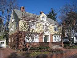 Theodore W. Richards House |
January 7, 1976 (#76001999) |
15 Follen St. 42°22′43″N 71°07′19″W |
||
| 164 | River Street Firehouse | 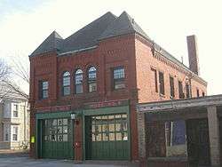 River Street Firehouse |
April 13, 1982 (#82001973) |
176 River St. 42°21′48″N 71°06′36″W |
||
| 165 | Sacred Heart Church, Rectory, School and Convent | 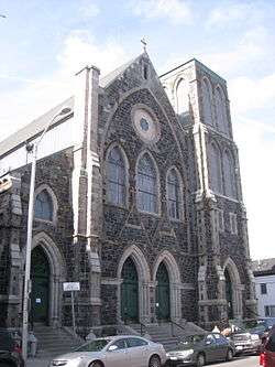 Sacred Heart Church, Rectory, School and Convent |
April 13, 1982 (#82001974) |
6th and Thorndike Sts. 42°22′15″N 71°05′06″W |
||
| 166 | St. James Episcopal Church | .jpg) St. James Episcopal Church |
June 30, 1983 (#83000828) |
1991 Massachusetts Ave. 42°23′27″N 71°07′16″W |
||
| 167 | St. John's Roman Catholic Church | 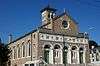 St. John's Roman Catholic Church |
June 30, 1983 (#83000829) |
2270 Massachusetts Ave. 42°23′40″N 71°07′38″W |
||
| 168 | Salem-Auburn Streets Historic District | 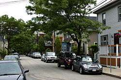 Salem-Auburn Streets Historic District |
April 13, 1982 (#82001975) |
Salem and Auburn Sts. 42°21′46″N 71°06′14″W |
||
| 169 | Hiram Sands House | 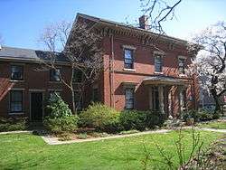 Hiram Sands House |
April 30, 1976 (#76000238) |
22 Putnam Ave. 42°22′10″N 71°06′48″W |
||
| 170 | Ivory Sands House | 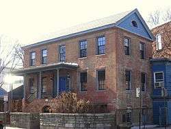 Ivory Sands House |
April 13, 1982 (#82001976) |
145 Elm St. 42°22′13″N 71°05′49″W |
||
| 171 | William Saunders House | 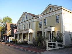 William Saunders House |
June 30, 1983 (#83000825) |
6 Prentiss St. 42°23′04″N 71°07′08″W |
||
| 172 | Sears Tower-Harvard Observatory | 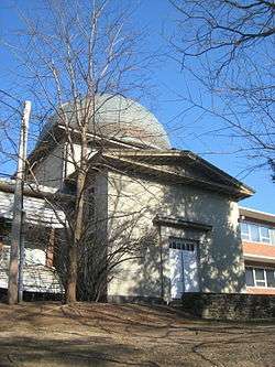 Sears Tower-Harvard Observatory |
February 26, 1987 (#86002075) |
60 Garden St. 42°22′54″N 71°07′42″W |
||
| 173 | Second Cambridge Savings Bank Building |  Second Cambridge Savings Bank Building |
June 30, 1983 (#83000826) |
11-21 Dunster St. 42°22′22″N 71°07′09″W |
||
| 174 | Second Waterhouse House |  Second Waterhouse House |
June 30, 1983 (#83000827) |
9 Follen St. 42°22′43″N 71°07′21″W |
||
| 175 | Sever Hall, Harvard University | _-_east_facade.JPG) Sever Hall, Harvard University |
December 30, 1970 (#70000732) |
Harvard Yard 42°22′27″N 71°06′56″W |
||
| 176 | Shady Hill Historic District |  Shady Hill Historic District |
May 19, 1986 (#86001680) |
Roughly bounded by Museum, Beacon and Holden, and Kirkland Sts., and Francis Ave. 42°22′45″N 71°06′41″W |
||
| 177 | Shell Oil Company "Spectacular" Sign | 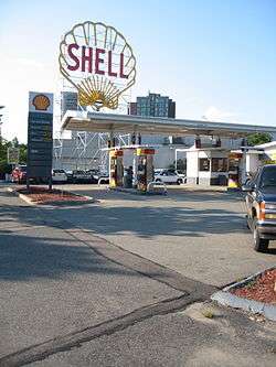 Shell Oil Company "Spectacular" Sign |
June 3, 1994 (#94000546) |
187 Magazine St. 42°21′25″N 71°06′52″W |
||
| 178 | Patrick Slowey House |  Patrick Slowey House |
April 13, 1982 (#82001977) |
71 Bolton St. 42°23′25″N 71°07′55″W |
Listed at 73 Bolton St. | |
| 179 | Lawrence Soule House |  Lawrence Soule House |
April 13, 1982 (#82001978) |
11 Russell St. 42°23′33″N 71°07′25″W |
||
| 180 | The Stanstead |  The Stanstead |
May 19, 1986 (#86001313) |
19 Ware St. 42°22′24″N 71°06′46″W |
||
| 181 | Stickney-Shepard House |  Stickney-Shepard House |
May 19, 1986 (#86001315) |
11-13 Remington St. 42°22′16″N 71°06′48″W |
||
| 182 | Mary Fisk Stoughton House | .jpg) Mary Fisk Stoughton House |
June 29, 1989 (#89001246) |
90 Brattle St. 42°22′33″N 71°07′29″W |
||
| 183 | Taylor Square Firehouse |  Taylor Square Firehouse |
April 13, 1982 (#82001979) |
113 Garden St. 42°23′03″N 71°07′47″W |
||
| 184 | Treadwell-Sparks House |  Treadwell-Sparks House |
September 12, 1986 (#86002078) |
21 Kirkland St. 42°22′36″N 71°06′54″W |
||
| 185 | Union Railway Car Barn |  Union Railway Car Barn |
April 13, 1982 (#82001980) |
613-621 Cambridge St. 42°22′19″N 71°05′13″W |
||
| 186 | University Hall, Harvard University | _-_east_facade.JPG) University Hall, Harvard University |
December 30, 1970 (#70000736) |
Harvard Yard 42°22′28″N 71°07′02″W |
||
| 187 | University Museum |  University Museum |
September 12, 1986 (#86002081) |
11-25 Divinity Ave. 42°22′42″N 71°06′57″W |
||
| 188 | Upper Magazine Street Historic District |  Upper Magazine Street Historic District |
April 13, 1982 (#82001981) |
Cottage, Magazine, William and Perry Sts. 42°21′47″N 71°06′25″W |
||
| 189 | Urban Rowhouse |  Urban Rowhouse |
April 13, 1982 (#82001983) |
30-38 Pearl St. 42°21′50″N 71°06′12″W |
||
| 190 | Urban Rowhouse |  Urban Rowhouse |
April 13, 1982 (#82001982) |
40-48 Pearl St. 42°21′49″N 71°06′13″W |
||
| 191 | Urban Rowhouse |  Urban Rowhouse |
June 30, 1983 (#83000831) |
26-32 River St. 42°21′53″N 71°06′21″W |
||
| 192 | US Post Office-Central Square |  US Post Office-Central Square |
June 18, 1986 (#86001343) |
770 Massachusetts Ave. 42°21′59″N 71°06′21″W |
||
| 193 | Valentine Soap Workers Cottage |  Valentine Soap Workers Cottage |
June 30, 1983 (#83000832) |
5–7 Cottage Street 42°21′45″N 71°06′20″W |
||
| 194 | Valentine Soap Workers Cottage |  Valentine Soap Workers Cottage |
June 30, 1983 (#83000833) |
101 Pearl Street 42°21′45″N 71°06′19″W |
||
| 195 | Albert Vinal House | 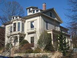 Albert Vinal House |
June 30, 1983 (#83000834) |
325 Harvard St. 42°22′14″N 71°06′30″W |
||
| 196 | Walden Street Cattle Pass | 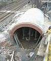 Walden Street Cattle Pass |
June 3, 1994 (#94000554) |
Adjacent to MBTA right-of-way at Walden St. 42°23′22″N 71°07′29″W |
||
| 197 | Ware Hall | 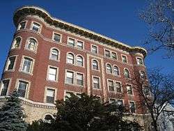 Ware Hall |
June 30, 1983 (#83000835) |
383 Harvard St. 42°22′19″N 71°06′49″W |
||
| 198 | Langford H. Warren House | 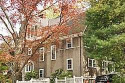 Langford H. Warren House |
May 19, 1986 (#86001317) |
6 Garden Terr. 42°22′57″N 71°07′41″W |
||
| 199 | Abraham Watson House |  Abraham Watson House |
April 13, 1982 (#82001984) |
181-183 Sherman St. 42°23′33″N 71°07′58″W |
||
| 200 | Stillman Willis House |  Stillman Willis House |
April 13, 1982 (#82001985) |
1 Potter Park 42°23′04″N 71°07′14″W |
||
| 201 | Winter Street Historic District |  Winter Street Historic District |
April 13, 1982 (#82001986) |
Winter St. 42°22′22″N 71°04′54″W |
||
| 202 | S. B. Withey House |  S. B. Withey House |
May 19, 1986 (#86001318) |
10 Appian Way 42°22′31″N 71°07′18″W |
||
| 203 | J. A. Wood House |  J. A. Wood House |
May 19, 1986 (#86001319) |
3 Sacramento St. 42°22′58″N 71°07′09″W |
Hartwell and Richardson, architects (1888). | |
| 204 | Wyeth Brickyard Superintendent's House |  Wyeth Brickyard Superintendent's House |
April 13, 1982 (#82001987) |
336 Rindge Ave. 42°23′36″N 71°08′15″W |
||
| 205 | John Wyeth House |  John Wyeth House |
April 13, 1982 (#82001988) |
56 Aberdeen Ave. 42°22′36″N 71°08′48″W |
||
| 206 | Wyeth-Smith House |  Wyeth-Smith House |
April 13, 1982 (#82001989) |
152 Vassal Lane 42°23′01″N 71°08′20″W |
Former listing
| [3] | Name on the Register | Image | Date listed | Date removed | Location | City or town | Summary |
|---|---|---|---|---|---|---|---|
| 1 | Cornerstone Baptist Church | February 8, 1979 (#79000363) | Unknown | 2114 Massachusetts Ave. |
gollark: My calculator says it is → it must be.
gollark: There's a Discord server for *polytopes*? That seems weirdly specific.
gollark: That doesn't seem horrible. They have to be 6n + something, and can't be +2 or +4 (even) or +3 (multiple of 3) or +0 or +6 (multiple of 2 *and* 3).
gollark: This is somewhat helpful, thanks.
gollark: Also, can someone comprehensibly explain what a "tensor" is? I hear about them a lot, but Wikipedia says something incomprehensible about multilinear maps and I remember reading something useless like that a "tensor is something that transforms like a tensor".
See also
| Wikimedia Commons has media related to National Register of Historic Places in Cambridge, Massachusetts. |
References
- The latitude and longitude information provided in this table was derived originally from the National Register Information System, which has been found to be fairly accurate for about 99% of listings. Some locations in this table may have been corrected to current GPS standards.
- "National Register of Historic Places: Weekly List Actions". National Park Service, United States Department of the Interior. Retrieved on August 14, 2020.
- Numbers represent an ordering by significant words. Various colorings, defined here, differentiate National Historic Landmarks and historic districts from other NRHP buildings, structures, sites or objects.
- "National Register Information System". National Register of Historic Places. National Park Service. April 24, 2008.
- The eight-digit number below each date is the number assigned to each location in the National Register Information System database, which can be viewed by clicking the number.
- MACRIS entry for Almshouse
- "784 Memorial Drive". The Bulfinch Companies, Inc. Retrieved 2019-09-19.
External links
- Historic Marker Program, Cambridge Historical Commission
- Protected property list of Cambridge
| Topics |  | ||||||||||||||||
|---|---|---|---|---|---|---|---|---|---|---|---|---|---|---|---|---|---|
| Lists by county | |||||||||||||||||
| Lists by city |
| ||||||||||||||||
| Other lists | |||||||||||||||||
| |||||||||||||||||
This article is issued from Wikipedia. The text is licensed under Creative Commons - Attribution - Sharealike. Additional terms may apply for the media files.