National Register of Historic Places listings in Richland County, South Carolina
This is a list of the National Register of Historic Places listings in Richland County, South Carolina.
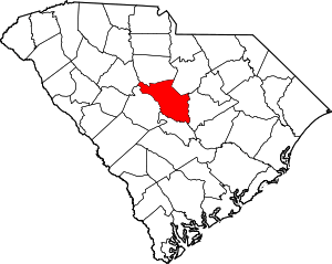
This is intended to be a complete list of the properties and districts on the National Register of Historic Places in Richland County, South Carolina, United States. The locations of National Register properties and districts for which the latitude and longitude coordinates are included below, may be seen on a map.[1]
There are 173 properties and districts listed on the National Register in the county, including 5 National Historic Landmarks. Listings in the city of Columbia, including all of the National Historic Landmarks, are listed separately, while the 37 properties and districts in the remaining parts of the county are listed here. Another property in Richland County outside Columbia was once listed but has been removed.
- This National Park Service list is complete through NPS recent listings posted August 14, 2020.[2]
Current listings
| [3] | Name on the Register[4] | Image | Date listed[5] | Location | City or town | Description |
|---|---|---|---|---|---|---|
| 1 | Barber House | March 27, 1986 (#86000531) |
Off County Road 37 33°53′39″N 80°52′37″W |
Hopkins | ||
| 2 | Big Lake Cattle Mound | November 25, 1996 (#96001092) |
Address Restricted |
Hopkins | In Congaree National Park | |
| 3 | Brady's Cattle Mound | November 25, 1996 (#96001094) |
Address Restricted |
Hopkins | In Congaree National Park | |
| 4 | Keziah Goodwyn Hopkins Brevard House | March 27, 1986 (#86000535) |
Off U.S. Route 378 Coordinates missing |
Eastover | ||
| 5 | Bridge Abutments | November 25, 1996 (#96001093) |
Address Restricted |
Hopkins | In Congaree National Park | |
| 6 | J.A. Byrd Mercantile Store |  J.A. Byrd Mercantile Store |
March 27, 1986 (#86000542) |
Main St. 33°52′40″N 80°41′40″W |
Eastover | |
| 7 | Cattle Mound No. 6 | November 25, 1996 (#96001095) |
Address Restricted |
Hopkins | In Congaree National Park | |
| 8 | Chappell House | March 27, 1986 (#86000589) |
Address Restricted |
Cedar Creek | ||
| 9 | Cook's Lake Cattle Mound |  Cook's Lake Cattle Mound |
November 25, 1996 (#96001096) |
Address Restricted |
Hopkins | In Congaree National Park |
| 10 | Cooner's Cattle Mound |  Cooner's Cattle Mound |
November 25, 1996 (#96001097) |
Address Restricted |
Hopkins | In Congaree National Park |
| 11 | Dead River Cattle Mound | November 25, 1996 (#96001098) |
Address Restricted |
Hopkins | In Congaree National Park | |
| 12 | Dead River Dike |  Dead River Dike |
November 25, 1996 (#96001099) |
Address Restricted |
Hopkins | In Congaree National Park |
| 13 | Farmers and Merchants Bank Building |  Farmers and Merchants Bank Building |
March 27, 1986 (#86000541) |
Main St. 33°52′39″N 80°41′39″W |
Eastover | |
| 14 | Good Hope Baptist Church |  Good Hope Baptist Church |
March 27, 1986 (#86000537) |
U.S. Route 378 near Sandhill Rd. 33°56′23″N 80°42′41″W |
Eastover | |
| 15 | Goodwill Plantation | March 27, 1986 (#86000528) |
Off U.S. Route 378 33°57′28″N 80°38′57″W |
Eastover | ||
| 16 | Grovewood | March 27, 1986 (#86000530) |
South Carolina Highway 769 33°54′24″N 80°48′09″W |
Congaree | ||
| 17 | George P. Hoffman House |  George P. Hoffman House |
March 27, 1986 (#86000586) |
North of County Road 54 34°12′53″N 80°58′19″W |
Blythewood | |
| 18 | Hopkins Family Cemetery | April 8, 2010 (#09000790) |
Address Restricted |
Hopkins | ||
| 19 | Hopkins Graded School | March 27, 1986 (#86000540) |
Junction of County Roads 37 and 1412 33°54′37″N 80°52′28″W |
Hopkins | ||
| 20 | Hopkins Presbyterian Church | March 27, 1986 (#86000538) |
Near the junction of County Roads 66 and 86 33°54′36″N 80°52′26″W |
Hopkins | ||
| 21 | John J. Kaminer House |  John J. Kaminer House |
March 27, 1986 (#86000532) |
Near the junction of South Carolina Highways 48 and 769 33°50′43″N 80°45′40″W |
Gadsden | |
| 22 | Kensington Plantation House | .jpg) Kensington Plantation House |
January 25, 1971 (#71000806) |
East of Eastover off South Carolina Highway 764 33°52′12″N 80°39′08″W |
Eastover | |
| 23 | John Jacob Calhoun Koon Farmstead |  John Jacob Calhoun Koon Farmstead |
March 27, 1986 (#86000590) |
County Road 27 off U.S. Routes 76/176 34°06′51″N 81°12′24″W |
Ballentine | |
| 24 | Laurelwood | March 27, 1986 (#86000529) |
200 Campbell Rd. 33°56′32″N 80°42′45″W |
Eastover, South Carolina | ||
| 25 | Magnolia | March 27, 1986 (#86000536) |
Adams Hayne Rd. 33°54′34″N 80°48′48″W |
Gadsden | ||
| 26 | Northwest Boundary Dike |  Northwest Boundary Dike |
November 25, 1996 (#96001100) |
Address Restricted |
Hopkins | |
| 27 | Oakwood | March 27, 1986 (#86000544) |
South Carolina Highway 48 33°50′07″N 80°41′19″W |
Gadsden | ||
| 28 | Olympia Armory |  Olympia Armory |
January 20, 1995 (#94001571) |
511 Granby Ln. 33°58′34″N 81°01′40″W |
Olympia | |
| 29 | Olympia Mill Village Historic District | November 20, 2018 (#100003058) |
Portions of Lincoln, Gadsden, Wayne, Heyward, Silver, S Parker, Alabama, Carolina, Delaware, Florida, Georgia, Kentucky, Maryland & Ohio Sts. 33°58′37″N 81°01′56″W |
Olympia | ||
| 30 | Pine Grove Rosenwald School |  Pine Grove Rosenwald School |
January 9, 2009 (#08001397) |
937 Piney Woods Rd. 34°03′47″N 81°07′28″W |
St. Andrews | |
| 31 | Richland Presbyterian Church | %2C_Gadsden%2C_SC.jpg) Richland Presbyterian Church |
March 27, 1986 (#86000533) |
County Road 1313 33°50′38″N 80°42′03″W |
Gadsden | |
| 32 | St. Phillip School | April 19, 1996 (#96000383) |
4350 McCords Ferry Rd. 33°50′56″N 80°39′07″W |
Eastover | ||
| 33 | Saint Thomas' Protestant Episcopal Church | March 27, 1986 (#86000539) |
Near the junction of U.S. Route 601 and South Carolina Highway 263 33°54′12″N 80°40′38″W |
Eastover | ||
| 34 | Claudius Scott Cottage | .jpg) Claudius Scott Cottage |
March 27, 1986 (#86000534) |
County Road 1182 33°55′01″N 80°42′07″W |
Eastover | |
| 35 | Siloam School | April 15, 1996 (#96000382) |
1331 Congaree Rd. 33°56′15″N 80°49′33″W |
Eastover | ||
| 36 | Southwest Boundary Dike | November 25, 1996 (#96001101) |
Address Restricted |
Hopkins | In Congaree National Park | |
| 37 | Woodlands | February 1, 2006 (#05001572) |
409 Old Woodlands Rd. 33°58′30″N 80°58′10″W |
Columbia | Folk Victorian two-story farm house built in 1896. |
Former listings
| [3] | Name on the Register | Image | Date listed | Date removed | Location | City or town | Summary |
|---|---|---|---|---|---|---|---|
| 1 | Zion Protestant Episcopal Church | March 27, 1986 (#86000543) | March 13, 2000 | Highway 263 |
Eastover | Burned[6] | |
| 2 | South Carolina Penitentiary | January 4, 1996 (#95001489) | December 8, 2005 | 1511 Williams Street |
Columbia | Demolished |
See also
| Wikimedia Commons has media related to National Register of Historic Places in Richland County, South Carolina. |
References
- The latitude and longitude information provided in this table was derived originally from the National Register Information System, which has been found to be fairly accurate for about 99% of listings. Some locations in this table may have been corrected to current GPS standards.
- "National Register of Historic Places: Weekly List Actions". National Park Service, United States Department of the Interior. Retrieved on August 14, 2020.
- Numbers represent an ordering by significant words. Various colorings, defined here, differentiate National Historic Landmarks and historic districts from other NRHP buildings, structures, sites or objects.
- "National Register Information System". National Register of Historic Places. National Park Service. March 13, 2009.
- The eight-digit number below each date is the number assigned to each location in the National Register Information System database, which can be viewed by clicking the number.
| Topics |  | |
|---|---|---|
| Lists by county |
| |
| Lists by city |
| |
| Other lists | ||
Municipalities and communities of Richland County, South Carolina, United States | ||
|---|---|---|
| Cities | Map of South Carolina highlighting Richland County | |
| Towns | ||
| CDPs | ||
| Unincorporated communities | ||
| Unincorporated community | ||
| Footnotes | ‡This populated place also has portions in an adjacent county or counties | |