South Carolina Highway 764
South Carolina Highway 764 (SC 764) is a 9-mile-long (14 km) state highway in the U.S. state of South Carolina. The highway connects rural areas of Richland County with Eastover.
| ||||
|---|---|---|---|---|
| ||||
| Route information | ||||
| Maintained by SCDOT | ||||
| Length | 8.95 mi[1] (14.40 km) | |||
| Major junctions | ||||
| West end | ||||
| East end | ||||
| Location | ||||
| Counties | Richland | |||
| Highway system | ||||
| ||||

Route description
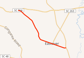
SC 764 begins at an intersection with U.S. Route 76 (US 76) and US 378 (Garners Ferry Road), northeast of McEntire Joint National Guard Base, and east-southeast of Horrell Hill, within Richland County. It travels to the southeast and crosses over Toms Creek. It curves to the south-southeast and crosses Ray Branch. The highway curves back to the southeast and begins paralleling railroad tracks; then, it enters Eastover. In town, it passes a U.S. Post Office before intersecting the southern terminus of SC 263 (Vanboklen Street). The highway crosses over Griffins Creek and leaves town. SC 764 continues traveling through rural areas of the county and curves to the east-northeast, where it no longer parallels the railroad tracks mentioned above. A very short distance later, it meets its eastern terminus, an intersection with US 601 (McCords Ferry Road). Here, the roadway continues as an access road to Kensington Mansion.[2]
Major intersections
The entire route is in Richland County.
| Location | mi[1] | km | Destinations | Notes | |
|---|---|---|---|---|---|
| | 0.00 | 0.00 | |||
| Eastover | 7.02 | 11.30 | Southern terminus of SC 263 | ||
| | 8.95 | 14.40 | |||
| 1.000 mi = 1.609 km; 1.000 km = 0.621 mi | |||||
See also


References
- "Statewide Highways (shapefile)" (zip). South Carolina Department of Transportation. September 29, 2017. Retrieved December 8, 2017.
- Google (May 17, 2016). "South Carolina Highway 764" (Map). Google Maps. Google. Retrieved May 17, 2016.
External links

- SC 764 South Carolina Hwy Index