National Register of Historic Places listings in Chester County, South Carolina
This is a list of the National Register of Historic Places listings in Chester County, South Carolina.

Location of Chester County in South Carolina
This is intended to be a complete list of the properties and districts on the National Register of Historic Places in Chester County, South Carolina, United States. The locations of National Register properties and districts for which the latitude and longitude coordinates are included below, may be seen in a map.[1]
There are 20 properties and districts listed on the National Register in the county.
- This National Park Service list is complete through NPS recent listings posted August 14, 2020.[2]
Current listings
| [3] | Name on the Register[4] | Image | Date listed[5] | Location | City or town | Description |
|---|---|---|---|---|---|---|
| 1 | Catholic Presbyterian Church | 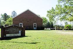 Catholic Presbyterian Church |
May 6, 1971 (#71000762) |
14 miles south of Chester on South Carolina Highway 97 and County Road 355 34°35′56″N 81°02′07″W |
Chester | |
| 2 | Chester City Hall and Opera House | 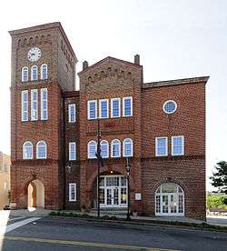 Chester City Hall and Opera House |
March 30, 1973 (#73001704) |
Corner of West End and Columbia Sts. 34°42′11″N 81°12′47″W |
Chester | |
| 3 | Chester Historic District | %2C_Chester%2C_South_Carolina.jpg) Chester Historic District |
June 13, 1972 (#72001203) |
Commercial area centered around the junction of U.S. Route 321 and South Carolina Highway 72; also roughly bounded by Hemphill Ave., Brawley, Saluda, and Foote Sts., and along Reedy St. 34°42′20″N 81°12′55″W |
Chester | Second set of boundaries represents a boundary increase of March 15, 1988 |
| 4 | Colvin-Fant-Durham Farm Complex | 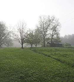 Colvin-Fant-Durham Farm Complex |
July 30, 1992 (#92000961) |
Eastern side of South Carolina Highway 22, approximately 1 mile west of its junction with South Carolina Highway 16 34°34′53″N 81°15′44″W |
Chester | |
| 5 | Cornwell Inn | 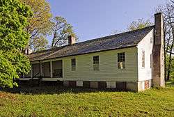 Cornwell Inn |
February 18, 1994 (#94000044) |
Junction of U.S. Route 321 and South Carolina Highway 205 34°36′27″N 81°10′42″W |
Blackstock | |
| 6 | Elliott House | May 6, 1971 (#71000764) |
North of Richburg off South Carolina Highway 901 on County Road 136 34°43′48″N 81°01′49″W |
Richburg | ||
| 7 | Fishdam Ford | 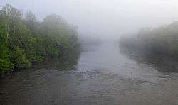 Fishdam Ford |
August 14, 1973 (#73001705) |
Southwest of Chester off South Carolina Highway 72 34°35′45″N 81°25′20″W |
Chester | |
| 8 | Great Falls Depot | 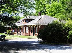 Great Falls Depot |
November 25, 1980 (#80003664) |
Republic St. 34°33′43″N 80°53′36″W |
Great Falls | |
| 9 | Great Falls Downtown Historic District | 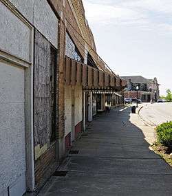 Great Falls Downtown Historic District |
June 2, 2000 (#00000588) |
Dearborn St. between Church and Republic St. 34°34′03″N 80°53′24″W |
Great Falls | |
| 10 | Kumler Hall | 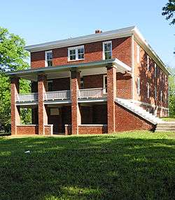 Kumler Hall |
January 27, 1983 (#83002190) |
Lancaster and Cemetery Sts. 34°42′27″N 81°11′19″W |
Chester | |
| 11 | Lando School | 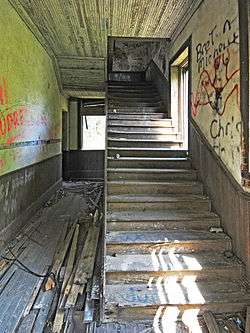 Lando School |
July 1, 2009 (#09000485) |
Schoolhouse Rd. 34°46′37″N 81°00′44″W |
Lando | |
| 12 | Landsford Canal | 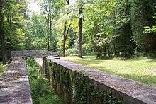 Landsford Canal |
December 3, 1969 (#69000163) |
Off U.S. Route 21 34°46′55″N 80°52′55″W |
Rowell | |
| 13 | Landsford Plantation House | 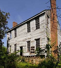 Landsford Plantation House |
February 4, 1987 (#86003520) |
County Road 595, ½ mile east of U.S. Route 21 34°47′04″N 80°54′43″W |
Richburg | |
| 14 | Lewis Inn | 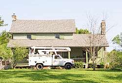 Lewis Inn |
May 6, 1971 (#71000763) |
Northeast of Chester off South Carolina Highway 72 34°46′36″N 81°08′16″W |
Chester | |
| 15 | McCollum Fish Weir |  McCollum Fish Weir |
August 28, 1974 (#74001845) |
Address Restricted |
Lockhart | |
| 16 | McCollum Mound | March 23, 1972 (#72001204) |
Confluence of the Broad River with Turkey Creek[6] 34°45′39″N 81°27′08″W |
Chester | Also known as "Turkey Creek Mound"[4] | |
| 17 | Mount Dearborn Military Reservation | January 16, 2018 (#100001719) |
Address Restricted |
Great Falls | ||
| 18 | People's Free Library of South Carolina | 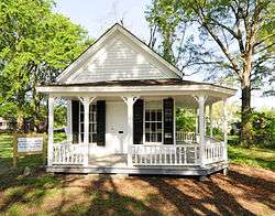 People's Free Library of South Carolina |
October 29, 1982 (#82001520) |
Church St. 34°48′16″N 81°14′29″W |
Lowrys | |
| 19 | James Phinney House | .jpg) James Phinney House |
October 11, 2016 (#16000714) |
2762 Blaney Rd. 34°45′48″N 81°07′01″W |
Chester | |
| 20 | Republic Theater | 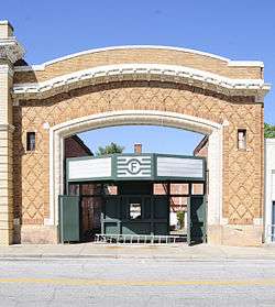 Republic Theater |
November 26, 1980 (#80003665) |
806 Dearborn St. 34°34′02″N 80°53′24″W |
Great Falls |
gollark: .pw and .cc apparently.
gollark: I managed to find an affordable six-letter domain.
gollark: But if I use nonpublic domains I can't get PKI-ized HTTPS certificates.
gollark: OpenNIC?
gollark: osmarksßsdomainsßsystem™.
See also
| Wikimedia Commons has media related to National Register of Historic Places in Chester County, South Carolina. |
References
- The latitude and longitude information provided in this table was derived originally from the National Register Information System, which has been found to be fairly accurate for about 99% of listings. Some locations in this table may have been corrected to current GPS standards.
- "National Register of Historic Places: Weekly List Actions". National Park Service, United States Department of the Interior. Retrieved on August 14, 2020.
- Numbers represent an ordering by significant words. Various colorings, defined here, differentiate National Historic Landmarks and historic districts from other NRHP buildings, structures, sites or objects.
- "National Register Information System". National Register of Historic Places. National Park Service. March 13, 2009.
- The eight-digit number below each date is the number assigned to each location in the National Register Information System database, which can be viewed by clicking the number.
- Lane, John. My Paddle to the Sea: Eleven Days on the River of the Carolinas. Athens: U of Georgia P, 2011, 67-68.
| Topics |  | |
|---|---|---|
| Lists by county |
| |
| Lists by city |
| |
| Other lists | ||
Municipalities and communities of Chester County, South Carolina, United States | ||
|---|---|---|
| City | Map of South Carolina highlighting Chester County | |
| Towns | ||
| CDPs | ||
| Unincorporated communities | ||
| Ghost town | ||
| Footnotes | ‡This populated place also has portions in an adjacent county or counties | |
This article is issued from Wikipedia. The text is licensed under Creative Commons - Attribution - Sharealike. Additional terms may apply for the media files.