National Register of Historic Places listings in Le Flore County, Oklahoma
This is a list of the National Register of Historic Places listings in Le Flore County, Oklahoma.
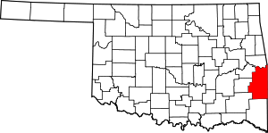
Location of Le Flore County in Oklahoma
This is intended to be a complete list of the properties and districts on the National Register of Historic Places in Le Flore County, Oklahoma, United States. The locations of National Register properties and districts for which the latitude and longitude coordinates are included below, may be seen in a map.[1]
There are 22 properties and districts listed on the National Register in the county.
- This National Park Service list is complete through NPS recent listings posted August 14, 2020.[2]
Current listings
| [3] | Name on the Register[4] | Image | Date listed[5] | Location | City or town | Description |
|---|---|---|---|---|---|---|
| 1 | Arkoma School | 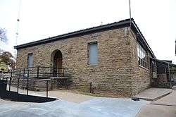 Arkoma School |
September 8, 1988 (#88001398) |
Arkoma and Blocker Sts. 35°21′18″N 94°26′00″W |
Arkoma | |
| 2 | Choctaw Agency | 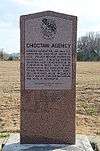 Choctaw Agency |
May 5, 1972 (#72001074) |
1 mile east of Skullyville on State Highway 9 35°15′03″N 94°35′29″W |
Spiro | |
| 3 | Peter Conser House | June 21, 1971 (#71000665) |
47114 Conser Creek Rd. 34°50′21″N 94°41′21″W |
Heavener | ||
| 4 | Dog Creek School | September 8, 1988 (#88001399) |
Southwest of Shady Point 35°04′50″N 94°51′54″W |
Shady Point | ||
| 5 | Jenson Tunnel | 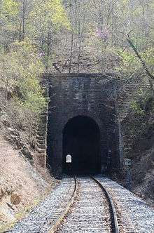 Jenson Tunnel |
May 13, 1976 (#76001567) |
Northeast of Cameron off State Highway 112 35°13′09″N 94°26′35″W |
Cameron | |
| 6 | Lake Wister Locality | August 19, 1975 (#75001566) |
Address Restricted |
Lake Wister | Extends into Latimer County | |
| 7 | LeFlore County Courthouse | 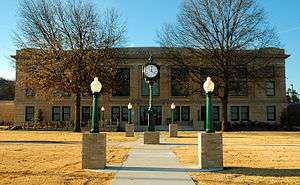 LeFlore County Courthouse |
August 23, 1984 (#84003099) |
Courthouse Sq. 35°03′15″N 94°37′27″W |
Poteau | |
| 8 | Old Military Road | October 22, 1976 (#76002155) |
7 miles northeast of Talihina in the Ouachita National Forest 34°47′46″N 94°56′38″W |
Talihina | ||
| 9 | Overstreet House | November 25, 1980 (#80004285) |
Northeast of Cowlington off U.S. Route 59 35°19′06″N 94°45′47″W |
Cowlington | ||
| 10 | Poteau Community Building | 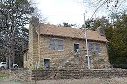 Poteau Community Building |
September 8, 1988 (#88001403) |
Hill and Hopkins Sts. 35°03′13″N 94°37′24″W |
Poteau | |
| 11 | Poteau School Gymnasium-Auditorium | 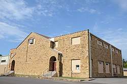 Poteau School Gymnasium-Auditorium |
September 8, 1988 (#88001404) |
Walter and Parker Sts. 35°03′07″N 94°37′03″W |
Poteau | |
| 12 | James E. Reynolds House | 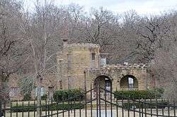 James E. Reynolds House |
April 13, 1977 (#77001093) |
East of Cameron off State Highway 112 35°08′03″N 94°31′47″W |
Cameron | |
| 13 | Shady Point School | September 8, 1988 (#88001405) |
Northeastern edge of the community 35°07′56″N 94°39′35″W |
Shady Point | ||
| 14 | Skullyville County Jail | 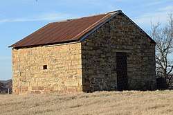 Skullyville County Jail |
November 6, 1980 (#80004286) |
West of Panama 35°10′25″N 94°43′04″W |
Panama | |
| 15 | Spiro Mound Group | 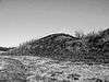 Spiro Mound Group |
September 30, 1969 (#69000153) |
18154 1st St.[6] 35°18′40″N 94°34′58″W |
Spiro | |
| 16 | State Line Marker | 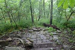 State Line Marker |
November 18, 1976 (#76000448) |
North of the east end of Highway 1 at the Arkansas state line 34°41′38″N 94°27′19″W |
Whitesboro | Extends into Polk County, Arkansas |
| 17 | Summerfield School | September 8, 1988 (#88001406) |
34518 Reichert-Summerfield Rd. 34°53′50″N 94°52′00″W |
Summerfield | ||
| 18 | Terry House | 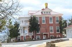 Terry House |
June 27, 1980 (#80004287) |
Terry Hill 35°03′14″N 94°37′44″W |
Poteau | |
| 19 | Trahern's Station | April 25, 1972 (#72001073) |
9 miles west of Shady Point 35°07′10″N 94°48′13″W |
Shady Point | ||
| 20 | Tucker School | _1_of_3.jpg) Tucker School |
September 8, 1988 (#88001407) |
Off U.S. Route 59 35°17′56″N 94°44′05″W |
Spiro | |
| 21 | Twyman Park | 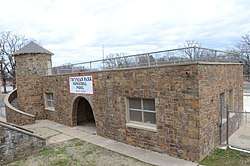 Twyman Park |
September 8, 1988 (#88001402) |
West St. 35°02′19″N 94°37′46″W |
Poteau | |
| 22 | Williams School | 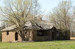 Williams School |
September 8, 1988 (#88001408) |
Northwest of Cameron 35°09′59″N 94°32′59″W |
Cameron |
gollark: An unknown network error has occurred.
gollark: Sorry, my network link temporarily became apiobees.
gollark: I suppose there's significant latency.
gollark: Bogosort?
gollark: Œ
See also
| Wikimedia Commons has media related to National Register of Historic Places in Le Flore County, Oklahoma. |
References
- The latitude and longitude information provided in this table was derived originally from the National Register Information System, which has been found to be fairly accurate for about 99% of listings. Some locations in this table may have been corrected to current GPS standards.
- "National Register of Historic Places: Weekly List Actions". National Park Service, United States Department of the Interior. Retrieved on August 14, 2020.
- Numbers represent an ordering by significant words. Various colorings, defined here, differentiate National Historic Landmarks and historic districts from other NRHP buildings, structures, sites or objects.
- "National Register Information System". National Register of Historic Places. National Park Service. March 13, 2009.
- The eight-digit number below each date is the number assigned to each location in the National Register Information System database, which can be viewed by clicking the number.
- Location derived from this Oklahoma Historical Society website; the NRIS lists the site as "Address Restricted"
| Arkoma | ||
|---|---|---|
| Cameron | ||
| Cowlington | ||
| Heavener | ||
| Panama | ||
| Poteau | ||
| Rural Areas |
| |
| Shady Point | ||
| Spiro | ||
| Summerfield and Talihina | ||
| Topics | |
|---|---|
| Lists by state |
|
| Lists by insular areas | |
| Lists by associated state | |
| Other areas | |
| Related | |
| |
Municipalities and communities of Le Flore County, Oklahoma, United States | ||
|---|---|---|
| Cities | Le Flore County map | |
| Towns | ||
| CDPs | ||
| Other unincorporated communities | ||
| Indian reservation | ||
| Footnotes | ‡This populated place also has portions in another county or counties | |
This article is issued from Wikipedia. The text is licensed under Creative Commons - Attribution - Sharealike. Additional terms may apply for the media files.