Page, Oklahoma
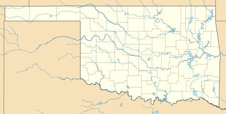
Page is an unincorporated community in Le Flore County, Oklahoma, United States. Page is located along U.S. Route 59 and U.S. Route 270 5.5 miles (8.9 km) west of the Arkansas border.
Page, Oklahoma | |
|---|---|
 Page  Page | |
| Coordinates: 34°42′38″N 94°32′59″W | |
| Country | United States |
| State | Oklahoma |
| County | Le Flore |
| Elevation | 922 ft (281 m) |
| Time zone | UTC-6 (Central (CST)) |
| • Summer (DST) | UTC-5 (CDT) |
| Area code(s) | 539/918 |
| GNIS feature ID | 1100715[1] |
History
A post office was established at Page, Indian Territory on April 6, 1896. It was named for William C. Page, a prominent Choctaw Indian.[2]
At the time of its founding, Page was located in Wade County, a part of the Apukshunnubbee District of the Choctaw Nation.[3]
gollark: <@!111608748027445248> PotatOS does *not* have Disknet.
gollark: I should æðð some GladoS quotes to potato os.
gollark: Not sure when, though.
gollark: Yes. GlaDOS is uploaded into potatOS.
gollark: No, GlaDOS is uploaded to the potatOS supercomputing cluster, but Wheatly is turned into Cortana.
References
- "US Board on Geographic Names". United States Geological Survey. 2007-10-25. Retrieved 2008-01-31.
- Shirk, George H. Oklahoma Place Names (Norman: University of Oklahoma, 1965), p. 160.
- Morris, John W. Historical Atlas of Oklahoma (Norman: University of Oklahoma, 1986), plate 38.
Municipalities and communities of Le Flore County, Oklahoma, United States | ||
|---|---|---|
| Cities | 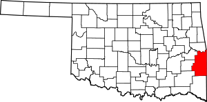 Le Flore County map | |
| Towns | ||
| CDPs | ||
| Other unincorporated communities | ||
| Indian reservation | ||
| Footnotes | ‡This populated place also has portions in another county or counties | |
This article is issued from Wikipedia. The text is licensed under Creative Commons - Attribution - Sharealike. Additional terms may apply for the media files.