National Register of Historic Places listings in Oklahoma County, Oklahoma
This is a list of the National Register of Historic Places listings in Oklahoma County, Oklahoma.
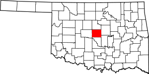
Location of Oklahoma County in Oklahoma
This is intended to be a complete list of the properties and districts on the National Register of Historic Places in Oklahoma County, Oklahoma, United States. The locations of National Register properties and districts for which the latitude and longitude coordinates are included below, may be seen in a map.[1]
There are 156 properties and districts listed on the National Register in the county. Another 2 properties were once listed but have since been removed.
- This National Park Service list is complete through NPS recent listings posted August 14, 2020.[2]
Current listings
| [3] | Name on the Register[4] | Image | Date listed[5] | Location | City or town | Description |
|---|---|---|---|---|---|---|
| 1 | 1210-1212-1214 North Hudson Historic District | March 15, 2018 (#100002218) |
1210–1214 North Hudson 35°28′50″N 97°31′09″W |
Oklahoma City | ||
| 2 | "Ringing the Wild Horse" Site | January 25, 1971 (#71001081) |
Northwest of Jones 35°36′07″N 97°20′01″W |
Jones | ||
| 3 | American Legion Hut | 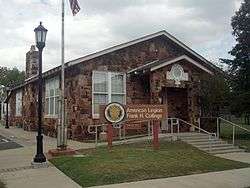 American Legion Hut |
December 2, 1993 (#93001336) |
Southwestern corner of the junction of 5th and Little Sts. 35°39′00″N 97°28′47″W |
Edmond | |
| 4 | Arcadia Round Barn | 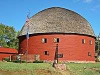 Arcadia Round Barn |
December 23, 1977 (#77001094) |
107 E. Highway 66 35°39′44″N 97°19′32″W |
Arcadia | |
| 5 | Arcadia Route 66 Roadbed | 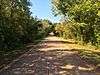 Arcadia Route 66 Roadbed |
November 30, 1999 (#99001424) |
Extends south-southeast from the junction of State Highway 66 and Hiwassee Rd. 35°39′43″N 97°17′43″W |
Arcadia | |
| 6 | Automobile Alley Historic District |  Automobile Alley Historic District |
March 18, 1999 (#99000351) |
Roughly along Broadway Ave., from NW. 4th St. to W. Park Place, and roughly along NW. 10th St. 35°28′33″N 97°30′53″W |
Oklahoma City | |
| 7 | Avery Building | 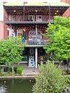 Avery Building |
August 12, 1983 (#83002097) |
15 E. California Ave. 35°27′56″N 97°30′39″W |
Oklahoma City | |
| 8 | Booher Site (OK48) | February 14, 1979 (#79003641) |
Address Restricted |
Luther | ||
| 9 | Bourne Dairy | Bourne Dairy |
October 3, 1979 (#79003642) |
5801 Eastern St. 35°31′48″N 97°28′37″W |
Oklahoma City | |
| 10 | Braniff Building | 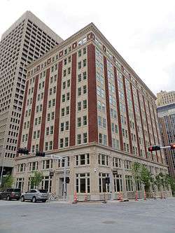 Braniff Building |
February 28, 1980 (#80003281) |
324 N. Robinson St. 35°28′15″N 97°30′57″W |
Oklahoma City | Renovations began 2012[6] |
| 11 | Frank and Merle Buttram House and Grounds | September 11, 1990 (#90001367) |
7316 Nichols Rd. 35°33′26″N 97°31′58″W |
Nichols Hills | ||
| 12 | Cain's Coffee Building | 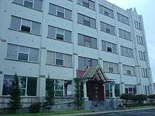 Cain's Coffee Building |
February 4, 1982 (#82004854) |
1 12th St., NW. 35°28′53″N 97°30′43″W |
Oklahoma City | |
| 13 | Calvary Baptist Church | 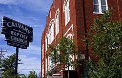 Calvary Baptist Church |
December 19, 1978 (#78002244) |
2nd and Walnut Sts. 35°28′11″N 97°30′30″W |
Oklahoma City | |
| 14 | Capitol Hill Commercial Historic District | Capitol Hill Commercial Historic District |
July 15, 2019 (#100004178) |
100–400 SW 25th St./ W. Commercial Ave. 35°26′22″N 97°31′06″W |
Oklahoma City | |
| 15 | Capitol Hill General Hospital | 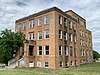 Capitol Hill General Hospital |
March 13, 2020 (#100005082) |
2400 South Harvey Ave. 35°26′29″N 97°31′05″W |
Oklahoma City | |
| 16 | Capitol-Lincoln Terrace Historic District | 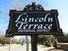 Capitol-Lincoln Terrace Historic District |
September 30, 1976 (#76001569) |
Irregular pattern roughly bounded by 13th, 23rd, Lincoln Boulevard, and Kelley Ave. 35°29′15″N 97°30′02″W |
Oklahoma City | |
| 17 | Carey Place Historic District |  Carey Place Historic District |
October 1, 1998 (#98001224) |
1800–2100 blocks of Carey Pl. 35°29′21″N 97°32′28″W |
Oklahoma City | |
| 18 | Cartmill Farm House | 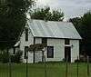 Cartmill Farm House |
September 6, 2006 (#06000795) |
21751 N. Macarthur Boulevard 35°41′33″N 97°37′15″W |
Edmond | |
| 19 | J.I. Case Plow Works Building | 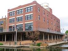 J.I. Case Plow Works Building |
August 12, 1983 (#83002098) |
2 E. California Ave. 35°27′54″N 97°30′41″W |
Oklahoma City | |
| 20 | Central High School | 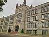 Central High School |
November 7, 1976 (#76001570) |
817 N. Robinson Ave. 35°28′32″N 97°30′59″W |
Oklahoma City | |
| 21 | Citizens Bank Tower | 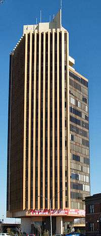 Citizens Bank Tower |
March 8, 2010 (#09000978) |
2200 N. Classen Boulevard 35°29′31″N 97°31′50″W |
Oklahoma City | Now known as The Classen |
| 22 | Citizens State Bank | 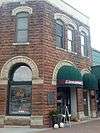 Citizens State Bank |
March 13, 1980 (#80003279) |
102 S. Broadway 35°39′14″N 97°28′51″W |
Edmond | |
| 23 | Citizens State Bank | 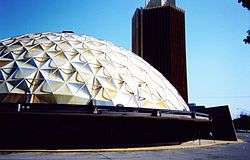 Citizens State Bank |
September 4, 2003 (#03000875) |
1112 NW. 23rd 35°29′34″N 97°31′51″W |
Oklahoma City | |
| 24 | Colcord Building | 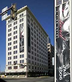 Colcord Building |
November 7, 1976 (#76001571) |
Robinson and Sheridan 35°28′00″N 97°31′00″W |
Oklahoma City | |
| 25 | Cotton-Exchange Building | 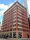 Cotton-Exchange Building |
March 18, 1980 (#80003282) |
218 N. Harvey St. 35°28′11″N 97°31′03″W |
Oklahoma City | |
| 26 | Crown Heights Historic District |  Crown Heights Historic District |
December 28, 1995 (#95001467) |
Roughly bounded by NW. 36th St., N. Western Ave., NW. 43rd St., and N. Walker Ave. 35°30′41″N 97°31′31″W |
Oklahoma City | |
| 27 | Czech Hall of Oklahoma City-Lodge Laska |  Czech Hall of Oklahoma City-Lodge Laska |
June 3, 2015 (#15000328) |
515 SW. 6th St. 35°27′32″N 97°31′19″W |
Oklahoma City | |
| 28 | Old Douglass High School | .jpg) Old Douglass High School |
April 4, 2007 (#07000259) |
600 N. High Ave. 35°28′31″N 97°29′38″W |
Oklahoma City | Converted to apartments.[7] |
| 29 | Dunbar Elementary School | Dunbar Elementary School |
March 15, 2018 (#100002217) |
1432 NE 7th St. 35°28′29″N 97°29′12″W |
Oklahoma City | Converted to apartments.[8] |
| 30 | Edgemere Park Historic District | November 12, 1980 (#80003283) |
Roughly bounded by Robinson and Walker and NW. 30 and NW. 36 35°30′12″N 97°31′02″W |
Oklahoma City | ||
| 31 | Edmond Armory |  Edmond Armory |
March 14, 1991 (#91000275) |
431 S. Boulevard 35°39′00″N 97°28′41″W |
Edmond | |
| 32 | Edmond Ice Company |  Edmond Ice Company |
June 14, 2016 (#16000371) |
101–109 W. 2nd St. 35°39′12″N 97°29′04″W |
Edmond | |
| 33 | Edwards Heights Historic District | September 7, 2005 (#05001003) |
Roughly bounded by NE. 16th St., N. Page Ave., NE. Success St. and N. Bryant Ave., extension on NE. Grand Boulevard 35°29′18″N 97°27′52″W |
Oklahoma City | ||
| 34 | Edwards Historic District | October 3, 1996 (#96001028) |
Roughly bounded by N. Page Ave., NE. 16th St., NE. Grand Boulevard, and E. Park Pl. 35°29′00″N 97°27′59″W |
Oklahoma City | ||
| 35 | Walter J. and Frances W. Edwards House |  Walter J. and Frances W. Edwards House |
September 8, 1994 (#94001084) |
1621 NE. Grand Boulevard 35°29′08″N 97°27′56″W |
Oklahoma City | |
| 36 | Electric Transformer House | Electric Transformer House |
June 14, 2016 (#16000372) |
2412 N. Olie Ave. 35°29′36″N 97°31′43″W |
Oklahoma City | |
| 37 | Elks Lodge Building |  Elks Lodge Building |
March 10, 1980 (#80003284) |
401 N. Harvey St. 35°28′16″N 97°31′10″W |
Oklahoma City | |
| 38 | Elks Victory Lodge-Ruby's Grill Building |  Elks Victory Lodge-Ruby's Grill Building |
January 11, 1996 (#95001498) |
322 NE. 2nd 35°28′10″N 97°30′22″W |
Oklahoma City | |
| 39 | Engels' Dry Goods Store |  Engels' Dry Goods Store |
March 3, 1980 (#80003280) |
114 S. Main St. 35°39′42″N 97°11′43″W |
Luther | |
| 40 | Fairchild Winery | March 13, 1975 (#75001570) |
1600 81st St., NE. 35°33′16″N 97°29′10″W |
Oklahoma City | ||
| 41 | Farmers Public Market | .jpg) Farmers Public Market |
December 2, 1982 (#82001497) |
311 S. Klein St. 35°27′46″N 97°31′59″W |
Oklahoma City | |
| 42 | Fidelity National Building | 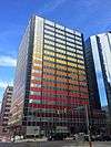 Fidelity National Building |
March 6, 2008 (#08000151) |
200 N. Harvey Ave. 35°28′15″N 97°31′04″W |
Oklahoma City | Now the Park Harvey Apartments |
| 43 | Film Exchange Historic District | .jpg) Film Exchange Historic District |
September 6, 2007 (#07000908) |
Junction of W. Sheridan Ave. and Lee Ave. 35°27′59″N 97°31′26″W |
Oklahoma City | |
| 44 | First Christian Church | _(Taken_20120926).jpg) First Christian Church |
March 8, 1984 (#84003383) |
1104 N. Robinson Ave. 35°28′43″N 97°31′35″W |
Oklahoma City | |
| 45 | First Christian Church Historic District | 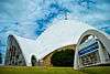 First Christian Church Historic District |
March 14, 2011 (#11000081) |
3700 N. Walker Ave. 35°30′33″N 97°31′06″W |
Oklahoma City | |
| 46 | First Church of Christ, Scientist | _(Taken_20120926).jpg) First Church of Christ, Scientist |
September 9, 2001 (#01000949) |
1200 N. Robinson Ave. 35°29′07″N 97°31′09″W |
Oklahoma City | |
| 47 | First National Bank and Trust Company Building | .jpg) First National Bank and Trust Company Building |
March 15, 2018 (#100002220) |
120 N. Robinson Ave. and 111 N. Broadway Ave. 35°28′06″N 97°30′56″W |
Oklahoma City | |
| 48 | Gatewood East Historic District | 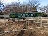 Gatewood East Historic District |
March 3, 2004 (#04000126) |
NW. 16th to north of NW. 22nd, N. Classen Boulevard to N. Blackwelder Ave., and N. Florida Ave. 35°29′17″N 97°32′09″W |
Oklahoma City | |
| 49 | Gatewood West Historic District | 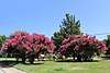 Gatewood West Historic District |
March 3, 2004 (#04000125) |
NW. 16th to NW. 23rd, N. Blackwelder Ave. and N. Florida Ave. to Pennsylvania Ave. 35°29′22″N 97°32′36″W |
Oklahoma City | |
| 50 | Goodholm House | 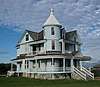 Goodholm House |
March 30, 1983 (#83002099) |
10735 NE 23rd St 35°28′29″N 97°34′11″W |
Nicoma Park | Relocated from State Fair Park in 2008 in Oklahoma City |
| 51 | Gower Cemetery | 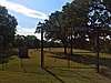 Gower Cemetery |
December 27, 1991 (#91001895) |
Covel Rd. between Douglas and Post Rds. 35°40′53″N 97°21′37″W |
Edmond | |
| 52 | W.T. Hales House | W.T. Hales House |
March 29, 1978 (#78002245) |
1521 N. Hudson Ave. 35°29′09″N 97°31′09″W |
Oklahoma City | |
| 53 | Harbour-Longmire Building | 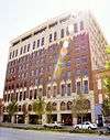 Harbour-Longmire Building |
March 3, 1980 (#80003285) |
420 W. Main St. 35°28′03″N 97°31′12″W |
Oklahoma City | |
| 54 | Harding Junior High School | 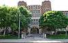 Harding Junior High School |
March 13, 2002 (#02000172) |
3333 N. Shartel Ave. 35°30′32″N 97°31′33″W |
Oklahoma City | |
| 55 | Harmony School | Harmony School |
December 2, 2019 (#100004742) |
1537 NE 24th St. 35°29′42″N 97°29′02″W |
Oklahoma City | |
| 56 | Harn House | 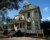 Harn House |
April 13, 1973 (#73001566) |
NE. 17th St. and Stiles 35°29′11″N 97°30′24″W |
Oklahoma City | |
| 57 | Haywood Building | 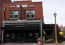 Haywood Building |
January 11, 1996 (#95001499) |
307 NE. 2nd 35°28′11″N 97°30′25″W |
Oklahoma City | |
| 58 | Heierding Building | 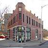 Heierding Building |
March 10, 1982 (#82003692) |
35 Harrison Ave. 35°28′21″N 97°30′39″W |
Oklahoma City | |
| 59 | Heritage Hills Historic and Architectural District | 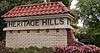 Heritage Hills Historic and Architectural District |
June 4, 1979 (#79002006) |
Roughly bounded by Robinson and Walker Aves., 14th, 15th, and 21st Sts., and Classen Boulevard 35°29′12″N 97°31′20″W |
Oklahoma City | |
| 60 | Hightower Building | 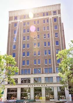 Hightower Building |
March 13, 2002 (#02000176) |
105 N. Hudson 35°28′11″N 97°31′11″W |
Oklahoma City | |
| 61 | Hopewell Baptist Church | 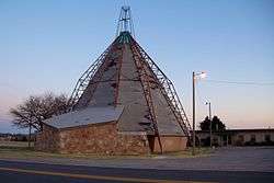 Hopewell Baptist Church |
September 14, 2002 (#02001018) |
5801 NW. 178th St. 35°39′11″N 97°37′13″W |
Edmond | |
| 62 | India Temple Shrine Building | 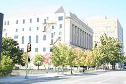 India Temple Shrine Building |
March 26, 1980 (#80003286) |
621 N. Robinson Ave. 35°28′25″N 97°30′58″W |
Oklahoma City | Also known as the Journal Record Building. Built by Freemasons in 1923; later used for offices; damaged in the 1995 Oklahoma City bombing; now houses the Oklahoma City National Memorial Museum. |
| 63 | Iroquois Apartments | 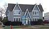 Iroquois Apartments |
December 2, 2019 (#100004741) |
900 NW 13th St. 35°28′56″N 97°31′38″W |
Oklahoma City | |
| 64 | Jefferson Park Historic District | 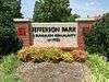 Jefferson Park Historic District |
December 14, 1995 (#95001466) |
Roughly bounded by NW. 23rd St., N. Walker Ave., NW. 30th St., and I-235 35°29′49″N 97°31′03″W |
Oklahoma City | |
| 65 | Jewel Theater | 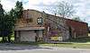 Jewel Theater |
September 3, 2009 (#09000686) |
904 NE 4th St. 35°28′16″N 97°29′49″W |
Oklahoma City | |
| 66 | Charles G. Jones Farmstead |  Charles G. Jones Farmstead |
June 14, 2001 (#01000658) |
12061 NE 108th St. 35°34′52″N 97°18′34″W |
Jones | |
| 67 | Kaiser's Ice Cream Parlour |  Kaiser's Ice Cream Parlour |
November 28, 1978 (#78002246) |
1039 N. Walker Ave. 35°28′43″N 97°31′16″W |
Oklahoma City | |
| 68 | Kelley Club | Kelley Club |
September 10, 2014 (#14000594) |
2300 N. Kelley Ave. 35°29′33″N 97°29′40″W |
Oklahoma City | |
| 69 | Kingman-More Building | 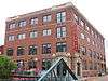 Kingman-More Building |
August 12, 1983 (#83002100) |
100 E. California Ave. 35°27′54″N 97°30′36″W |
Oklahoma City | |
| 70 | Kivlehen House | 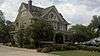 Kivlehen House |
December 4, 2008 (#08001150) |
525 N. Jackson St. 35°39′39″N 97°28′37″W |
Edmond | |
| 71 | Lake Overholser Bridge | 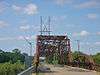 Lake Overholser Bridge |
March 2, 2004 (#04000133) |
N. Overholser Dr., 0.5 miles (0.80 km) west of N. Council Rd. 35°30′51″N 97°37′49″W |
Oklahoma City | |
| 72 | Lake Overholser Dam | 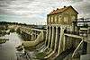 Lake Overholser Dam |
June 5, 2007 (#07000518) |
NW. 16th St. and E. Lake Overholser Dr. 35°29′10″N 97°39′54″W |
Oklahoma City | |
| 73 | Lincoln Park Bathhouse | September 12, 2016 (#16000620) |
2000 Remington Place 35°31′30″N 97°28′12″W |
Oklahoma City | ||
| 74 | Lincoln Plaza Historic District | March 15, 2016 (#16000086) |
4345–4545 N. Lincoln Boulevard and 416 NE. 46th St. 35°31′06″N 97°30′11″W |
Oklahoma City | ||
| 75 | Lincoln Terrace East Historic District | .jpg) Lincoln Terrace East Historic District |
March 3, 2004 (#04000124) |
Roughly bounded by Kelley Ave, NE. 16th St., Philips Ave., NE. 14th St., Linday Ave., Culbertston Dr., and NE. 21st St. 35°29′15″N 97°29′49″W |
Oklahoma City | |
| 76 | Littlepage Building | 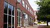 Littlepage Building |
January 11, 1996 (#95001500) |
219 N. Central Ave. 35°28′10″N 97°30′27″W |
Oklahoma City | |
| 77 | Melvin F. Luster House | 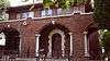 Melvin F. Luster House |
June 7, 1983 (#83002101) |
300 3rd St., NE. 35°28′14″N 97°30′25″W |
Oklahoma City | |
| 78 | Mager Mortgage Company Building | 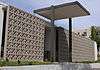 Mager Mortgage Company Building |
June 14, 2013 (#13000392) |
231 NW 10th St. 35°28′42″N 97°31′03″W |
Oklahoma City | |
| 79 | Magnolia Petroleum Building | 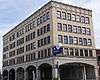 Magnolia Petroleum Building |
October 4, 1979 (#79002007) |
722 N. Broadway St. 35°28′29″N 97°30′49″W |
Oklahoma City | |
| 80 | Main Public Library |  Main Public Library |
December 13, 2010 (#10001009) |
131 Dean McGee Ave. 35°28′16″N 97°30′58″W |
Oklahoma City | First built 1901, remodeled 1954, downtown public library moved, 1954 building repurposed 2009[9] |
| 81 | Main Street Arcade |  Main Street Arcade |
December 5, 2014 (#14001028) |
629 W. Main 35°28′04″N 97°31′26″W |
Oklahoma City | |
| 82 | Maney Historic District |  Maney Historic District |
July 18, 1979 (#79002008) |
725 NW. 11th St. and 1200 and 1224 N. Shartel Ave. 35°28′49″N 97°31′30″W |
Oklahoma City | |
| 83 | The Mayfair |  The Mayfair |
September 12, 2012 (#12000786) |
1315 N. Broadway Pl. 35°28′55″N 97°30′54″W |
Oklahoma City | "Once home to some of Oklahoma City's wealthiest residents"[10] |
| 84 | Medical Arts Building |  Medical Arts Building |
December 13, 2016 (#16000849) |
100 Park Ave. 35°28′07″N 97°30′53″W |
Oklahoma City | |
| 85 | Merchants Transfer and Storage | Merchants Transfer and Storage |
April 2, 1999 (#83004655) |
19 E. California 35°27′56″N 97°30′38″W |
Oklahoma City | |
| 86 | Mesta Park | 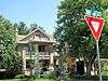 Mesta Park |
July 26, 1983 (#83002102) |
Roughly bounded by NW. 16th and 23rd Sts. and Western and Walker Aves. 35°29′21″N 97°31′25″W |
Oklahoma City | |
| 87 | Mid-Continent Life Building | 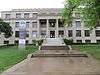 Mid-Continent Life Building |
March 12, 1979 (#79002009) |
1400 Classen Dr. 35°29′00″N 97°31′33″W |
Oklahoma City | |
| 88 | Mideke Supply Building | 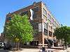 Mideke Supply Building |
August 12, 1983 (#83002103) |
100 E. Main St. 35°28′02″N 97°30′35″W |
Oklahoma City | |
| 89 | Milk Bottle Grocery | 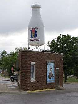 Milk Bottle Grocery |
March 5, 1998 (#98000199) |
2426 N. Classen Boulevard 35°29′39″N 97°31′55″W |
Oklahoma City | |
| 90 | Miller-Jackson Building | 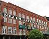 Miller-Jackson Building |
August 12, 1983 (#83002104) |
121 E. California Ave. 35°27′56″N 97°30′34″W |
Oklahoma City | |
| 91 | Miller's Boulevard Historic District | 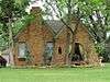 Miller's Boulevard Historic District |
December 4, 2014 (#14001029) |
Bounded by NW. 16th St., W. Park Place, N. May & N. Villa Aves. 35°28′54″N 97°33′41″W |
Oklahoma City | |
| 92 | Municipal Auditorium | 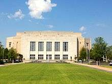 Municipal Auditorium |
December 13, 2016 (#16000850) |
201 North Walker Ave. 35°28′09″N 97°31′23″W |
Oklahoma City | |
| 93 | Mutual Savings and Loan Association Building | Mutual Savings and Loan Association Building |
September 12, 2016 (#16000621) |
601–605 NW. 23rd St. 35°29′36″N 97°31′22″W |
Oklahoma City | |
| 94 | Nagle Site | February 14, 1979 (#79002011) |
Address Restricted |
Spencer | ||
| 95 | Norton-Johnson Buick Company | 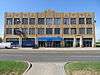 Norton-Johnson Buick Company |
June 22, 1998 (#98000668) |
117–125 NW. 13th St. 35°28′58″N 97°30′53″W |
Oklahoma City | multistory Art Deco structure built in 1930 |
| 96 | Oklahoma City Discovery Well | 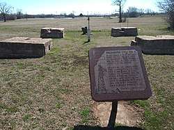 Oklahoma City Discovery Well |
December 9, 1977 (#77001095) |
SE. 57th St. and ITIO Boulevard 35°24′29″N 97°27′40″W |
Oklahoma City | |
| 97 | Oklahoma City Ford Motor Company Assembly Plant | 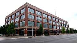 Oklahoma City Ford Motor Company Assembly Plant |
September 10, 2014 (#14000595) |
900 W. Main Ave. 35°28′04″N 97°31′40″W |
Oklahoma City | |
| 98 | Oklahoma City Municipal Building | .jpg) Oklahoma City Municipal Building |
June 5, 2007 (#07000521) |
200 N. Walker Ave. 35°28′08″N 97°31′13″W |
Oklahoma City | |
| 99 | Oklahoma City National Memorial | Oklahoma City National Memorial |
October 9, 1997 (#01000278) |
Bounded by NW. 6th St., N. Robinson Ave., NW. 4th St., and N. Harvey Ave. 35°28′22″N 97°31′02″W |
Oklahoma City | |
| 100 | Oklahoma City Schools Administration Building | 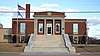 Oklahoma City Schools Administration Building |
September 19, 2019 (#100004400) |
400 N. Walnut Ave. 35°28′15″N 97°30′31″W |
Oklahoma City | |
| 101 | Oklahoma City University | 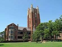 Oklahoma City University |
December 19, 1978 (#78002247) |
2501 N. Blackwelder Ave. 35°29′42″N 97°32′39″W |
Oklahoma City | |
| 102 | Oklahoma County Courthouse | .jpg) Oklahoma County Courthouse |
March 5, 1992 (#92000126) |
321 Park Ave. 35°28′08″N 97°31′14″W |
Oklahoma City | |
| 103 | Oklahoma County Home for Girls | March 21, 1978 (#78002248) |
6300 N. Western Ave. 35°32′09″N 97°31′43″W |
Oklahoma City | Demolished to make way for Chesapeake Energy campus.[11] | |
| 104 | Oklahoma Gas and Electric Company Building | .jpg) Oklahoma Gas and Electric Company Building |
April 9, 1980 (#80003288) |
321 N. Harvey Ave. 35°28′15″N 97°31′09″W |
Oklahoma City | |
| 105 | Oklahoma Hardware Building | 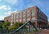 Oklahoma Hardware Building |
August 12, 1983 (#83002105) |
27 E. California Ave. 35°27′56″N 97°30′38″W |
Oklahoma City | |
| 106 | Oklahoma Historical Society Building | Oklahoma Historical Society Building |
February 21, 1990 (#90000124) |
2100 Lincoln Boulevard 35°29′24″N 97°30′07″W |
Oklahoma City | |
| 107 | Oklahoma National Guard Armory | Oklahoma National Guard Armory |
December 2, 2019 (#100004739) |
200 NE 23rd St. 35°29′35″N 97°30′33″W |
Oklahoma City | |
| 108 | Oklahoma Publishing Company Building | 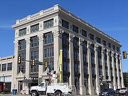 Oklahoma Publishing Company Building |
September 18, 1978 (#78002249) |
500 N. Broadway 35°28′19″N 97°30′50″W |
Oklahoma City | |
| 109 | Oklahoma State Capitol |  Oklahoma State Capitol |
October 8, 1976 (#76001572) |
22nd St. and Lincoln Boulevard 35°29′32″N 97°30′11″W |
Oklahoma City | |
| 110 | Old North Tower, Central State College | 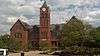 Old North Tower, Central State College |
June 21, 1971 (#71000671) |
400 E. Hurd St. on the Central State College campus 35°39′21″N 97°28′25″W |
Edmond | |
| 111 | Osler Building | 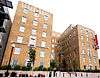 Osler Building |
June 15, 2012 (#12000347) |
1200 N. Walker Ave. 35°28′49″N 97°31′15″W |
Oklahoma City | |
| 112 | Overholser Mansion | 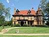 Overholser Mansion |
June 22, 1970 (#70000536) |
405 15th St., NW. 35°29′06″N 97°30′45″W |
Oklahoma City | |
| 113 | Paseo Neighborhood Historic District |  Paseo Neighborhood Historic District |
May 27, 2004 (#04000517) |
Roughly by NW. 30th St., North Western Ave., NW. 24th St., and N. Walker Ave. 35°29′58″N 97°31′31″W |
Oklahoma City | |
| 114 | Pilgrim Congregational Church | 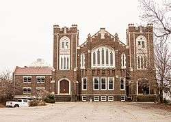 Pilgrim Congregational Church |
February 23, 1984 (#84003389) |
1433 Classen Dr. 35°28′58″N 97°31′36″W |
Oklahoma City | now City Presbyterian Church |
| 115 | Pioneer Building | 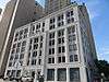 Pioneer Building |
March 3, 1980 (#80003289) |
401 N. Broadway St. 35°28′16″N 97°30′51″W |
Oklahoma City | built 1909; first downtown high-rise and fireproof building in Oklahoma City |
| 116 | Pioneer Telephone Company Warehouse and Garage | 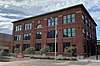 Pioneer Telephone Company Warehouse and Garage |
June 7, 2018 (#100002545) |
1–13 NE. 6th St. 35°28′27″N 97°30′36″W |
Oklahoma City | |
| 117 | Plaza Court | 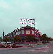 Plaza Court |
September 8, 1980 (#80003290) |
1100 Classen Dr. 35°28′46″N 97°31′16″W |
Oklahoma City | |
| 118 | Point 8 Site | September 6, 1978 (#78002250) |
Address Restricted |
Oklahoma City | ||
| 119 | Donald Pollock House | Donald Pollock House |
December 13, 2001 (#01001356) |
2400 NW. 59th St. 35°32′07″N 97°33′13″W |
Oklahoma City | |
| 120 | Post Office, Courthouse, and Federal Office Building | 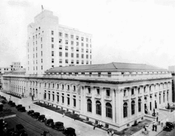 Post Office, Courthouse, and Federal Office Building |
August 30, 1974 (#74001665) |
Robinson at 3rd St. 35°28′16″N 97°31′01″W |
Oklahoma City | |
| 121 | Putnam Heights Historic Preservation District |  Putnam Heights Historic Preservation District |
June 2, 1982 (#82003693) |
Georgia and McKinley Boulevards and 35th, 37th, and 38th Sts. 35°30′28″N 97°32′12″W |
Oklahoma City | |
| 122 | Quillin Site | February 14, 1979 (#79002005) |
Address Restricted |
Midwest City | ||
| 123 | Edward Richardson Building | 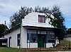 Edward Richardson Building |
December 4, 2017 (#100001870) |
101 Main St. 35°39′45″N 97°19′31″W |
Arcadia | |
| 124 | Rock Island Plow Building | 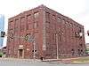 Rock Island Plow Building |
August 12, 1983 (#83002106) |
29 E. Reno Ave. 35°27′52″N 97°30′38″W |
Oklahoma City | |
| 125 | St. Joseph's Cathedral | 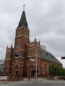 St. Joseph's Cathedral |
January 30, 1978 (#78002253) |
225 4th St., NW. 35°28′20″N 97°31′05″W |
Oklahoma City | |
| 126 | St. Paul's Cathedral | 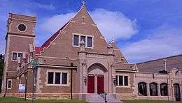 St. Paul's Cathedral |
April 11, 1977 (#77001096) |
127 7th St., NW. 35°28′31″N 97°30′56″W |
Oklahoma City | |
| 127 | Santa Fe Depot | .jpg) Santa Fe Depot |
December 8, 2015 (#15000874) |
146 S. E.K. Gaylord Blvd. 35°27′54″N 97°30′46″W |
Oklahoma City | |
| 128 | Shepherd Historic District | 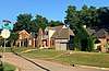 Shepherd Historic District |
June 20, 1997 (#97000612) |
Roughly bounded by NW. 30th and NW. 25th Sts., N. Pennsylvania Ave., and N. Youngs Boulevard 35°29′55″N 97°33′05″W |
Oklahoma City | |
| 129 | Sherman Machine and Iron Works Building | 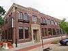 Sherman Machine and Iron Works Building |
August 12, 1983 (#83002107) |
26 E. Main St. 35°28′03″N 97°30′38″W |
Oklahoma City | |
| 130 | Sieber Grocery and Apartment Hotel | 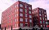 Sieber Grocery and Apartment Hotel |
September 7, 2005 (#05001001) |
1305–1313 N. Hudson Ave. 35°29′01″N 97°30′58″W |
Oklahoma City | |
| 131 | John Sinopoulo House | November 28, 1978 (#78002251) |
4000 N. Kelley 35°30′41″N 97°29′34″W |
Oklahoma City | ||
| 132 | Skirvin Hotel | 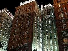 Skirvin Hotel |
October 10, 1979 (#79002010) |
1 Park Ave. 35°28′08″N 97°30′49″W |
Oklahoma City | |
| 133 | Dr. W.H. Slaughter House | 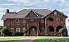 Dr. W.H. Slaughter House |
December 20, 2018 (#100003237) |
3101 NE 50th St. 35°31′23″N 97°27′23″W |
Oklahoma City | |
| 134 | Smith and Kernke Funeral Directors | 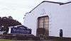 Smith and Kernke Funeral Directors |
June 3, 1999 (#99000671) |
1401 NW. 23rd St. 35°29′37″N 97°32′05″W |
Oklahoma City | |
| 135 | Spanish Village Historic District | 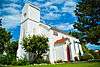 Spanish Village Historic District |
February 24, 1983 (#83002108) |
2909–3024 Paseo 35°29′57″N 97°31′19″W |
Oklahoma City | |
| 136 | Spencer No. 2 Site | November 27, 1978 (#78002252) |
Address Restricted |
Oklahoma City | ||
| 137 | Stanford Furniture Co. Building | .jpg) Stanford Furniture Co. Building |
August 12, 1983 (#83002109) |
1 E. Sheridan Ave. 35°28′00″N 97°30′41″W |
Oklahoma City | |
| 138 | State Highway Department Testing Laboratory | State Highway Department Testing Laboratory |
December 2, 2019 (#100004740) |
2311 North Central Ave. 35°29′34″N 97°30′26″W |
Oklahoma City | |
| 139 | Stockyards City Historic District | .jpg) Stockyards City Historic District |
August 24, 1979 (#79003643) |
An irregular pattern along Agnew and Exchange Aves. 35°27′11″N 97°33′22″W |
Oklahoma City | |
| 140 | Stonegate Elementary School | Stonegate Elementary School |
July 15, 2019 (#100004179) |
2525 NW 112th St. 35°35′01″N 97°33′36″W |
Oklahoma City | |
| 141 | Sunshine Cleaners |  Sunshine Cleaners |
June 14, 2016 (#16000374) |
1002 NW. 1st St. 35°28′08″N 97°31′45″W |
Oklahoma City | |
| 142 | Taft Junior High School | 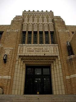 Taft Junior High School |
June 5, 2007 (#07000515) |
2901 NW. 23rd. St. 35°29′38″N 97°33′58″W |
Oklahoma City | |
| 143 | The "Y" Chapel of Song | 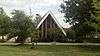 The "Y" Chapel of Song |
June 14, 2001 (#01000657) |
100 N. University; on the campus of the University of Central Oklahoma 35°39′19″N 97°28′23″W |
Edmond | |
| 144 | Threatt Filling Station | 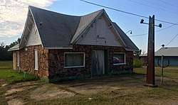 Threatt Filling Station |
February 23, 1995 (#95000038) |
Southwestern corner of the former U.S. Route 66 and Pottawatomi Rd. 35°39′59″N 97°08′28″W |
Luther | |
| 145 | Tiffany House |  Tiffany House |
June 13, 2016 (#16000375) |
5505 N. Brookline Ave. 35°31′34″N 97°34′05″W |
Oklahoma City | |
| 146 | Town House Hotel | 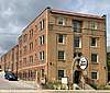 Town House Hotel |
December 10, 2014 (#14001031) |
627 Northwest 5th St. 35°28′24″N 97°31′27″W |
Oklahoma City | |
| 147 | Tradesman's National Bank Building | November 5, 1980 (#80003292) |
101 N. Broadway St. 35°28′04″N 97°30′52″W |
Oklahoma City | ||
| 148 | Trinity United Presbyterian Church | 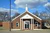 Trinity United Presbyterian Church |
September 20, 2019 (#100004401) |
2301 NE 23rd St. 35°29′35″N 97°28′14″W |
Oklahoma City | |
| 149 | Tuton's Drugstore | 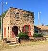 Tuton's Drugstore |
March 3, 1980 (#80003278) |
1st and Main Sts. 35°39′47″N 97°19′30″W |
Arcadia | |
| 150 | Union Depot | .jpg) Union Depot |
May 16, 1978 (#78002254) |
300 7th St., NW. 35°27′26″N 97°31′06″W |
Oklahoma City | |
| 151 | United Founders Life Tower | 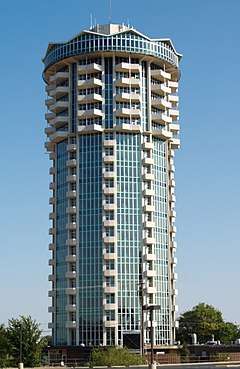 United Founders Life Tower |
March 13, 2013 (#13000076) |
5900 Mosteller Dr. 35°31′53″N 97°34′17″W |
Oklahoma City | |
| 152 | Walcourt Building | 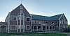 Walcourt Building |
March 19, 1982 (#82003694) |
1401 Walnut Ave., NE. 35°28′58″N 97°30′32″W |
Oklahoma City | |
| 153 | Weather Service Building | .jpg) Weather Service Building |
July 12, 1978 (#78002255) |
1923 Classen Boulevard 35°29′24″N 97°31′53″W |
Oklahoma City | |
| 154 | Wells Fargo and Company Livery Stable | 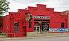 Wells Fargo and Company Livery Stable |
July 9, 1982 (#82003695) |
115 E. Reno Ave. 35°27′52″N 97°30′34″W |
Oklahoma City | |
| 155 | Wesley Hospital | 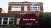 Wesley Hospital |
September 9, 2013 (#13000706) |
300 NW 12th St. 35°28′53″N 97°31′05″W |
Oklahoma City | |
| 156 | Will Rogers Park Gardens and Arboretum | 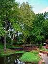 Will Rogers Park Gardens and Arboretum |
September 7, 2005 (#05001000) |
3400–3500 NW. 36th St. 35°30′30″N 97°34′46″W |
Oklahoma City |
Former listings
| [3] | Name on the Register | Image | Date listed | Date removed | Location | City or town | Summary |
|---|---|---|---|---|---|---|---|
| 1 | Montgomery Ward Building | March 13, 1980 (#80003287) | March 8, 2005 | Oklahoma City | |||
| 2 | Snyder's Super Service Station | March 26, 1980 (#80003291) | January 25, 2001 | 1325 N. Broadway Ave. |
Oklahoma City |
gollark: *he says, approximately 23 minutes after we stopped talking*
gollark: Suspicious, that.
gollark: No, HTech™ has mass 1.694915254kg.
gollark: Yep, 1.694.
gollark: Oh, wait, wrong question, you may be right.
See also
| Wikimedia Commons has media related to National Register of Historic Places in Oklahoma County, Oklahoma. |
References
- The latitude and longitude information provided in this table was derived originally from the National Register Information System, which has been found to be fairly accurate for about 99% of listings. Some locations in this table may have been corrected to current GPS standards.
- "National Register of Historic Places: Weekly List Actions". National Park Service, United States Department of the Interior. Retrieved on August 14, 2020.
- Numbers represent an ordering by significant words. Various colorings, defined here, differentiate National Historic Landmarks and historic districts from other NRHP buildings, structures, sites or objects.
- "National Register Information System". National Register of Historic Places. National Park Service. March 13, 2009.
- The eight-digit number below each date is the number assigned to each location in the National Register Information System database, which can be viewed by clicking the number.
- Lackmeyer, Steve (3 October 2012). "Downtown Oklahoma City's Braniff Building renovation continues under Sandridge". NewsOK. Retrieved 23 May 2014.
- Lackmeyer, Steve (August 13, 2019). "Moving forward: Community, neighborhood the goal of Page Woodson developer". The Oklahoman. Retrieved February 27, 2020.
- "Historic OKC elementary school converted into senior apartments". KOCO. October 7, 2019. Retrieved February 26, 2020.
- Hatfield, Judy. "Carnegie Centre: A storied past, an inspired vision, a loft lifestyle". Equity Realty. Retrieved 23 May 2014.
- Lackmeyer, Steve (20 October 2012). "Mayfair Building in Oklahoma City is added to National Register of Historic Places". NewsOK. Retrieved 22 May 2014.
- Phillips, Mary (June 18, 2018). "The Archivist: A Castle on Western". The Oklahoman. Retrieved February 25, 2020.
| Arcadia |
| |
|---|---|---|
| Edmond |
| |
| Jones |
| |
| Luther |
| |
| Midwest City |
| |
| Nichols Hills |
| |
| Nicoma Park |
| |
| Oklahoma City |
| |
| Spencer |
| |
| Topics | |
|---|---|
| Lists by state |
|
| Lists by insular areas | |
| Lists by associated state | |
| Other areas | |
| Related | |
| |
Municipalities and communities of Oklahoma County, Oklahoma, United States | ||
|---|---|---|
| Cities | Oklahoma County map | |
| Towns | ||
| Unincorporated communities | ||
| Footnotes | ‡This populated place also has portions in an adjacent county or counties | |
This article is issued from Wikipedia. The text is licensed under Creative Commons - Attribution - Sharealike. Additional terms may apply for the media files.