National Register of Historic Places listings in Huntington (town), New York
This list is intended to provide a comprehensive listing of entries on the National Register of Historic Places in the Town of Huntington, New York. The locations of National Register properties for which the latitude and longitude coordinates are included below, may be seen in a Google map.[1]
Listings
| [2] | Name on the Register | Image | Date listed[3] | Location | City or town | Description |
|---|---|---|---|---|---|---|
| 1 | Bay Crest Historic District | 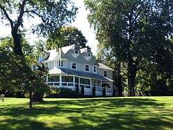 Bay Crest Historic District |
September 26, 1985 (#85002486) |
Beech Avenue, Valley Road, and Woodside and Valley Drives 40°54′02″N 73°25′04″W |
Huntington Bay | |
| 2 | M. Baylis House | September 26, 1985 (#85002487) |
530 Sweet Hollow Road 40°47′24″N 73°25′02″W |
Melville | ||
| 3 | Beaux Arts Park Historic District | 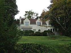 Beaux Arts Park Historic District |
September 26, 1985 (#85002489) |
Locust Lane, Upper & Lower Drives 40°54′02″N 73°24′31″W |
Huntington Bay | |
| 4 | Bethel AME Church and Manse | 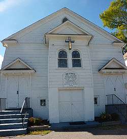 Bethel AME Church and Manse |
September 26, 1985 (#85002490) |
291 Park Avenue 40°52′41″N 73°25′07″W |
Huntington | |
| 5 | Bowes House | September 26, 1985 (#85002492) |
15 Harbor Hill Drive 40°54′02″N 73°25′28″W |
Huntington Bay | ||
| 6 | George McKesson Brown Estate-Coindre Hall | 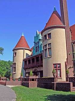 George McKesson Brown Estate-Coindre Hall |
September 26, 1985 (#85002493) |
Brown's Road 40°53′41″N 73°26′13″W |
Huntington | |
| 7 | Eliphas Buffett House |  Eliphas Buffett House |
September 26, 1985 (#85002495) |
159 West Rogues Path 40°50′16″N 73°26′38″W |
Cold Spring Harbor | |
| 8 | Joseph Buffett House |  Joseph Buffett House |
September 26, 1985 (#85002497) |
169 West Rogues Path 40°50′16″N 73°26′43″W |
Cold Spring Harbor | |
| 9 | John Bumpstead House | September 26, 1985 (#85002499) |
473 Woodbury Road 40°50′44″N 73°27′02″W |
Cold Spring Harbor | ||
| 10 | Carll S. Burr Mansion |  Carll S. Burr Mansion |
September 26, 1985 (#85002502) |
304 Burr Road 40°51′04″N 73°17′47″W |
Commack | A historic Second Empire mansion built in 1830 in Commack, New York by Carll S. Burr |
| 11 | Carll Burr, Jr., House |  Carll Burr, Jr., House |
September 26, 1985 (#85002503) |
293 Burr Road 40°51′04″N 73°18′06″W |
Commack | |
| 12 | Carll House |  Carll House |
September 26, 1985 (#85002505) |
380 Deer Park Road Coordinates missing |
Dix Hills | |
| 13 | Carll House |  Carll House |
September 26, 1985 (#85002504) |
79 Wall Street 40°52′26″N 73°25′40″W |
Huntington | |
| 14 | Ezra Carll Homestead |  Ezra Carll Homestead |
September 26, 1985 (#85002506) |
49 Melville Road 40°49′40″N 73°23′48″W |
South Huntington | |
| 15 | Marion Carll Farm |  Marion Carll Farm |
June 26, 1979 (#79001632) |
475 Commack Road 40°49′33″N 73°17′44″W |
Commack | |
| 16 | Chichester's Inn | Chichester's Inn |
September 26, 1985 (#85002508) |
97 Chichester Road 40°49′11″N 73°25′31″W |
West Hills | 17th-century inn frequented by Walt Whitman and Theodore Roosevelt at different times. A house today. |
| 17 | Cold Spring Harbor Beach Club | 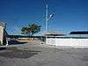 Cold Spring Harbor Beach Club |
December 12, 2012 (#12001037) |
101 Shore Rd. 40°52′34″N 73°28′10″W |
Cold Spring Harbor | Official site |
| 18 | Cold Spring Harbor Fire District Hook and Ladder Company Building | 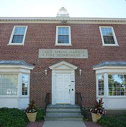 Cold Spring Harbor Fire District Hook and Ladder Company Building |
November 15, 2003 (#03001147) |
Main Street at Elm Place 40°52′10″N 73°27′39″W |
Cold Spring Harbor | |
| 19 | Cold Spring Harbor Library | _(2).jpg) Cold Spring Harbor Library |
September 26, 1985 (#85002509) |
1 Shore Road 40°52′20″N 73°27′40″W |
Cold Spring Harbor | |
| 20 | Coltrane House | 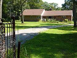 Coltrane House |
June 29, 2007 (#07000628) |
247 Candlewood Path 40°47′59″N 73°19′27″W |
Dix Hills | |
| 21 | Commack Methodist Church and Cemetery | 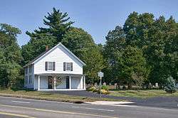 Commack Methodist Church and Cemetery |
September 26, 1985 (#85002511) |
486 Townline Road 40°50′41″N 73°17′36″W |
Commack | |
| 22 | David Conklin House |  David Conklin House |
September 26, 1985 (#85002513) |
2 High Street 40°51′55″N 73°25′26″W |
Huntington | |
| 23 | The Crest | October 3, 2007 (#85003645) |
563 Asharoken Avenue 40°56′22″N 73°23′09″W |
Asharoken | ||
| 24 | Charles Homer Davis House |  Charles Homer Davis House |
February 22, 2006 (#06000057) |
381 West Neck Road 40°53′37″N 73°27′18″W |
Lloyd Harbor | |
| 25 | Delamater-Bevin Mansion |  Delamater-Bevin Mansion |
September 26, 1985 (#85002514) |
Bevin Lane 40°56′05″N 73°22′43″W |
Asharoken | |
| 26 | Harry E. Donnell House |  Harry E. Donnell House |
September 26, 1985 (#85002516) |
71 Locust Lane 40°56′02″N 73°23′21″W |
Eatons Neck | |
| 27 | Arthur Dove-Helen Torr Cottage | 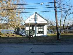 Arthur Dove-Helen Torr Cottage |
January 28, 2000 (#99001682) |
30 Centershore Road 40°53′16″N 73°22′21″W |
Centerport | |
| 28 | Dowden Tannery | 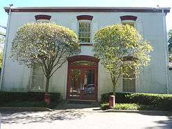 Dowden Tannery |
September 26, 1985 (#85002519) |
210 West Rogues Path 40°50′16″N 73°26′58″W |
Cold Spring Harbor | |
| 29 | East Shore Road Historic District | 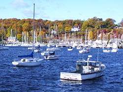 East Shore Road Historic District |
September 26, 1985 (#85002521) |
East Shore Road 40°53′27″N 73°25′00″W |
Halesite | |
| 30 | Eatons Neck Light | 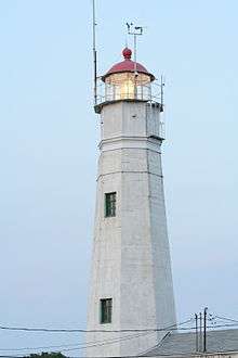 Eatons Neck Light |
April 3, 1973 (#73001273) |
Eatons Neck Point at Huntington Bay and Long Island Sound off Lighthouse Road 40°57′15″N 73°23′48″W |
Asharoken | |
| 31 | John Everit House |  John Everit House |
September 26, 1985 (#85002522) |
130 Old Country Road 40°47′33″N 73°25′18″W |
West Hills | |
| 32 | N. J. Felix House |  N. J. Felix House |
September 26, 1985 (#85002523) |
235 Asharoken Avenue 40°55′41″N 73°21′47″W |
Asharoken | |
| 33 | Marshall Field, III, Estate |  Marshall Field, III, Estate |
April 30, 1979 (#79001633) |
Lloyd Harbor Road 40°55′39″N 73°28′18″W |
Lloyd Harbor | |
| 34 | Fort Golgotha and the Old Burial Hill Cemetery |  Fort Golgotha and the Old Burial Hill Cemetery |
March 2, 1981 (#81000415) |
Main Street and Nassau Road 40°52′17″N 73°25′26″W |
Huntington | |
| 35 | Fort Hill Estate |  Fort Hill Estate |
June 2, 1988 (#88000599) |
Fort Hill Drive 40°55′04″N 73°29′19″W |
Lloyd Harbor | |
| 36 | Charles Geoghegan House | September 26, 1985 (#85002524) |
9 Harbor Hill Drive 40°54′07″N 73°25′23″W |
Huntington Bay | ||
| 37 | Gilsey Mansion |  Gilsey Mansion |
September 26, 1985 (#85002525) |
36 Browns Road 40°53′39″N 73°26′07″W |
Huntington | |
| 38 | Goose Hill Road Historic District | September 26, 1985 (#85002528) |
Goose Hill Road 40°52′40″N 73°27′06″W |
Cold Spring Harbor | ||
| 39 | John Green House | September 26, 1985 (#85002526) |
167 East Shore Road 40°53′54″N 73°25′33″W |
Huntington Bay | ||
| 40 | Halsey Estate-Tallwood | September 26, 1985 (#85002527) |
Sweet Hollow Road 40°49′32″N 73°25′53″W |
West Hills | ||
| 41 | Harbor Road Historic District |  Harbor Road Historic District |
September 26, 1985 (#85002529) |
Harbor Road 40°51′34″N 73°27′43″W |
Cold Spring Harbor | |
| 42 | John Harned House | September 26, 1985 (#85002530) |
26 Little Neck Road 40°53′16″N 73°21′55″W |
Centerport | ||
| 43 | Wallace K. Harrison Estate | September 26, 1985 (#85002531) |
140 Round Swamp Road 40°48′28″N 73°26′30″W |
West Hills | ||
| 44 | Heckscher Park |  Heckscher Park |
September 26, 1985 (#85002532) |
Bounded by Madison Street, Sabbath Day Path, Main Street & Prime Avenue 40°52′29″N 73°25′15″W |
Huntington | |
| 45 | Hewlett House | September 26, 1985 (#85002533) |
559 Woodbury Road 40°50′13″N 73°27′12″W |
Cold Spring Harbor | ||
| 46 | House at 200 Bay Avenue | September 26, 1985 (#85002535) |
200 Bay Avenue 40°54′00″N 73°25′11″W |
Huntington Bay | ||
| 47 | House at 244 Park Avenue | September 26, 1985 (#85002534) |
244 Park Avenue 40°52′47″N 73°25′05″W |
Huntington | ||
| 48 | Ireland-Gardiner Farm | September 26, 1985 (#85002537) |
863 Lake Road 40°51′46″N 73°22′56″W |
Greenlawn | ||
| 49 | Jarvis-Fleet House |  Jarvis-Fleet House |
September 26, 1985 (#85002538) |
138 Cove Road 40°53′58″N 73°23′31″W |
Huntington | |
| 50 | John P. Kane Mansion |  John P. Kane Mansion |
September 26, 1985 (#85002580) |
37 Kanes Lane 40°53′54″N 73°25′15″W |
Huntington Bay | |
| 51 | Karpen House | July 26, 2006 (#06000643) |
3 Harbor Hill Drive 40°53′46″N 73°27′17″W |
Lloyd Harbor | ||
| 52 | A. P. W. Kennan House |  A. P. W. Kennan House |
November 6, 1985 (#85003502) |
Sydney Road 40°54′10″N 73°24′40″W |
Huntington Bay | |
| 53 | B. Ketchum House |  B. Ketchum House |
September 26, 1985 (#85002581) |
237 Middleville Road 40°53′57″N 73°17′51″W |
Fort Salonga | |
| 54 | LITTLE JENNIE (Chesapeake Bay bugeye) | May 12, 1986 (#86001081) |
Centerport Harbor 40°53′36″N 73°22′28″W |
Centerport | ||
| 55 | Lloyd Harbor Lighthouse | 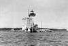 Lloyd Harbor Lighthouse |
May 31, 1989 (#89000501) |
Entrance to Lloyd Harbor 40°54′39″N 73°25′54″W |
Lloyd Harbor | |
| 56 | Joseph Lloyd House | 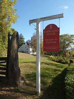 Joseph Lloyd House |
November 7, 1976 (#76001278) |
Northwest of Huntington on Lloyd Harbor Road 40°54′51″N 73°28′42″W |
Lloyd Harbor | |
| 57 | Long Island National Cemetery | 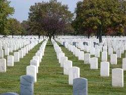 Long Island National Cemetery |
March 22, 2016 (#16000113) |
2040 Wellwood Ave. 40°45′27″N 73°23′48″W |
Melville | Veterans' cemetery shared with town of Babylon to south built in 1930s to handle overflow from Cypress Hills soon expanded to take in 10,000 World War II veterans and POWs. |
| 58 | Isaac Losee House | 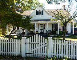 Isaac Losee House |
September 26, 1985 (#85002582) |
269 Park Avenue 40°52′44″N 73°25′07″W |
Huntington | |
| 59 | Stanley H. Lowndes House | May 20, 2019 (#100003935) |
155 Bayview Avenue 40°54′18″N 73°21′17″W |
Northport | 1895 Queen Anne harborfront mansion built by local oyster magnate | |
| 60 | Main Street Historic District | 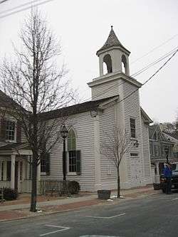 Main Street Historic District |
September 26, 1985 (#85002583) |
Main Street 40°52′18″N 73°27′21″W |
Cold Spring Harbor | |
| 61 | Northport Public Library |  Northport Public Library |
December 6, 1996 (#96001429) |
215 Main Street 40°54′05″N 73°20′38″W |
Northport | |
| 62 | Northport Veterans Administration Hospital Historic District |  Northport Veterans Administration Hospital Historic District |
May 24, 2012 (#12000312) |
79 Middleville Rd. 40°53′52″N 73°18′48″W |
East Northport | part of the United States Second Generation Veterans Hospitals Multiple Property Submission |
| 63 | C. A. O'Donohue House | September 26, 1985 (#85002584) |
158 Shore Road 40°53′59″N 73°25′26″W |
Huntington Bay | ||
| 64 | John Oakley House | November 6, 1985 (#85003501) |
Sweet Hollow Road 40°49′14″N 73°25′31″W |
West Hills | ||
| 65 | Oheka |  Oheka |
September 15, 2004 (#04000996) |
135 West Gate Drive 40°49′40″N 73°26′55″W |
Cold Springs Hills | |
| 66 | Old First Church |  Old First Church |
November 6, 1985 (#85003500) |
126 Main Street 40°52′28″N 73°25′11″W |
Huntington | |
| 67 | Old Town Green Historic District |  Old Town Green Historic District |
September 26, 1985 (#85002586) |
Park Avenue 40°52′29″N 73°24′52″W |
Huntington | |
| 68 | Old Town Hall Historic District |  Old Town Hall Historic District |
September 26, 1985 (#85002588) |
Main Street & Nassau Road 40°52′17″N 73°25′26″W |
Huntington | |
| 69 | Potter-Williams House |  Potter-Williams House |
September 26, 1985 (#85002579) |
165 Wall Street 40°52′35″N 73°25′33″W |
Huntington | |
| 70 | Prime House |  Prime House |
September 26, 1985 (#85002568) |
35 Prime Avenue 40°52′26″N 73°25′23″W |
Huntington | |
| 71 | Prime-Octagon House | 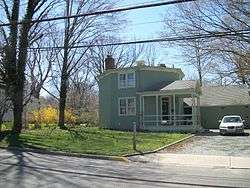 Prime-Octagon House |
September 26, 1985 (#85002569) |
41 Prime Avenue 40°52′28″N 73°25′23″W |
Huntington | |
| 72 | Michael Remp House | 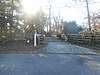 Michael Remp House |
September 26, 1985 (#85002570) |
42 Godfrey Lane 40°50′48″N 73°21′15″W |
Greenlawn | |
| 73 | Rogers House | 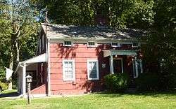 Rogers House |
September 26, 1985 (#85002571) |
136 Spring Road 40°51′57″N 73°24′56″W |
Huntington | |
| 74 | John Rogers House | 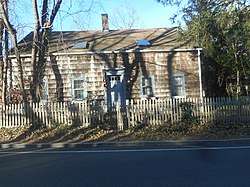 John Rogers House |
September 26, 1985 (#85002572) |
627 Half Hollow Road 40°47′18″N 73°20′50″W |
Dix Hills | |
| 75 | Silas Sammis House |  Silas Sammis House |
September 26, 1985 (#85002573) |
302 West Neck Road 40°53′09″N 73°26′23″W |
Huntington | |
| 76 | Seaman Farm | September 26, 1985 (#85002575) |
1378 Carlls Straight Path 40°48′37″N 73°19′11″W |
Dix Hills | Demolished in 1995[4] | |
| 77 | Shore Road Historic District |  Shore Road Historic District |
September 26, 1985 (#85002578) |
Shore Road 40°52′22″N 73°27′45″W |
Cold Spring Harbor | |
| 78 | Daniel Smith House |  Daniel Smith House |
September 26, 1985 (#85002576) |
117 West Shore Road 40°53′13″N 73°25′31″W |
Huntington | |
| 79 | Henry Smith Farmstead |  Henry Smith Farmstead |
September 26, 1985 (#85002539) |
900 Park Avenue 40°51′03″N 73°22′48″W |
Huntington Station | Also known as the John Gardiner Farm |
| 80 | Jacob Smith House |  Jacob Smith House |
September 26, 1985 (#85002540) |
High Hold Drive 40°48′46″N 73°26′16″W |
West Hills | |
| 81 | Suydam House |  Suydam House |
October 27, 1988 (#88002135) |
1 Fort Salonga Road 40°53′09″N 73°22′01″W |
Centerport | |
| 82 | Sweet Hollow Presbyterian Church Parsonage | September 26, 1985 (#85002541) |
152 Old Country Road 40°47′33″N 73°25′05″W |
Melville | ||
| 83 | Titus-Bunce House | 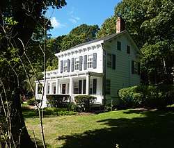 Titus-Bunce House |
September 26, 1985 (#85002542) |
7 Goose Hill Road 40°52′27″N 73°27′06″W |
Cold Spring Harbor | |
| 84 | Henry Townsend House | 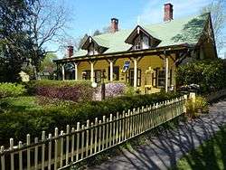 Henry Townsend House |
September 26, 1985 (#85002543) |
231 West Neck Road 40°55′33″N 73°26′12″W |
Huntington | |
| 85 | US Post Office-Northport | 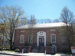 US Post Office-Northport |
May 11, 1989 (#88002356) |
244 Main Street 40°54′02″N 73°20′52″W |
Northport | |
| 86 | Charles Van Iderstine Mansion | September 26, 1985 (#85002544) |
Idle Day Drive 40°54′13″N 73°21′48″W |
Centerport | ||
| 87 | Van Wyck-Lefferts Tide Mill | Van Wyck-Lefferts Tide Mill |
December 27, 1978 (#78001916) |
2 miles (3.2 km) northeast of Mill and Southdown Roads 40°53′59″N 73°26′42″W |
Lloyd Harbor | |
| 88 | William K. Vanderbilt Estate-Eagles Nest | 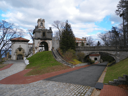 William K. Vanderbilt Estate-Eagles Nest |
September 26, 1985 (#85002545) |
Little Neck Road 40°54′18″N 73°22′04″W |
Centerport | |
| 89 | N. Velzer House and Caretaker's Cottage | N. Velzer House and Caretaker's Cottage |
September 26, 1985 (#85002546) |
22 Fort Salonga Road 40°53′10″N 73°21′47″W |
Centerport | |
| 90 | Charles M. Weeks House |  Charles M. Weeks House |
September 26, 1985 (#85002547) |
76 Mill Lane 40°52′45″N 73°25′10″W |
Huntington | |
| 91 | West Neck Road Historic District |  West Neck Road Historic District |
September 26, 1985 (#85002567) |
West Neck Road 40°52′22″N 73°25′58″W |
Huntington | |
| 92 | Joseph Whitman House | September 26, 1985 (#85002548) |
365 West Hills Road 40°49′14″N 73°25′19″W |
West Hills | ||
| 93 | Walt Whitman House |  Walt Whitman House |
September 26, 1985 (#85002549) |
246 Old Walt Whitman Road 40°49′01″N 73°24′44″W |
West Hills | |
| 94 | Whitman-Place House | September 26, 1985 (#85002550) |
69 Chichester Road 40°49′11″N 73°25′08″W |
West Hills | ||
| 95 | Wiggins-Rolph House | September 26, 1985 (#85002551) |
518 Park Avenue 40°52′18″N 73°24′37″W |
Huntington | ||
| 96 | Henry Williams House |  Henry Williams House |
September 26, 1985 (#85002552) |
43 Mill Lane 40°52′44″N 73°25′22″W |
Halesite | |
| 97 | Harry Wood House |  Harry Wood House |
September 26, 1985 (#85002553) |
481 West Main Street 40°52′28″N 73°26′27″W |
Huntington | |
| 98 | John Wood House | September 26, 1985 (#85002554) |
121 McKay Road 40°51′10″N 73°25′29″W |
Huntington Station | ||
| 99 | William Wooden Wood House | September 26, 1985 (#85002555) |
90 Preston Street 40°53′20″N 73°25′34″W |
Huntington | ||
| 100 | Charles Woodhull House | .JPG) Charles Woodhull House |
September 26, 1985 (#85002564) |
70 Main Street 40°52′28″N 73°25′05″W |
Huntington |
gollark: I would also tell you a Jua joke, but it might randomly drop the event.
gollark: I would tell you a UDP joke, but I don't know if you would get it.
gollark: But I meant actual Haskell. Just communicate with the server over UDP.
gollark: Or frege.
gollark: That fixes all bugs.
See also
| Wikimedia Commons has media related to National Register of Historic Places in Suffolk County, New York. |
References
- The latitude and longitude information provided is primarily from the National Register Information System, and has been found to be fairly accurate for about 99% of listings. For 1%, the location info may be way off. We seek to correct the coordinate information wherever it is found to be erroneous. Please leave a note in the Discussion page for this article if you believe any specific location is incorrect.
- Numbers represent an ordering by significant words. Various colorings, defined here, differentiate National Historic Landmarks and historic districts from other NRHP buildings, structures, sites or objects.
- The eight-digit number below each date is the number assigned to each location in the National Register Information System database, which can be viewed by clicking the number.
- http://patch.com/new-york/halfhollowhills/history-lost-1378-carlls-straight-path
External links
- NRHP applications for New York State sites (Note, interface works best with Microsoft Internet Explorer browser; hit "Results" after searching, to actually see the results).
| Topics |  | |
|---|---|---|
| Lists by county |
| |
| Lists by city | ||
| Other lists | ||
| ||
This article is issued from Wikipedia. The text is licensed under Creative Commons - Attribution - Sharealike. Additional terms may apply for the media files.