National Register of Historic Places listings in Davis County, Iowa
This is a list of the National Register of Historic Places listings in Davis County, Iowa.
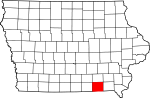
Location of Davis County in Iowa
This is intended to be a complete list of the properties and districts on the National Register of Historic Places in Davis County, Iowa, United States. Latitude and longitude coordinates are provided for many National Register properties and districts; these locations may be seen together in a map.[1]
There are 12 properties and districts listed on the National Register in the county, including one National Historic Landmark.
- This National Park Service list is complete through NPS recent listings posted August 14, 2020.[2]
| [3] | Name on the Register[4] | Image | Date listed[5] | Location | City or town | Description |
|---|---|---|---|---|---|---|
| 1 | Bloomfield Public Library | 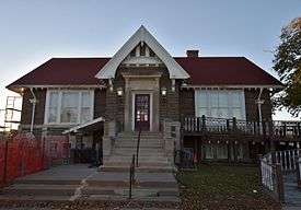 Bloomfield Public Library |
October 13, 2015 (#15000721) |
107 N. Columbia 40°45′09″N 92°24′59″W |
Bloomfield | |
| 2 | Bloomfield Square | 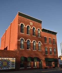 Bloomfield Square |
November 7, 1976 (#76000756) |
Madison, Jefferson, Franklin, and Washington Sts. 40°45′05″N 92°24′52″W |
Bloomfield | |
| 3 | Davis County Courthouse | 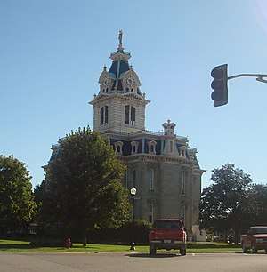 Davis County Courthouse |
May 3, 1974 (#74000779) |
Bloomfield Town Sq. 40°45′10″N 92°25′01″W |
Bloomfield | |
| 4 | William Findley House | 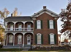 William Findley House |
June 9, 1978 (#78001213) |
302 E. Franklin St. 40°45′01″N 92°24′43″W |
Bloomfield | |
| 5 | "Lockkeeper's" House | October 14, 2009 (#09000826) |
Whitefish Trail 40°53′35″N 92°12′26″W |
Eldon | ||
| 6 | Stringtown House | April 16, 1974 (#74000780) |
East of Centerville on Iowa Highway 2 40°45′34″N 92°24′10″W |
Centerville | ||
| 7 | Trimble-Parker Historic Farmstead District | March 21, 2003 (#03000125) |
23981 240th St. 40°43′01″N 92°22′12″W |
Bloomfield | ||
| 8 | Troy Academy | 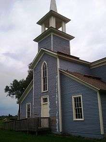 Troy Academy |
June 23, 1976 (#76000758) |
Off Iowa Highway 2 40°44′47″N 92°12′03″W |
Troy | |
| 9 | James B. Weaver House | 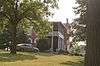 James B. Weaver House |
May 15, 1975 (#75000680) |
Weaver Park Rd. (U.S. Route 63) 40°45′18″N 92°24′44″W |
Bloomfield | |
| 10 | West Grove United Methodist Church | 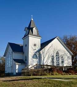 West Grove United Methodist Church |
May 26, 2004 (#04000514) |
21944 Echo Ave., 40°43′32″N 92°33′23″W |
West Grove | |
| 11 | Asa Wilson House | 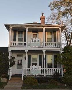 Asa Wilson House |
December 10, 1982 (#82000404) |
207 S. Washington 40°45′00″N 92°24′46″W |
Bloomfield | |
| 12 | Henry Wishard House | 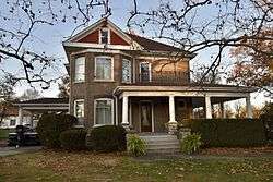 Henry Wishard House |
December 15, 2004 (#04001350) |
406 W. Jefferson St. 40°45′05″N 92°25′11″W |
Bloomfield |
Former listings
| [3] | Name on the Register | Image | Date listed | Date removed | Location | City or town | Summary |
|---|---|---|---|---|---|---|---|
| 1 | Clay Avenue Bridge | June 25, 1998 (#98000795) | May 8, 2002 | Clay Ave. and 118th St. over intermittent stream |
Drakesville vicinity | ||
| 2 | Russell Octagon House | 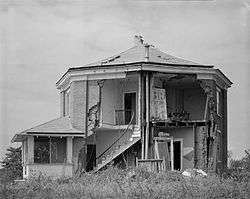 Russell Octagon House |
October 8, 1976 (#76000757) | June 11, 1998 | SW of Bloomfield off U.S. 63 |
Bloomfield vicinity | |
| 3 | Tarrence Round Barn | June 30, 1986 (#86001424) | May 22, 1998 | Off IA 2 |
Bloomfield vicinity |
gollark: --magic reload_ext irc_link
gollark: I forgot where this test instance of the bot was operating.
gollark: Hmm.
gollark: And without Horse WHO will rotate our icon?
gollark: We don't have R.Danny, see.
See also
| Wikimedia Commons has media related to National Register of Historic Places in Davis County, Iowa. |
References
- The latitude and longitude information provided in this table was derived originally from the National Register Information System, which has been found to be fairly accurate for about 99% of listings. Some locations in this table may have been corrected to current GPS standards.
- "National Register of Historic Places: Weekly List Actions". National Park Service, United States Department of the Interior. Retrieved on August 14, 2020.
- Numbers represent an ordering by significant words. Various colorings, defined here, differentiate National Historic Landmarks and historic districts from other NRHP buildings, structures, sites or objects.
- "National Register Information System". National Register of Historic Places. National Park Service. April 24, 2008.
- The eight-digit number below each date is the number assigned to each location in the National Register Information System database, which can be viewed by clicking the number.
| Topics | |
|---|---|
| Lists by state |
|
| Lists by insular areas | |
| Lists by associated state | |
| Other areas | |
| Related | |
| |

Municipalities and communities of Davis County, Iowa, United States | ||
|---|---|---|
| Cities | Map of Iowa highlighting Davis County | |
| Townships | ||
| Unincorporated communities | ||
This article is issued from Wikipedia. The text is licensed under Creative Commons - Attribution - Sharealike. Additional terms may apply for the media files.