National Highway 11A (India, old numbering)
National Highway 11A (NH 11A) is an Indian National Highway entirely within the state of Rajasthan. NH 11A connects Manoharpur with Kothum and is 145 km (90 mi) long. [1]
| ||||
|---|---|---|---|---|
| Route information | ||||
| Length | 145 km (90 mi) | |||
| Major junctions | ||||
| North end | Manoharpur | |||
| South end | Kothum | |||
| Location | ||||
| States | Rajasthan: 145 km (90 mi) | |||
| Primary destinations | Dausa - Lalsot | |||
| Highway system | ||||
| ||||

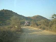
Route
gollark: Sixth at best, really, even if we only include Ampere.
gollark: Generally midrange, but you basically cannot get GPUs right now.
gollark: Obviously all spare computers should go to me, as my server is somewhat outdated nowadays.
gollark: Area 52 is of course what you really have to worry about.
gollark: Besides, it isn't the REAL SCP Foundation if everyone knows about it.
References
- "Archived copy". Archived from the original on 10 April 2009. Retrieved 20 July 2011.CS1 maint: archived copy as title (link) Start and end points of National Highways
External links
- NH 11A on OpenStreetMap
- NH network map of India

This article is issued from Wikipedia. The text is licensed under Creative Commons - Attribution - Sharealike. Additional terms may apply for the media files.