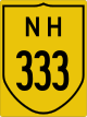
National Highway 33 (India)
National Highway 33 (NH 33) is a National Highway in India. It runs from Arwal to Farakka. It is a very important highway linking Bihar and West Bengal .
| ||||
|---|---|---|---|---|
| Route information | ||||
| Length | 443 km (275 mi) | |||
| Major junctions | ||||
| From | Arwal | |||
| To | Farrakka | |||
| Location | ||||
| States | Bihar, Jharkhand, West Bengal | |||
| Primary destinations | Jehanabad, Bandhuganj, Ekangarsarai, Biharsharif, Mokama, Lakhisarai, Munger, Bhagalpur, Kahalgaon, Sahibganj, Rajmahal, Barharwa | |||
| Highway system | ||||
| ||||
Route
Bihar
Arwal, Jehanabad, Bandhuganj, Biharsharif, Mokama, Lakhisarai, Safiabad(Munger), Sultanagnj, Bhagalpur, Kahalgaon, Jharkhand Border.
Jharkhand
Bihar Border, Sahibganj, Rajmahal, Barharwa, West Bengal Border.
Junction


gollark: ~~you can't read this secret text~~
gollark: If each only has to report a bit of information about their dragon, you'll get loads of data about what you're studying.
gollark: The best way would probably be just to do massive studies with participation from a bunch of people.
gollark: See? Vague but slightly useful.
gollark: "Reverse engineering includes but is not limited to:- accessing the site's code to figure out how a thing works- blahblah"
References
- "Rationalisation of Numbering Systems of National Highways" (PDF). New Delhi: Department of Road Transport and Highways. Archived from the original (PDF) on 1 February 2016. Retrieved 3 April 2012.
- "State-wise length of National Highways in India as on 30.06.2017" (PDF). National Highways Authority of India. Archived from the original (PDF) on 3 November 2018. Retrieved 13 November 2018.
External links
Secondary routes of National Highway 33 | ||
|---|---|---|
 | ||
| Secondary Routes of NH 33 | ||
This article is issued from Wikipedia. The text is licensed under Creative Commons - Attribution - Sharealike. Additional terms may apply for the media files.