Murray, Indiana
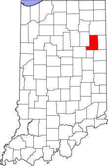
Murray is an unincorporated community in Lancaster Township, Wells County, in the U.S. state of Indiana.[3]
Murray, Indiana | |
|---|---|
 Wells County's location in Indiana | |
 Murray Location of Murray in Wells County | |
| Coordinates: 40°47′31″N 85°12′03″W | |
| Country | United States |
| State | Indiana |
| County | Wells |
| Township | Lancaster |
| Elevation | 807 ft (246 m) |
| Time zone | UTC-5 (Eastern (EST)) |
| • Summer (DST) | UTC-4 (EDT) |
| ZIP code | 46714 |
| Area code(s) | 260 |
| FIPS code | 18-51966[2] |
| GNIS feature ID | 439894 |
History
An old variant name of the community was called New Lancaster.[4] A post office was established at Murray in 1837, and remained in operation until 1902.[5]
On February 29, 1996, Murray was inadvertently strafed by a military aircraft, though no injuries resulted.
Geography
Murray is located at 40°47′31″N 85°12′03″W, on State Highway 116.
gollark: Idea: CommonMark-compliant Markdown renderer as next code guessing competition.
gollark: Markdown parsing definitely is. Please use an existing Markdown library.
gollark: * osmarksßsoftware™
gollark: https://github.com/osmarks/website/blob/master/src/index.js
gollark: It has its own built-in dependency resolver system to order everything right!
References
- "US Board on Geographic Names". United States Geological Survey. October 25, 2007. Retrieved 2016-07-07.
- "U.S. Census website". United States Census Bureau. Retrieved 2008-01-31.
- "Murray, Indiana". Geographic Names Information System. United States Geological Survey. Retrieved July 24, 2017.
- "USGS detail on Murray - Variant Citation". Retrieved 2017-05-10.
- "Wells County". Jim Forte Postal History. Retrieved July 7, 2016.
This article is issued from Wikipedia. The text is licensed under Creative Commons - Attribution - Sharealike. Additional terms may apply for the media files.