Mount Wilson, Nevada
Mount Wilson is a census-designated place in Lincoln County, Nevada, United States. As of the 2010 census it had a population of 33.[1]
Mount Wilson, Nevada | |
|---|---|
 Mount Wilson Location within the state of Nevada | |
| Coordinates: 38°15′17″N 114°26′41″W | |
| Country | United States |
| State | Nevada |
| County | Lincoln |
| Area | |
| • Total | 4.6 sq mi (11.9 km2) |
| • Land | 4.6 sq mi (11.9 km2) |
| • Water | 0 sq mi (0 km2) |
| Elevation | 6,746 ft (2,056 m) |
| Population (2010) | |
| • Total | 33 |
| • Density | 7.2/sq mi (2.8/km2) |
| Time zone | UTC-8 (Pacific (PST)) |
| • Summer (DST) | UTC-7 (PDT) |
| FIPS code | 32-49425 |
Geography
The CDP takes its name from Mount Wilson, a 9,315-foot (2,839 m) summit that rises to the east of the community and is part of the Wilson Creek Range. The CDP is located on Mount Wilson Road, 8 miles (13 km) east of U.S. Route 93, along which it is 23 miles (37 km) south to Pioche and 84 miles (135 km) north to Ely.
According to the U.S. Census Bureau, the Mount Wilson CDP has an area of 4.6 square miles (11.9 km2), all of it land.[1]
gollark: There is a difference between "body" and even "human body" and "person".
gollark: It's historically important, at least.
gollark: I mean, it doesn't seem very well-written, or hugely coherent.
gollark: Is it actually that good as fiction goes though?
gollark: I assume they'll just extend the dam thing into a giant Netherlands-covering dome.
References
- "Geographic Identifiers: 2010 Demographic Profile Data (G001): Mount Wilson CDP, Nevada". U.S. Census Bureau, American Factfinder. Archived from the original on February 12, 2020. Retrieved January 25, 2013.
Municipalities and communities of Lincoln County, Nevada, United States | ||
|---|---|---|
| City | 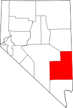 Lincoln County map | |
| CDPs | ||
| Other unincorporated communities | ||
| Ghost towns | ||
| Proposed communities | ||
| Footnotes | ‡This populated place also has portions in an adjacent county or counties | |
This article is issued from Wikipedia. The text is licensed under Creative Commons - Attribution - Sharealike. Additional terms may apply for the media files.