Mosa Rural LLG
Mosa Rural LLG is a local-level government (LLG) of West New Britain Province, Papua New Guinea.[1][2]
Mosa Rural LLG | |
|---|---|
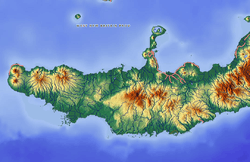 Mosa Rural LLG Location within Papua New Guinea | |
| Coordinates: 5.626408°S 150.237622°E | |
| Country | Papua New Guinea |
| Province | West New Britain Province |
| Time zone | UTC+10 (AEST) |
Wards
- 01. Gamapili
- 02. Bugal
- 03. Kavui
- 04. Gaopore
- 05. Laheri
- 06. Bebere
- 07. Tamba
- 08. Sarakolok
- 86. Mosa Urban
gollark: Of course it needs multiple Jeff Bezoi. I really don't see why anyone would be against the idea.
gollark: I'd like to just entirely drop os.loadAPI in potatOS, since it makes for a ton of flaky potatoBIOS code, but I think shell would break.
gollark: Or go to great lengths to virtualize environments/FSes exactly as programs want them using YAFSS or something.
gollark: You probably have to be able to make people adapt their programs a *bit*.
gollark: What if you just virtualize the filesystem for every single program?
References
- "Census Figures by Wards - Islands Region". www.nso.gov.pg. 2011 National Population and Housing Census: Ward Population Profile. Port Moresby: National Statistical Office, Papua New Guinea. 2014.
- "Final Figures". www.nso.gov.pg. 2011 National Population and Housing Census: Ward Population Profile. Port Moresby: National Statistical Office, Papua New Guinea. 2014.
- OCHA FISS (2018). "Papua New Guinea administrative level 0, 1, 2, and 3 population statistics and gazetteer". Humanitarian Data Exchange. 1.31.9.
- United Nations in Papua New Guinea (2018). "Papua New Guinea Village Coordinates Lookup". Humanitarian Data Exchange. 1.31.9.
This article is issued from Wikipedia. The text is licensed under Creative Commons - Attribution - Sharealike. Additional terms may apply for the media files.