Kandrian Coastal Rural LLG
Kandrian Coastal Rural LLG is a local-level government (LLG) of West New Britain Province, Papua New Guinea.[1][2]
Kandrian Coastal Rural LLG | |
|---|---|
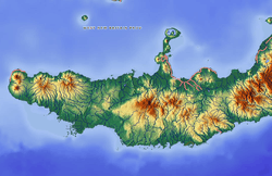 Kandrian Coastal Rural LLG Location within Papua New Guinea | |
| Coordinates: 6.20531°S 149.552°E | |
| Country | Papua New Guinea |
| Province | West New Britain Province |
| Time zone | UTC+10 (AEST) |
Wards
- 01. Amnge
- 02. Apalik
- 03. Aeglep
- 04. Kandrian
- 05. Kaul
- 06. Loko Nambis
- 07. Ioudo
- 08. Vinum
- 09. Pilolo
- 10. Agulo
- 11. Ivangnga
- 12. Naplavui
- 81. Kandrian Urban
gollark: Well, the matrix way lets you get fib(n) in O(log n) time, thus good.
gollark: It has 128-bit decimal floats with each component as quaternary posits, grouped into pairs to form complex numbers in all circumstances.
gollark: https://discord.com/channels/346530916832903169/348702212110680064/863472225063272448
gollark: Macron does not have integers.
gollark: Use of `lea` or something.
References
- "Census Figures by Wards - Islands Region". www.nso.gov.pg. 2011 National Population and Housing Census: Ward Population Profile. Port Moresby: National Statistical Office, Papua New Guinea. 2014.
- "Final Figures". www.nso.gov.pg. 2011 National Population and Housing Census: Ward Population Profile. Port Moresby: National Statistical Office, Papua New Guinea. 2014.
- OCHA FISS (2018). "Papua New Guinea administrative level 0, 1, 2, and 3 population statistics and gazetteer". Humanitarian Data Exchange. 1.31.9.
- United Nations in Papua New Guinea (2018). "Papua New Guinea Village Coordinates Lookup". Humanitarian Data Exchange. 1.31.9.
This article is issued from Wikipedia. The text is licensed under Creative Commons - Attribution - Sharealike. Additional terms may apply for the media files.