Gasmata Rural LLG
Gasmata Rural LLG is a local-level government (LLG) of West New Britain Province, Papua New Guinea.[1][2]
Gasmata Rural LLG | |
|---|---|
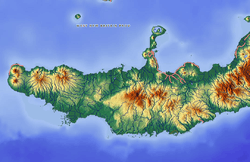 Gasmata Rural LLG Location within Papua New Guinea | |
| Coordinates: 6.27378°S 150.331°E | |
| Country | Papua New Guinea |
| Province | West New Britain Province |
| Time zone | UTC+10 (AEST) |
Wards
- 01. Amio
- 02. Poronga
- 03. Tesopol
- 04. Akolet
- 05. Aigon
- 06. Kasuilo
- 07. Asirim
gollark: e
gollark: Some of my code's in the Arctic, but I think only my CC contributions.
gollark: It is kind of annoying that they made their own protocol and constantly fiddle with it despite the myriad of standards for this stuff.
gollark: Minecraft rewrite in Rust WHEN?
gollark: The protocol is surprisingly well-documented (unofficially) at this point.
See also
References
- "Census Figures by Wards - Islands Region". www.nso.gov.pg. 2011 National Population and Housing Census: Ward Population Profile. Port Moresby: National Statistical Office, Papua New Guinea. 2014.
- "Final Figures". www.nso.gov.pg. 2011 National Population and Housing Census: Ward Population Profile. Port Moresby: National Statistical Office, Papua New Guinea. 2014.
- OCHA FISS (2018). "Papua New Guinea administrative level 0, 1, 2, and 3 population statistics and gazetteer". Humanitarian Data Exchange. 1.31.9.
- United Nations in Papua New Guinea (2018). "Papua New Guinea Village Coordinates Lookup". Humanitarian Data Exchange. 1.31.9.
This article is issued from Wikipedia. The text is licensed under Creative Commons - Attribution - Sharealike. Additional terms may apply for the media files.