Morris Township, Grundy County, Illinois
Morris Township is one of seventeen townships in Grundy County, Illinois, USA. As of the 2010 United States Census, its population was 7,110 and it contained 3,299 housing units.[2]
Morris Township | |
|---|---|
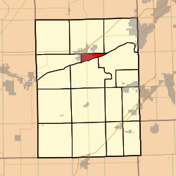 Location in Grundy County | |
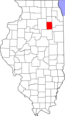 Grundy County's location in Illinois | |
| Coordinates: 41°21′52″N 88°24′26″W | |
| Country | United States |
| State | Illinois |
| County | Grundy |
| Established | November 6, 1849 |
| Area | |
| • Total | 3.9 sq mi (10 km2) |
| • Land | 3.51 sq mi (9.1 km2) |
| • Water | 0.38 sq mi (1.0 km2) 9.74% |
| Elevation | 518 ft (158 m) |
| Population (2010) | |
| • Estimate (2016)[1] | 7,422 |
| • Density | 2,025.5/sq mi (782.0/km2) |
| Time zone | UTC-6 (CST) |
| • Summer (DST) | UTC-5 (CDT) |
| ZIP code | 60450 |
| FIPS code | 17-063-50504 |
Geography
According to the 2010 census, the township has a total area of 3.9 square miles (10 km2), of which 3.51 square miles (9.1 km2) (or 90.0%) is land and 0.38 square miles (0.98 km2) (or 9.74%) is water.[2]
Cities, towns, villages
- Morris (east quarter)
Cemeteries
The township contains Evergreen Cemetery.
Major highways
Airports and landing strips
- Morris Hospital Heliport
Landmarks
- Gebhard Woods State Park
- Goold Park
- Grundy County Courthouse & Govt Center
- William G. Stratton State Park
Political districts
- Illinois' 11th congressional district
- State House District 75
- State Senate District 38
gollark: Sooooo basically a proxy.
gollark: ```Trying 2a00:23c5:2d01:4a00:a2b3:ccff:feea:e38b...Connected to osmarks.tk.Escape character is '^]'.GET / HTTP/1.0HTTP/1.1 404 Not FoundServer: nginxDate: Wed, 24 Oct 2018 19:52:39 GMTContent-Type: text/htmlContent-Length: 162Connection: close<html><head><title>404 Not Found</title></head><body bgcolor="white"><center><h1>404 Not Found</h1></center><hr><center>nginx</center></body></html>Connection closed by foreign host.```
gollark: ```telnet osmarks.tk 80```and type `GET / HTTP/1.0` and two newlines, by the way. Manual HTTP!
gollark: Or [EVERY OTHER PROXY IN EXISTENCE].
gollark: Can you access them through `archive.org` maybe?
References
- "Morris Township, Grundy County, Illinois". Geographic Names Information System. United States Geological Survey. Retrieved 2010-01-17.
- United States Census Bureau 2007 TIGER/Line Shapefiles
- United States National Atlas
- "Population and Housing Unit Estimates". Retrieved June 9, 2017.
- "Population, Housing Units, Area, and Density: 2010 - County -- County Subdivision and Place -- 2010 Census Summary File 1". United States Census. Archived from the original on 2020-02-12. Retrieved 2013-05-28.
- "Census of Population and Housing". Census.gov. Retrieved June 4, 2016.
External links
Places adjacent to Morris Township, Grundy County, Illinois | |
|---|---|
Municipalities and communities of Grundy County, Illinois, United States | ||
|---|---|---|
| Cities | Map of Illinois highlighting Grundy County | |
| Villages | ||
| Townships | ||
| Unincorporated communities | ||
| Footnotes | ‡This populated place also has portions in an adjacent county or counties | |
This article is issued from Wikipedia. The text is licensed under Creative Commons - Attribution - Sharealike. Additional terms may apply for the media files.