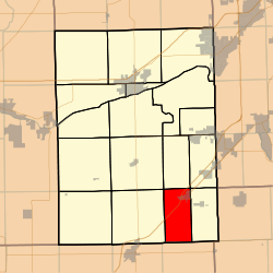
Garfield Township, Grundy County, Illinois
Garfield Township is one of seventeen townships in Grundy County, Illinois, USA. As of the 2010 census, its population was 1,586 and it contained 673 housing units.[2]
Garfield Township | |
|---|---|
 Location in Grundy County | |
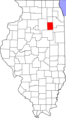
 Grundy County's location in Illinois | |
| Coordinates: 41°09′47″N 88°19′46″W | |
| Country | United States |
| State | Illinois |
| County | Grundy |
| Established | March 10, 1903 |
| Area | |
| • Total | 18.15 sq mi (47.0 km2) |
| • Land | 18.1 sq mi (47 km2) |
| • Water | 0.04 sq mi (0.1 km2) 0.22% |
| Elevation | 594 ft (181 m) |
| Population (2010) | |
| • Estimate (2016)[1] | 1,539 |
| • Density | 87.6/sq mi (33.8/km2) |
| Time zone | UTC-6 (CST) |
| • Summer (DST) | UTC-5 (CDT) |
| ZIP code | 60424 |
| FIPS code | 17-063-28677 |
History
Garfield township was formed from Greenfield township on March 10, 1903.[3] The area contained coal mines.
Geography
According to the 2010 census, the township has a total area of 18.15 square miles (47.0 km2), of which 18.1 square miles (47 km2) (or 99.72%) is land and 0.04 square miles (0.10 km2) (or 0.22%) is water.[2]
Cities, towns, villages
- Gardner (vast majority)
Cemeteries
The township contains Grand Prairie Lutheran Cemetery.
Major highways
School districts
- Herscher Community Unit School District 2
Political districts
- Illinois' 11th congressional district
- State House District 75
- State Senate District 38
gollark: I should probably make that look better.
gollark: --help tel
gollark: You can dial configured channels in other servers to hav e chat sessions with them!
gollark: That's irrelevant.
gollark: I made an inter-channel "calls" thing.
References
- "Garfield Township, Grundy County, Illinois". Geographic Names Information System. United States Geological Survey. Retrieved 2010-01-17.
- United States Census Bureau 2007 TIGER/Line Shapefiles
- United States National Atlas
- "Population and Housing Unit Estimates". Retrieved June 9, 2017.
- "Population, Housing Units, Area, and Density: 2010 - County -- County Subdivision and Place -- 2010 Census Summary File 1". United States Census. Archived from the original on 2020-02-12. Retrieved 2013-05-28.
- "Archived copy". Archived from the original on 2007-10-20. Retrieved 2007-10-20.CS1 maint: archived copy as title (link)
- "Census of Population and Housing". Census.gov. Retrieved June 4, 2016.
External links
This article is issued from Wikipedia. The text is licensed under Creative Commons - Attribution - Sharealike. Additional terms may apply for the media files.