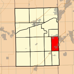
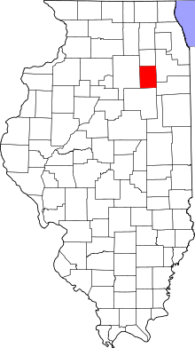
Braceville Township, Grundy County, Illinois
Braceville Township is one of seventeen townships in Grundy County, Illinois, USA. As of the 2010 census, its population was 6,467 and it contained 2,510 housing units.[2]
Braceville Township | |
|---|---|
 Location in Grundy County | |
 Grundy County's location in Illinois | |
| Coordinates: 41°14′43″N 88°16′35″W | |
| Country | United States |
| State | Illinois |
| County | Grundy |
| Established | November 6, 1849 |
| Area | |
| • Total | 18.08 sq mi (46.8 km2) |
| • Land | 17.88 sq mi (46.3 km2) |
| • Water | 0.2 sq mi (0.5 km2) 1.11% |
| Elevation | 571 ft (174 m) |
| Population (2010) | |
| • Estimate (2016)[1] | 6,294 |
| • Density | 361.8/sq mi (139.7/km2) |
| Time zone | UTC-6 (CST) |
| • Summer (DST) | UTC-5 (CDT) |
| ZIP codes | 60407, 60416, 60424 |
| FIPS code | 17-063-07653 |
Geography
According to the 2010 census, the township has a total area of 18.08 square miles (46.8 km2), of which 17.88 square miles (46.3 km2) (or 98.89%) is land and 0.2 square miles (0.52 km2) (or 1.11%) is water.[2]
Cities, towns, villages
- Braceville
- Coal City (south three-quarters)
- Diamond (south quarter)
- Godley (west half)
Unincorporated towns
- Central City at 41.23781°N 88.281729°W
- Mazonia at 41.209199°N 88.281172°W
(This list is based on USGS data and may include former settlements.)
Extinct towns
- Centerville at 41.256421°N 88.293952°W
(These towns are listed as "historical" by the USGS.)
Cemeteries
The township contains Cotton Cemetery.
Major highways
School districts
- Coal City Community Unit School District 1
Political districts
- Illinois' 11th congressional district
- State House District 75
- State Senate District 38
gollark: Capitalism is a Windows executable?
gollark: I've seen many older people who just store all their files on their desktop and such.
gollark: But anyway, I don't think not knowing much about how computers work is an incredibly new phenomenon.
gollark: Great!
gollark: As far as I know most people (around my age) don't actually use non-phone computers very much at all, and then only for text editing and such.
References
- "Braceville Township, Grundy County, Illinois". Geographic Names Information System. United States Geological Survey. Retrieved 2010-01-17.
- United States Census Bureau 2007 TIGER/Line Shapefiles
- United States National Atlas
- "Population and Housing Unit Estimates". Retrieved June 9, 2017.
- "Population, Housing Units, Area, and Density: 2010 - County -- County Subdivision and Place -- 2010 Census Summary File 1". United States Census. Archived from the original on 2020-02-12. Retrieved 2013-05-28.
- "Census of Population and Housing". Census.gov. Retrieved June 4, 2016.
External links
This article is issued from Wikipedia. The text is licensed under Creative Commons - Attribution - Sharealike. Additional terms may apply for the media files.