Montegiorgio
Montegiorgio is a comune (municipality) in the Province of Fermo in the Italian region Marche, located about 70 kilometres (43 mi) south of Ancona and about 80 kilometres (50 mi) north of Ascoli Piceno.
Montegiorgio | |
|---|---|
| Comune di Montegiorgio | |
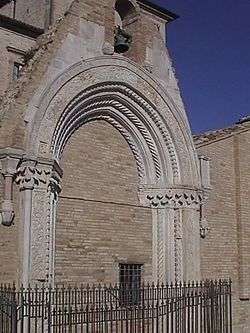 Portal of the church of San Salvatore | |
Location of Montegiorgio 
| |
 Montegiorgio Location of Montegiorgio in Italy 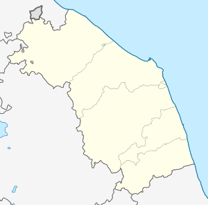 Montegiorgio Montegiorgio (Marche) | |
| Coordinates: 43°8′N 13°32′E | |
| Country | Italy |
| Region | Marche |
| Province | Fermo (FM) |
| Government | |
| • Mayor | Michele Ortenzi |
| Area | |
| • Total | 47.45 km2 (18.32 sq mi) |
| Elevation | 411 m (1,348 ft) |
| Population (30 November 2017)[2] | |
| • Total | 6,715 |
| • Density | 140/km2 (370/sq mi) |
| Demonym(s) | Montegiorgesi |
| Time zone | UTC+1 (CET) |
| • Summer (DST) | UTC+2 (CEST) |
| Postal code | 63025 |
| Dialing code | 0734 |
| Website | Official website |
Montegiorgio borders the following municipalities: Belmonte Piceno, Falerone, Fermo, Francavilla d'Ete, Magliano di Tenna, Massa Fermana, Montappone, Monte San Pietrangeli, Monte Vidon Corrado, Rapagnano.
Main sights
- Remains of the portal of church of San Salvatore (late 14th century)
- Castle walls (13th-14th centuries)
- Church of San Francesco (13th century, restored in the 16th century)
- Castles of Cerreto and Alteta
People
- Domenico Alaleona (1881–1900), composer
gollark: Wow, cool.
gollark: I made a firewolf site for potatOS which installs it.
gollark: No website actually follows the standard.
gollark: HTML is impossible.
gollark: What?
References
- "Superficie di Comuni Province e Regioni italiane al 9 ottobre 2011". Istat. Retrieved 16 March 2019.
- All demographics and other statistics: Italian statistical institute Istat.
This article is issued from Wikipedia. The text is licensed under Creative Commons - Attribution - Sharealike. Additional terms may apply for the media files.