Michaelnbach
Michaelnbach is a municipality in the district of Grieskirchen in the Austrian state of Upper Austria.
Michaelnbach | |
|---|---|
 Coat of arms | |
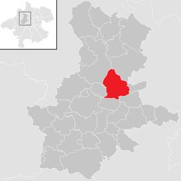 Location in the district | |
 Michaelnbach Location within Austria | |
| Coordinates: 48°17′19″N 13°49′57″E | |
| Country | Austria |
| State | Upper Austria |
| District | Grieskirchen |
| Government | |
| • Mayor | Martin Dammayr (ÖVP) |
| Area | |
| • Total | 23.02 km2 (8.89 sq mi) |
| Elevation | 394 m (1,293 ft) |
| Population (2018-01-01)[2] | |
| • Total | 1,263 |
| • Density | 55/km2 (140/sq mi) |
| Time zone | UTC+1 (CET) |
| • Summer (DST) | UTC+2 (CEST) |
| Postal code | 4712 |
| Area code | 07277 |
| Vehicle registration | GR |
| Website | www.michaelnbach.at |
Geography
Michaelnbach lies in the Hausruckviertel. About 10 percent of the municipality is forest, and 82 percent is farmland.
gollark: That looks like it was made in the same program as the bee concentration to profits one?
gollark: So obtain money from backers by telling them you'll use the toaster to get them the money back.
gollark: Make some sort of toaster Ponzi scheme?
gollark: Although, I will make it "work well on mobile" for £47.36, calculated based on the likely time required for this.
gollark: Besides, it's perfect and without flaw already, I couldn't really do that.
References
- "Dauersiedlungsraum der Gemeinden Politischen Bezirke und Bundesländer - Gebietsstand 1.1.2018". Statistics Austria. Retrieved 10 March 2019.
- "Einwohnerzahl 1.1.2018 nach Gemeinden mit Status, Gebietsstand 1.1.2018". Statistics Austria. Retrieved 9 March 2019.
| Wikimedia Commons has media related to Michaelnbach. |
This article is issued from Wikipedia. The text is licensed under Creative Commons - Attribution - Sharealike. Additional terms may apply for the media files.