Heiligenberg, Austria
Heiligenberg is a municipality in the district of Grieskirchen in the Austrian state of Upper Austria.
Heiligenberg | |
|---|---|
 Coat of arms | |
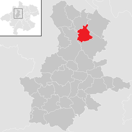 Location in the district | |
 Heiligenberg Location within Austria | |
| Coordinates: 48°21′18″N 13°49′23″E | |
| Country | Austria |
| State | Upper Austria |
| District | Grieskirchen |
| Government | |
| • Mayor | Manfred Haslehner (ÖVP) |
| Area | |
| • Total | 13.86 km2 (5.35 sq mi) |
| Elevation | 398 m (1,306 ft) |
| Population (2018-01-01)[2] | |
| • Total | 691 |
| • Density | 50/km2 (130/sq mi) |
| Time zone | UTC+1 (CET) |
| • Summer (DST) | UTC+2 (CEST) |
| Postal code | 4733 |
| Area code | 07277 |
| Vehicle registration | GR |
| Website | www.heiligenberg. ooe.gv.at |
Geography
Heiligenberg lies in the Hausruckviertel. About 14 percent of the municipality is forest, and 79 percent is farmland.
gollark: Oh, right, that's fair.
gollark: <@478798120650670091> Why would I DO that? WHY?
gollark: Using a single CC file would probably create problems with, er, atomicity or whatever.
gollark: Interesting idea but dealing with file handles would be irritating. I could just steal the code from Opus I guess and stick a note in the licenses.
gollark: I mean, sort of.
References
- "Dauersiedlungsraum der Gemeinden Politischen Bezirke und Bundesländer - Gebietsstand 1.1.2018". Statistics Austria. Retrieved 10 March 2019.
- "Einwohnerzahl 1.1.2018 nach Gemeinden mit Status, Gebietsstand 1.1.2018". Statistics Austria. Retrieved 9 March 2019.
This article is issued from Wikipedia. The text is licensed under Creative Commons - Attribution - Sharealike. Additional terms may apply for the media files.